Related Research Articles

The acre is a unit of land area used in the imperial and US customary systems. It is traditionally defined as the area of one chain by one furlong, which is exactly equal to 10 square chains, 1⁄640 of a square mile, 4,840 square yards, or 43,560 square feet, and approximately 4,047 m2, or about 40% of a hectare. Based upon the International yard and pound agreement of 1959, an acre may be declared as exactly 4,046.8564224 square metres. The acre was sometimes abbreviated ac, but was often spelled out as the word "acre".

Saint Lucia is an island country in the West Indies in the eastern Caribbean Sea on the boundary with the Atlantic Ocean. The island was previously called Iyonola, the name given to the island by the native Arawaks, and later Hewanorra, the name given by the native Caribs, two separate Amerindian peoples. Part of the Windward Islands of the Lesser Antilles, it is located north/northeast of the island of Saint Vincent, northwest of Barbados and south of Martinique. It covers a land area of 617 km2 and reported a population of 165,595 in the 2010 census. Its capital is Castries. Soufrière was colonized by the French and was the original capital of the island.

Saint Lucia is one of many small land masses composing the insular group known as the Windward Islands. Unlike large limestone areas such as Florida, Cuba, and the Yucatan Peninsula, or the Bahamas, which is a small island group composed of coral and sand, St. Lucia is a typical Windward Island formation of volcanic rock that came into existence long after much of the region had already been formed.

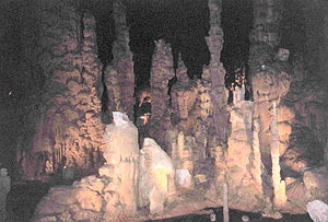
Kartchner Caverns State Park is a state park of Arizona, United States, featuring a show cave with 2.4 miles (3.9 km) of passages. The park is located 9 miles (14 km) south of the town of Benson and west of the north-flowing San Pedro River. Long hidden from view, the caverns were discovered in 1974 by local cavers, assisted by state biologist Erick Campbell who helped in its preservation.

Oregon Caves National Monument and Preserve is a protected area in the northern Siskiyou Mountains of southwestern Oregon in the United States. The 4,554-acre (1,843 ha) park, including the marble cave, is 20 miles (32 km) east of Cave Junction, on Oregon Route 46. The protected area, managed by the National Park Service (NPS), is in southwestern Josephine County, near the Oregon–California border.

Dennery District is one of 10 districts of the Caribbean island nation of Saint Lucia. The seat of Dennery District is the Dennery Village. The main economic activities are fishing, and the cultivation of lima beans, bananas, and other tropical fruit. The population of the quarter was estimated at 12,876 in 2002 and fell to 12,767 in 2010.

Cathedral Caverns State Park is a publicly owned recreation area and natural history preserve located in Kennamer Cove, Alabama, approximately 5 miles (8.0 km) northeast of Grant and 7 miles (11 km) southeast of Woodville in Marshall County. The park's main feature, first known as Bats Cave, was developed as a tourist attraction in the 1950s. Cathedral Caverns was declared a National Natural Landmark in 1972 and opened as a state park in 2000.

Anse la Raye District is one of 10 districts of the island nation of St. Lucia in the Caribbean Sea. The name Anse la Raye is French for cover/bay of the rays, since there are a large number of skate fish or rays in the bay. In 2005/2010, the population of the district was 6,382/6,060 people, and they are mainly fishers and agricultural workers. The main town in the area takes the same name as the district and is located down the western coast from Castries, the capital of the country.

Choiseul District is one of the 10 districts of the Caribbean island nation of Saint Lucia. Located on the southwestern side of the island, the district is home to 6,130 people, according to the 2019 census. The seat of Choiseul District is the town of Choiseul.

The Borra Caves, also called Borra Guhalu, are located on the East Coast of India, in the Ananthagiri hills of the Araku Valley of the Visakhapatnam district in Andhra Pradesh. The caves, one of the largest in the country, at an elevation of about 705 m (2,313 ft), distinctly exhibit a variety of speleothems ranging in size and irregularly shaped stalactites and stalagmites. The caves are basically karstic limestone structures extending to a depth of 80 m (260 ft), and are considered the deepest caves in India.

The University of Health Sciences Antigua (UHSA) is a private, for-profit medical and nursing school located in Dow's Hill near Falmouth, Antigua, in the Caribbean. UHSA confers upon its graduates the Doctor of Medicine (MD) and Bachelor of Science in Nursing degree.

Saint Lucia, an island nation in the Caribbean islands, has a relatively large and lucrative tourism industry. Due to the relatively small land area of the country, most of the governmental promotion is performed by the state-operated Saint Lucia Tourism Authority, led by Executive Chairperson Agnes.
Byahaut Bat Cave is a coastal cave in the Caribbean Island of St. Vincent on the Western Coast.

Canaries District is one of 10 districts of the island nation of St. Lucia in the Caribbean Sea. In 2010, the population of the region was 2,009 people, and they are mainly fishers and agricultural workers. The main town in the area takes the same name as the district and is located down the western coast from Castries, the capital of the country. It is the smallest quarter of Saint Lucia, both by population and area.

The Oregon High Desert Grotto is an American caving club, known as a Grotto. It is affiliated with the National Speleological Society.

Agnes Milowka was an Australian technical diver, underwater photographer, author, maritime archaeologist and cave explorer. She gained international recognition for penetrating deeper than previous explorers into cave systems across Australia and Florida, and as a public speaker and author on the subjects of diving and maritime archaeology. She died aged 29 while diving in a confined space.

St Lucia is a settlement in Umkhanyakude District Municipality in the KwaZulu-Natal province of South Africa. The small town is mainly a hub for the iSimangaliso Wetland Park.

Tory Cave is a marble solutional cave near New Milford, Connecticut.

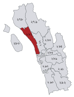
Chittagong-4 is a constituency represented in the Jatiya Sangsad of Bangladesh since 2014 by Didarul Alam of the Awami League.

University of the West Indies at Cave Hill is a public research university in Cave Hill, Barbados. It is one of 5 general campuses in the University of the West Indies system.
References
- ↑ "The Mammals of St Lucia" (PDF). bananatrustslu.com. Archived from the original (PDF) on 19 March 2013. Retrieved 8 February 2014.
- ↑ "St Lucia - Bat Cave". youtube.com. Archived from the original on 2021-12-12. Retrieved 8 February 2014.
- ↑ "St. Lucia: Day Trips". tripadvisor.com. Retrieved 8 February 2014.
Coordinates: 13°47′55″N61°01′10″W / 13.798681822635439°N 61.01957692269437°W