Related Research Articles

The Pearl River is a river in the U.S. states of Mississippi and Louisiana. It forms in Neshoba County, Mississippi from the confluence of Nanih Waiya and Tallahaga creeks, and has a meander length of 444 miles (715 km). The lower part of the river forms part of the boundary between Mississippi and Louisiana.

The headwater of a river or stream is the point on each of its tributaries upstream from its mouth or estuary into a lake, sea, or confluence with another river. Each headwater is considered one of the river's sources, as it is the place where surface runoffs from rainwater, meltwater, or spring water begin accumulating into a more substantial and consistent flow that becomes a first-order tributary of that river. The tributary with the longest course downstream of the headwaters is regarded as the main stem.
The Sunflower River is one of the main tributaries of the Yazoo River in the U.S. state of Mississippi. It is navigable by barge for 50 miles. It rises in DeSoto County, Mississippi near the Tennessee border and flows south for 100 miles to the Yazoo River, a major tributary of the Mississippi River. At Clarksdale, the county seat of Coahoma County, the annual Sunflower River Blues & Gospel Festival is held.
The Obey River is a 47.8-mile-long (76.9 km) tributary of the Cumberland River in the U.S. state of Tennessee. It joins the Cumberland River near the town of Celina, which is generally considered to be the Cumberland's head of navigation. Via the Cumberland and Ohio rivers, the Obey River is part of the Mississippi River watershed.

The Tallahatchie River is a river in Mississippi which flows 230 miles (370 km) from Tippah County, through Tallahatchie County, to Leflore County, where it joins the Yalobusha River to form the Yazoo River, which ultimately meets the Mississippi River at Vicksburg, Mississippi. The river is navigable for about 100 miles (160 km). At Money, Mississippi, the river's flow measures approximately 7,861 cubic feet (222.6 m3) per second.

The Yalobusha River is a river, 165 miles (266 km) long, in north-central Mississippi in the United States. It is a principal tributary of the Yazoo River, via which it is part of the watershed of the Mississippi River.

The Skuna River is a tributary of the Yalobusha River, about 75 mi (120 km) long, in north-central Mississippi in the United States. Via the Yalobusha and Yazoo Rivers, it is part of the watershed of the Mississippi River.
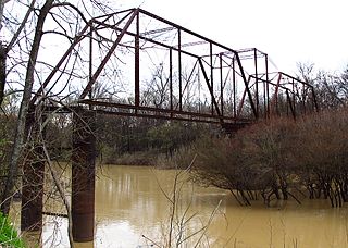
The Strong River is a 95.2-mile-long (153.2 km) river in south-central Mississippi in the United States. It is a tributary of the Pearl River, which flows to the Gulf of Mexico.

Temescal Creek is an approximately 29-mile-long (47 km) watercourse in Riverside County, in the U.S. state of California. Flowing primarily in a northwestern direction, it connects Lake Elsinore with the Santa Ana River. It drains the eastern slopes of the Santa Ana Mountains on its left and on its right the western slopes of the Temescal Mountains along its length. With a drainage basin of about 1,000 square miles (2,600 km2), it is the largest tributary of the Santa Ana River, hydrologically connecting the 720-square-mile (1,900 km2) San Jacinto River and Lake Elsinore watersheds to the rest of the Santa Ana watershed. However, flowing through an arid rain shadow zone of the Santa Ana Mountains, and with diversion of ground water for human use, the creek today is ephemeral for most of its length, except for runoff from housing developments and agricultural return flows.
Sinking Creek is a stream in Lawrence and Dade counties of southwest Missouri. It is a tributary of Turnback Creek.
Dardenne Creek is a stream in St. Charles and Warren counties in the U.S. state of Missouri. It is a tributary of the Mississippi River.
Big Bogue is a stream in the U.S. state of Mississippi.
Bogue Faliah is a stream in the U.S. state of Mississippi.
Bogue Fallah is a stream in the U.S. state of Mississippi.
Bogue Homa is a stream in the U.S. state of Mississippi. It is a tributary to the Pearl River.
Little Bogue is a stream in the U.S. state of Mississippi.
Bogue Phalia is a stream in the U.S. state of Mississippi. It is a tributary to the Big Sunflower River.
Bophumpa Creek is a stream in Holmes County in the U.S. state of Mississippi. It is a tributary to Fannegusha Creek.
Coffee Bogue is a stream in the U.S. state of Mississippi. It is a tributary to the Pearl River.
References
- 1 2 3 U.S. Geological Survey Geographic Names Information System: Batupan Bogue
- ↑ "USGS Surface Water data for Mississippi: USGS Surface-Water Annual Statistics".
- ↑ Baca, Keith A. (2007). Native American Place Names in Mississippi. University Press of Mississippi. p. 7. ISBN 978-1-60473-483-6.
33°47′13″N89°47′38″W / 33.78694°N 89.79389°W