The Dominican Republic is a country in the West Indies that occupies the eastern five-eighths of Hispaniola. It has an area of 48,670 km2, including offshore islands. The land border shared with Haiti, which occupies the western three-eighths of the island, is 376 km long. The maximum length, east to west, is 390 km from Punta de Agua to Las Lajas, on the border with Haiti. The maximum width, north to south, is 265 km from Cape Isabela to Cape Beata. The capital, Santo Domingo, is located on the south coast.

The San Francisco Peninsula is a peninsula in the San Francisco Bay Area that separates San Francisco Bay from the Pacific Ocean. On its northern tip is the City and County of San Francisco. Its southern base is Los Altos, Mountain View, in Santa Clara County, south of Palo Alto and north of Sunnyvale and Los Altos. Most of the Peninsula is occupied by San Mateo County, between San Francisco and Santa Clara counties, and including the cities and towns of Atherton, Belmont, Brisbane, Burlingame, Colma, Daly City, East Palo Alto, El Granada, Foster City, Hillsborough, Half Moon Bay, La Honda, Loma Mar, Los Altos, Menlo Park, Millbrae, Mountain View, Pacifica, Palo Alto, Pescadero, Portola Valley, Redwood City, San Bruno, San Carlos, San Mateo, South San Francisco, and Woodside.

Northern California is a geographic and cultural region that generally comprises the northern portion of the U.S. state of California, spanning the northernmost 48 of the state's 58 counties. Its main population centers include the San Francisco Bay Area, the Greater Sacramento area, the Redding, California, area south of the Cascade Range, and the Metropolitan Fresno area. Northern California also contains redwood forests, along with most of the Sierra Nevada, including Yosemite Valley and part of Lake Tahoe, Mount Shasta, and most of the Central Valley, one of the world's most productive agricultural regions.

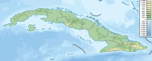
Villa Clara is one of the provinces of Cuba. It is located in the central region of the island bordering on the Atlantic Ocean to the north, Matanzas Province to the west, Sancti Spiritus Province to the east, and Cienfuegos Province to the South. Villa Clara shares with Cienfuegos and Sancti Spiritus on the south the Escambray Mountain Range. Its main cities are Santa Clara, Remedios, Sagua La Grande, Camajuani, Caibarién, Ranchuelo, Placetas, and Manicaragua.

Serekunda is the largest urban centre in The Gambia. It is situated close to the Atlantic coast, 13 km (8 mi) south-west of the capital, Banjul, and is formed of nine villages which have grown together into a larger urban area.

The Diablo Range is a mountain range in the California Coast Ranges subdivision of the Pacific Coast Ranges in northern California, United States. It stretches from the eastern San Francisco Bay Area at its northern end to the Salinas Valley area at its southern end.
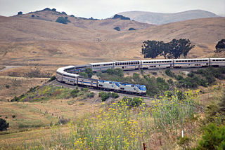
The Coast Line is a railroad line between Burbank, California and the San Francisco Bay Area, roughly along the Pacific Coast. It is the shortest rail route between Los Angeles and the Bay Area. Though not as busy as the Surf Line, the continuation of the Coast Line southbound to San Diego, it still sees freight movements and lots of passenger trains. The Pacific Surfliner, which runs from the San Diego Santa Fe Depot to San Luis Obispo via Union Station in Los Angeles, is the third busiest Amtrak route, and the busiest outside of the Northeast Corridor between Washington D.C. and Boston.

Grenadines is an administrative parish of Saint Vincent and the Grenadines, comprising the islands of the Grenadines other than those belonging to Grenada. The capital is Port Elizabeth. It's the only parish in the country that's not located on the main island.
Pedro Bank is a large bank of sand and coral, partially covered with seagrass, about 80 km south and southwest of Jamaica, rising steeply from a seabed of 800 metres depth. It slopes gently from the Pedro Cays to the west and north with depths from 13 to 30 metres. The total area of the bank within the 100-metre (328-foot) isobath measures 8,040 square kilometres. The area of a depth to 40 metres is triangular, 70 kilometres long east-west, and 43 kilometres wide. 2,400 square kilometres are less than 20 metres deep. With its islets, cays and rocks, a total land area of 270,000 m2 (2,906,256 sq ft), it is the location of one of the two offshore island groups of Jamaica, the other one being the Morant Cays. The bank is centered at 17°06′N78°20′W.

Cay Sal Bank is the third largest and the westernmost of the Bahama Banks. It is located between 23º27'N - 24º10'N and 079º25'W – 080º35'W. In a geographical sense, it is separate from the Bahamas proper as it is much closer to Cuba than to the closest Bahamian island. It is separated by Santaren Channel from the Great Bahama Bank, the western rim of which is 50 km (31 mi) to the east. The Straits of Florida separate it from the United States mainland and the Florida Keys.

The Tiburon Peninsula, or The Xaragua Peninsula, simply "the Tiburon", is a region of Haiti encompassing most of Haiti's southern coast. It starts roughly at the southernmost point of the Haiti-Dominican Republic border and extends westward near Cuba, forming a large headland. Three of Haiti's ten departments are located entirely within the region. They are the departments of Grand'Anse, Nippes and Sud.

Corralillo is a municipality and town in the Villa Clara Province of Cuba. It was founded in 1831 and established as a municipality in 1879.
The Bay of Buena Vista is a bay on Cuba's northern Atlantic shore. It is located in the northern part of the provinces of Sancti Spíritus, Villa Clara and Ciego de Ávila, between mainland Cuba and the archipelago that lines its northern coast.
Sabana-Camagüey is an archipelago that lies on Cuba's north-central Atlantic coast. It is located off the northern coast of the provinces of Matanzas, Villa Clara, Sancti Spíritus, Ciego de Ávila and Camagüey, and is bounded to the north by the Atlantic Ocean, specifically by the Nicholas Channel and Old Bahama Channel.
The Bay of Jorge Cárdenas is a shallow bay on Cuba's northern shore, in the province of Matanzas.
The Colorados Archipelago is a chain of isles and cays on Cuba's north-western coast.

Hick's Cayes are a group of uninhabited islands in the South of Chetumal Bay, between St. George's Caye and Caye Chapel, about halfway between Belize City and San Pedro Town.
Bryan Coast is that portion of the coast of Antarctica along the south shore of the Bellingshausen Sea between Pfrogner Point and the northern tip of the Rydberg Peninsula. To the west is Eights Coast, and to the east is English Coast.

The Elbow Cays are uninhabited cays in the Cay Sal Bank, Bahamas. It is the most Western point in the Bahamas. They are part of a reef shelf located at the northwestern end of the bank about 80 km (50 mi) off the Cuban coast and 130 km (80 mi) southeast of Key West, Florida. These cays are an excellent scuba diving spot.