Beanblossom Creek is a stream in Monroe and Brown counties, Indiana, in the United States. [1] The creek drains roughly 91.97 square miles into the two counties of south central Indiana. [2]
Contents

Beanblossom Creek is a stream in Monroe and Brown counties, Indiana, in the United States. [1] The creek drains roughly 91.97 square miles into the two counties of south central Indiana. [2]
Beanblossom Creek was named for a pioneer named Beanblossom, who almost drowned when swimming across the swollen creek. [3]
A dam was constructed on Beanblossom Creek in the 1950s, forming Lake Lemon. Earlier, a smaller Griffy Lake has been created by a dam impounding Griffy Creek, one of Beanblossom Creek's tributaries.
From September to October 2001, the Indiana Department of Environmental Management conducted a comprehensive survey of the Beanblossom Creek Watershed. Escherichia coli bacteria (E. coli bacteria) was found to be the primary impairment, as well as 15 other pollutants. The E. coli bacteria was declared to have come from a variety of sources, including but not limited to animal agriculture, urban and rural runoff, home sewage treatment, and sewer overflow. The Total Maximum Daily Load (TMDL) report for the Beanblossom Creek Watershed was approved by the Environmental Protection Agency on April 2, 2006. Solutions, including manure management and storm water controls, were proposed in the report. [2]
To commemorate the state of Indiana's 200th anniversary in 2016, then-governor Mitch Daniels started the Bicentennial Nature Trust. The state program, a $30 million trust for to buy land for conservation purposes, allocated $1 million for land in northern Monroe county around Beanblossom Creek. The trust established the Beanblossom Creek Bicentennial Conservation Area, protecting the Beanblossom Bottoms Nature Preserve, the Lake Griffy Nature Preserve, and a section of the Morgan-Monroe state forest in the hopes of improving water quality and other conservation goals. [4]
In 1976, a fire destroyed the historic Cedar Ford Covered Bridge over Beanblossom Creek, which dated back to the 1880s. The bridge was the only one of its kind in all of Monroe County. Reconstruction started in the fall of 2018 and finished 2019.

The $1.6 million project is 80% funded by the Federal government. 30% of the lumber for the reconstruction comes from another Indiana covered bridge, Cedar Ford Bridge of Shelby, which was erected in 1885 and taken down in 1975. [5]

Monroe County is a county in the U.S. state of Indiana. In 1910 the US Census Bureau calculated the nation's mean population center to lie in Monroe County. The population was 139,718 at the 2020 United States Census. The county seat is Bloomington. Monroe County is part of the Bloomington, Indiana, Metropolitan Statistical Area.

The Tippecanoe River is a gentle, 182-mile-long (293 km) river in the Central Corn Belt Plains ecoregion in northern Indiana. It flows from Crooked Lake in Noble County to the Wabash River near what is now Battle Ground, about 12 miles (19 km) northeast of Lafayette. The name "Tippecanoe" was derived from a Miami-Illinois word for buffalo fish, reconstructed as */kiteepihkwana/ or as kiteepihkwana siipiiwi.

The Rogue River in southwestern Oregon in the United States flows about 215 miles (346 km) in a generally westward direction from the Cascade Range to the Pacific Ocean. Known for its salmon runs, whitewater rafting, and rugged scenery, it was one of the original eight rivers named in the Wild and Scenic Rivers Act of 1968. Beginning near Crater Lake, which occupies the caldera left by the explosive volcanic eruption and collapse of Mount Mazama, the river flows through the geologically young High Cascades and the older Western Cascades, another volcanic province. Further west, the river passes through multiple exotic terranes of the more ancient Klamath Mountains. In the Kalmiopsis Wilderness section of the Rogue basin are some of the world's best examples of rocks that form the Earth's mantle. Near the mouth of the river, the only dinosaur fragments ever discovered in Oregon were found in the Otter Point Formation, along the coast of Curry County.

The Jordan River is a 51.4-mile-long (82.7 km) river in the U.S. state of Utah. Regulated by pumps at its headwaters at Utah Lake, it flows northward through the Salt Lake Valley and empties into the Great Salt Lake. Four of Utah's six largest cities border the river: Salt Lake City, West Valley City, West Jordan, and Sandy. More than a million people live in the Jordan Subbasin, part of the Jordan River watershed that lies within Salt Lake and Utah counties. During the Pleistocene, the area was part of Lake Bonneville.

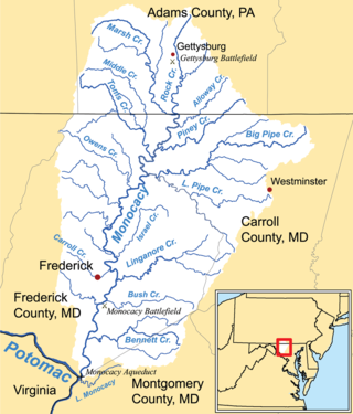
The Monocacy River is a free-flowing left tributary to the Potomac River, which empties into the Atlantic Ocean via the Chesapeake Bay. The river is 58.5 miles (94.1 km) long, with a drainage area of about 970 square miles (2,500 km2). It is the largest Maryland tributary to the Potomac.
Cedar Creek Canyon, also called simply Cedar Canyon, is a topographical feature located in Allen County, Indiana, United States. It is a very straight, narrow gorge about 50 to 100 feet deep that contains part of the lower segment of Cedar Creek, the largest tributary of the St. Joseph River. The canyon originated at the end of the last ice age as a tunnel valley, a channel under the Erie Lobe of the Wisconsin Glacier that discharged meltwater under considerable pressure into the ancestral Eel River, a tributary of the Wabash River. Cutting through the north limb of the Wabash Moraine, a debris deposit left by the retreating ice, the discharge left a large outwash fan that blocked the Eel, diverting its upper portion into the canyon in a classic example of stream piracy that formed today's Cedar Creek. This was part of a general drainage reversal that occurred in northeastern Indiana as the Maumee River opened and captured drainage that was previously part of the watershed of the Wabash. While the lower Eel remained a tributary of the Wabash, 175,000 acres (710 km2) that it formerly drained became part of the Maumee watershed.

Beanblossom, also spelled Bean Blossom, is an unincorporated community in Jackson Township, Brown County, in the U.S. state of Indiana. The town was named for the nearby Beanblossom Creek, which was in turn named for a person whose surname was Beanblossom.

Lake Erie Basin consists of Lake Erie and surrounding watersheds, which are typically named after the river, creek, or stream that provides drainage into the lake. The watersheds are located in the states of Indiana, Michigan, New York, Ohio, and Pennsylvania in the United States, and in the province of Ontario in Canada. The basin is part of the Great Lakes Basin and Saint Lawrence River Watershed, which feeds into the Atlantic Ocean. 80% of the lake's water flows in from the Detroit River, with only 9% coming from all of the remaining watersheds combined. A littoral zone serves as the interface between land and lake, being that portion of the basin where the lake is less than 15 feet (4.6 m) in depth.

Benton Township is one of eleven townships in Monroe County, Indiana, United States. As of the 2010 census, its population was 3,358 and it contained 1,716 housing units.
Cedar Bayou is an area in east central Harris County, Texas, United States.
The Galena River is an 8.5-mile-long (13.7 km) stream in northern Indiana in the United States. It rises in the northeast corner of Springfield Township, about 5 miles (8 km) north of LaPorte in LaPorte County and flows northeast. Just after it crosses the state boundary into Three Oaks Township in Berrien County, Michigan, it is joined from the east by Spring Creek to form the South Branch Galien River. After becoming the Galien River in Michigan, the river ultimately flows to Lake Michigan in New Buffalo.
The Chauga River is a 31.3-mile-long (50.4 km) tributary of the Tugaloo River in Oconee County, South Carolina.
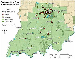
Sycamore Land Trust is a 501(c)(3) non-profit member-supported land trust headquartered in Bloomington in the U.S. state of Indiana.

Trail Creek is a 7.3-mile-long (11.7 km) north- by northwest-flowing stream whose main stem begins at the confluence of the West Branch Trail Creek and the East Branch Trail Creek in LaPorte County, Indiana, United States. Its mouth is a Lake Michigan harbor and marina adjacent to Washington Park in Michigan City, Indiana.
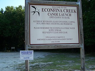
Econfina Creek is a small river in the middle Florida Panhandle. It flows through hilly country, and has sections of whitewater rapids. Much of its flow comes from springs. The river ends at Deer Point Lake, a reservoir that provides the freshwater supply for Panama City and much of Bay County.

Salt Creek is a 24.0-mile-long (38.6 km) tributary of the East Arm Little Calumet River that begins south of Valparaiso in Porter County, Indiana and flows north until it joins the East Arm Little Calumet River just before it exits to Lake Michigan via the Port of Indiana-Burns Waterway.

Clear Creek is an American creek in Monroe County, Indiana. Flowing in the general south-western and southern direction, it is a tributary of Salt Creek, which in its turn flows into the East Fork of Indiana's White River.

Griffy Reservoir, commonly known as Lake Griffy, is a reservoir in the city of Bloomington, Indiana. Created by a dam on Griffy Creek in the 1920s, the reservoir used to serve as the main source of drinking water for Bloomington for several decades, until that role was taken over by the larger Lake Lemon and Lake Monroe in the 1950s.

Dunes Creek is a northwards-flowing 4.3-mile-long (6.9 km) stream which drains the Great Marsh of Indiana Dunes State Park and Indiana Dunes National Park in Porter County, Indiana, United States. Dunes Creek passes through the coastal sand dunes to empty into Lake Michigan.
A proposed Union Mills Reservoir represents a half century of efforts by the Commissioners of the Carroll County, Maryland, to build variations on a "dam" or "reservoir" near Union Mills, Maryland, on the Big Pipe Creek, defeated by a petition led by the Carroll County Taxpayers' Committee in the 1970s. The plan may be alive among some county officials but may also be postponed "indefinitely." Land threatened by the reservoir includes the Whittaker Chambers Farm, also known as the Pipe Creek Farm, a National Historic Landmark as well as protected under the Maryland Agricultural Land Preservation Foundation (MALPF).
39°19′49″N86°39′31″W / 39.33028°N 86.65861°W
| | This Brown County, Indiana location article is a stub. You can help Wikipedia by expanding it. |
| | This Monroe County, Indiana location article is a stub. You can help Wikipedia by expanding it. |
| | This article related to a river in Indiana is a stub. You can help Wikipedia by expanding it. |