Tributaries and post offices
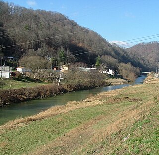
The mouth of Bear Creek is 6.25 miles (10.06 km) upstream on Red Bird River at an altitude of 752 feet (229 m) above sea level.
- Its major tributaries are:
- a left branch 1 mile (1.6 km) upstream at altitude 765 feet (233 m)
- a left branch 1.5 miles (2.4 km) upstream at altitude 780 feet (240 m)
- a left branch 2.25 miles (3.62 km) upstream at altitude 825 feet (251 m)
- a left branch 2.75 miles (4.43 km) upstream at altitude 860 feet (260 m)
- a left branch 3 miles (4.8 km) upstream at altitude 875 feet (267 m)
- Bowling Branch 3.75 miles (6.04 km) upstream at altitude 925 feet (282 m)
- three forks 4.5 miles (7.2 km) upstream at (where 2 of the forks meet) altitude 950 feet (290 m)
Barcreek post office
Barcreek was established on 1900-03-07 by Elijah Herd, and remained in operation until March 1969. It was half a mile upriver on Bear Creek from its confluence with the Red Bird River. Its name was most likely a corruption of Bear Creek, but could also have been a reference to a large local sandbar. Herd's first choice of his own name had been rejected by the USPS because it clashed with an already existing postoffice in Boyd County.
Green L. Langdon moved it upriver in 1914, close to, or possibly at, the site of what was later to be Spurlock post office. It was relocated back to Bear Creek in the 1920s, and was 1⁄2 mile (0.80 km) up the creek when it closed.
Spurlock post office
Spurlock post office was established on 1928-10-02, Silvania Herd's first choice of "Herd" similarly being rejected by the USPS because it then clashed with an already existing postoffice by that name in Jackson County. Named after the Spurlock family, descendants of settler William Spurlock (1815–1855) from North Carolina who had arrived at Bear Creek in 1835, it lasted until July 1988. It was located 1 mile upstream of the mouth of Banks Branch, a tributary of Red Bird River to the south of Bear Creek, to replace Barcreek post office after it moved back to Bear Creek.
General
Across a ridge lies Laurel Creek.
In 1918, Daniel Bowling had a mine 0.5 miles (0.80 km) upstream on Bowling Branch.
North Fork Kentucky River is a river in Kentucky in the United States. It is a fork of the Kentucky River. It is nearly 148 miles (238 km) long with an average slope of 3.2 feet per mile (0.61 m/km), and an overall basin size of 1,101 square miles (2,850 km2)
The Red Bird River is one of two tributaries at the head of the South Fork of the Kentucky River, the other being the Goose Creek. It is located in the Daniel Boone National Forest in extreme southeastern portion of the U.S. state of Kentucky. It is 34.3 miles (55.2 km) long and drains an area of 195.7 square miles (507 km2).
Laurel Creek is a creek that is a tributary of Goose Creek river in Clay County, Kentucky. It is 7.5 miles (12.1 km) long. The name comes from the proliferation of mountain laurel on its riverbanks.
Big Creek is a stream in Perry County, Kentucky in the United States. It a tributary of the North Fork Kentucky River that joins it 1 mile (1.6 km) upstream of Typo and 5 miles (8.0 km) downstream of Hazard, at an altitude of 810 feet (250 m). It is nearly 10 miles (16 km) long, and is paralleled by Kentucky Route 80 for some of its length.
Lotts Creek is a stream in Perry County, Kentucky in the United States. It a tributary of the North Fork Kentucky River that joins it at Darfork 3 miles (4.8 km) downstream of Hazard at an altitude of 820 feet (250 m). It is 8.5 miles (13.7 km) long from its mouth to where it splits into the Young and Big Forks.
Sibert is a coal town and rail depot, and was a post office, in Clay County, Kentucky, United States located below the mouth of the Paw Paw Branch of the Horse Creek tributary of the Goose Creek river, half a mile above Hima. The town, depot, and postoffice were all named after a local family who were descendants, through William and Milton Siebert, of pioneers Daniel and Sarah (Sallie) Siebert.
Horse Creek is a tributary of Goose Creek river in Clay County, Kentucky. It is 1.5 miles (2.4 km) upstream on Goose at an altitude of 800 feet (240 m).
Sextons Creek river in Clay County in the U.S. state of Kentucky is a tributary of the South Fork of Kentucky River in neighbouring Owsley County, Kentucky. It was named for a Sexton family of settlers who arrived some time before 1815.
Trace Fork or Trace Branch is a stream in Perry County, Kentucky in the United States. It a fork of Lotts Creek 1 mile (1.6 km) upstream from the latter's mouth at an altitude of 825 feet (251 m).
Big Creek is a 4.5 miles (7.2 km) long creek in Kentucky, United States whose headwaters are in Leslie County and that flows into the Red Bird River in Clay County. A postoffice and village are named for it. Its own name is likely purely descriptive of its frequent flooding and high water levels, as it is not otherwise one of the biggest tributaries of Red Bird River.
Goose Creek is a creek in Clay County, Kentucky. It is one of two tributaries at the head of the South Fork of the Kentucky River, the other being the Red Bird River. It is 40 miles (64 km) long.
Troublesome Creek is a creek in Breathitt, Perry and Knott counties, Kentucky, a fork of the North Fork Kentucky River. It is 41.46 miles (66.72 km) long with a gradient of 8.92 feet per mile (168.9 cm/km), normally free-flowing, and with banks that vary between tree-lined and open.
Little Goose Creek is a tributary of Goose Creek river in Clay County with headwaters in Laurel County in the U.S. state of Kentucky. It is 16.5 miles (26.6 km) long with its confluence with Goose just north of Manchester, at an altitude of 795 feet (242 m).
Collins Creek, also known as Collins Fork, is a creek that is a fork of Goose Creek in Knox County and Clay County, Kentucky. It is 19 miles (31 km) long; is named for its first settler James Collins, a salt maker and hunter; joins Goose just south of Garrard; and is paralleled by road and railway for most of its course.
Martins Creek is creek that is a tributary of Goose Creek in Clay County, Kentucky that used to have a Martins Creek post office. It is 4.5 miles (7.2 km) long and named for early settler Salathiel Martin.
Beech Creek is a tributary of Goose Creek in Clay County, Kentucky. It is just under 6 miles (9.7 km) long and joins the Goose approximately 1⁄2 mile (0.80 km) below the mouth of Laurel Creek.
Lost Creek is a creek that is mainly in Breathitt County, Kentucky in the United States. It a tributary of the Troublesome Creek tributary of the North Fork Kentucky River that it joins over the county line in Perry County slightly more than 1 mile (1.6 km) upstream of the mouth of Troublesome, at an altitude of 810 feet (250 m). It is 10 miles (16 km) long. The junction of Kentucky Route 476 with Kentucky Route 15 about 6 miles (9.7 km) south-southeast of Jackson is nearby.
The Forks of Troublesome, more simply The Forks, are the Left Fork and Right Fork tributaries of Troublesome Creek in what is now Knott County, Kentucky. This was the name of the place where they met until the city of Hindman was established as the county seat in April 1884, and the name used in the Act of the Kentucky General Assembly that established Knott County. At the time, The Forks was in Letcher County, Kentucky.
Balls Fork is a stream that is mainly in Knott County, Kentucky in the United States. It a fork of the Troublesome Creek tributary of the North Fork Kentucky River that it joins over the county line in Perry County. It is 19.5 miles (31.4 km) long.
The North Fork Kentucky River has several tributary creeks at, or in the immediate vicinity of, the city of Hazard, Kentucky. They were surveyed by the Kentucky Geological Survey in 1918. Most still exist, although some have since been eliminated by mining and the subsequent expansion of the city, and the post-World War 2 construction of the Daniel Boone Parkway.
