Related Research Articles

Hitchin is a market town in the North Hertfordshire district of Hertfordshire, England.

Baldock is a historic market town in the North Hertfordshire district of Hertfordshire, England. The River Ivel rises from springs in the town. It lies 33 miles (53 km) north of London and 14 miles (23 km) north northwest of the county town of Hertford. Nearby towns include Royston to the northeast, Letchworth and Hitchin to the southwest and Stevenage to the south.

North Hertfordshire is one of ten local government districts in the county of Hertfordshire, England. Its council is based in Letchworth. The district borders East Hertfordshire, Stevenage, Welwyn Hatfield, St Albans, Central Bedfordshire, Luton, and South Cambridgeshire.

Cheshunt is a town in the Borough of Broxbourne in Hertfordshire, England, 13 miles (21 km) north of London on the River Lea and Lee Navigation and directly south of Broxbourne. It contains a section of the Lee Valley Park, including much of the River Lee Country Park. To the north lies Broxbourne and Wormley, Waltham Abbey to the east, Waltham Cross and Enfield to the south, and Cuffley to the west.

Hitchin and Harpenden is a constituency represented in the House of Commons of the UK Parliament since 2017 by Bim Afolami, a Conservative.
Walsworth is a part of the town of Hitchin in Hertfordshire, England. It was originally a village about a mile north east of the town, and later became incorporated into it, although it is still referred to as a village by some locals. Hitchin Walsworth is one of five wards for the purposes of electing councillors to North Hertfordshire District Council. The ward includes the Purwell neighbourhood, south of Walsworth, which is named after the River Purwell.

St Ippolyts is a village and civil parish on the southern edge of Hitchin in Hertfordshire, England. It has a population of approximately 2,000.

Kimpton is a village in Hertfordshire, England, six miles south of Hitchin, seven miles north of St Albans and four miles from Harpenden and Luton. The population at the 2011 Census was 2,167.

Shephall is a neighbourhood of the new town of Stevenage in Hertfordshire. It was formerly a separate village and parish, being absorbed into Stevenage in 1953.

Aston is a village and civil parish in the East Hertfordshire district of Hertfordshire, England. According to the 2001 census it had a population of 844, increasing to 871 at the 2011 Census. Located on a ridge between Stevenage and the Beane Valley, Aston is a 10 minutes drive from the A1(M).

Barley is a village and civil parish in the district of North Hertfordshire, England. According to the 2001 census, it has a population of 659, increasing to 662 at the 2011 Census. The place-name refers to a lea or meadow and not to the grain-producing plant. Coincidentally to the southwest lies the village of Reed. The Prime Meridian passes to the west of Barley, which is located on the Royston to Saffron Walden road, as well as the medieval London to Cambridge road.

Bayford is a village and civil parish in the East Hertfordshire district of Hertfordshire, England. According to the 2001 census it had a population of 435, increasing to 466 at the 2011 Census. The village is about three miles south of Hertford, and is served by Bayford railway station.

Offley is a civil parish in the English county of Hertfordshire, between Hitchin and Luton. The main village is Great Offley, and the parish also contains the nearby hamlets of Little Offley and The Flints. In the south-west of the parish, near Luton, there are the hamlets of Cockernhoe, Mangrove Green and Tea Green, and also the Putteridge Bury estate; these have LU2 postcodes and 01582 telephone numbers.
Benslow is a district of Hitchin, Hertfordshire, England. It is located very close to the railway station. Houses in the area range from those built in the late 19th century to a more modern housing estate at the top of Benslow Lane built in the 1990s. The original properties were built as a response to the arrival of the railway in Hitchin and the housing needs this created, and consist mainly of terraced housing, with some larger properties.

Wymondley is a civil parish in Hertfordshire, England.
Highbury Ward is an electoral ward in Hitchin, Hertfordshire. It covers 230.174 hectares. It is a largely residential area bounded roughly to the north by the A505, to the south west by the A602, and by the railway line to the east. Schools in the ward include Highbury JMI and Whitehill Junior School.

Langley is a hamlet and civil parish in the non-metropolitan district of North Hertfordshire and county of Hertfordshire. The population was 175 in the 2011 census. It is located four miles south of Hitchin, on the B656 road near the large town of Stevenage. Minsden Chapel lies within the parish.

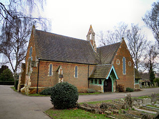
Hitchin Cemetery, also known as St John's Road Cemetery, is the main burial ground for the town of Hitchin in Hertfordshire. The cemetery is located on Hitchin Hill, with Standhill Road running along the north-western boundary and St. John's Road along the south-eastern boundary. It has been owned and managed by North Hertfordshire District Council since 1974 and has a Chapel which can accommodate about 50 mourners which is available for the burial of all faiths.
References
- 1 2 "Member and Committee Information". North Hertfordshire District Council. Retrieved 12 October 2016.
- ↑ "Area: Hitchin Bearton (Ward), Key Figures for 2011 Census". Neighbourhood Statistics. Office for National Statistics. Retrieved 12 October 2016.