Related Research Articles

The Peace River is a 1,923-kilometre-long (1,195 mi) river in Canada that originates in the Rocky Mountains of northern British Columbia and flows to the northeast through northern Alberta. The Peace River joins the Athabasca River in the Peace-Athabasca Delta to form the Slave River, a tributary of the Mackenzie River. The Finlay River, the main headwater of the Peace River, is regarded as the ultimate source of the Mackenzie River. The combined Finlay–Peace–Slave–Mackenzie river system is the 13th longest river system in the world.

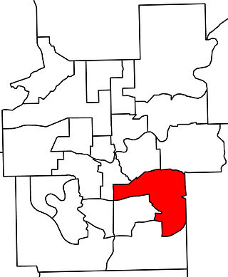
Livingstone-Macleod is a provincial electoral district in Alberta, Canada. The district is one of 87 current districts in the province mandated to return a single member to the Legislative Assembly of Alberta using the first past the post method of voting.
Edmonton Mill Creek was a provincial electoral district in Alberta, Canada, mandated to return a single member to the Legislative Assembly of Alberta using the first past the post method of voting from 1997 to 2019.

Little Beaver Creek is a wild and scenic area in Ohio. The Little Beaver Creek watershed is located primarily in Columbiana County in eastern Ohio, and in portions of Carroll County, Mahoning County, and western Pennsylvania, draining approximately 605 mi² (1,567 km²), of which 503 mi² (1,303 km²) are in Ohio. The watershed in total size covers an area of approximately 510 square miles, with about 80% of this being situated in Ohio. The great majority of land within the watershed is privately owned. Within the watershed are roughly 808 miles of linear streams.

Division No. 3 is a census division in Alberta, Canada. It is located in the southwest corner of southern Alberta and its largest urban community is the Town of Claresholm.
Brocket is a settlement in Peigan 147, in southern Alberta located on Highway 3 between Pincher Creek and Fort Macleod. It is the main community on the Piikani Nation reserve.
There are several lakes named Mud Lake within the Canadian province of Alberta.

The Beaver River is an intermittent river, 280 miles (450 km) long, in western Oklahoma and northern Texas in the United States. It is a tributary of the North Canadian River, draining an area of 11,690 square miles (30,300 km2) in a watershed that extends to northeastern New Mexico and includes most of the Oklahoma Panhandle.

Waterton Lake is a mountain lake in southern Alberta, Canada, and northern Montana, United States. The lake is composed of two bodies of water, connected by a shallow channel known locally as the Bosporus. The two parts are referred to as Middle Waterton Lake, and Upper Waterton Lake, the latter of which is divided by the Canada–United States border with Canada containing about two thirds of the lake while the southern third falls in the United States. The Boundary Commission Trail ends at the lake as the last border marker was placed there on 8 August 1874. The United States Geological Survey gives the geocoordinates of 49°03′00″N113°54′03″W for Upper Waterton Lake. Lower Waterton Lake is north of Middle Waterton Lake and is separated by a channel known as the Dardanelles.

Beaver River is a large river in east-central Alberta and central Saskatchewan, Canada. It flows east through Alberta and Saskatchewan and then turns sharply north to flow into Lac Île-à-la-Crosse on the Churchill River which flows into Hudson Bay.
Pincher Creek was a provincial electoral district in Alberta, Canada, mandated to return a single member to the Legislative Assembly of Alberta from 1905 to 1940.
Blackmud Creek is a creek in Edmonton that flows into Whitemud Creek. The creek starts at Saunders Lake East of Nisku and runs northwest into the City, joining Whitemud Creek in the neighbourhood of Twin Brooks.

Waterhen River is an east-flowing river in the north-west area of the Canadian province of Saskatchewan in the drainage basin of the Beaver River. It is north of and parallel to the east-flowing part of the Beaver River and joins the north-flowing part of that river. Most of the river and its drainage basin is at the southern edge of the boreal forest belt. While the river's source is Lac des Îles, its drainage basin reaches north into the Mostoos Hills and west well into the neighbouring province of Alberta.
Boundary Creek is a cross-border tributary of the St. Mary River, flowing through Alberta in Canada and Montana in the United States.
Castor Creek is a stream in Alberta, Canada. It is a tributary of the Battle River.
Conjuring Creek is a stream in Alberta, Canada, and is a minor tributary of the North Saskatchewan River. It originates at Wizard Lake and drains into the North Saskatchewan River. It runs from south to north passing through the town of Calmar.
Drywood Creek is a stream in Alberta, Canada.
Haynes Creek is a stream in Alberta, Canada.
East Arrowwood Creek is a stream in Alberta, Canada.
References
- ↑ "Beaver Creek". Geographical Names Data Base . Natural Resources Canada.
- ↑ Place-names of Alberta. Ottawa: Geographic Board of Canada. 1928. p. 17.
49°37′46″N113°42′00″W / 49.6294444°N 113.7°W