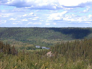
The Opeongo River is a river in the Saint Lawrence River drainage basin in Nipissing District in northeastern Ontario, Canada. The river is entirely within Algonquin Provincial Park and Opeongo River Provincial Park, except for a small portion around Victoria Lake, and is a left tributary of the Madawaska River.

The Clearwater River is located in the Canadian provinces of Saskatchewan and Alberta. It rises in the northern forest region of northwestern Saskatchewan and joins the Athabasca River in northeastern Alberta. It was part of an important trade route during the fur trade era and has been designated as a Canadian Heritage River.

The Brightsand River is a river in the James Bay drainage basin in Unorganized Thunder Bay District in northwestern Ontario, Canada.

Beaver Creek Provincial Park is a provincial park on Lake Winnipeg near the mouth of Beaver Creek in the Northeast Northern Region census division in the Northern Region of Manitoba, Canada.

North Thompson Oxbows Manteau Provincial Park is a provincial park in Thompson-Nicola Regional District in the Interior region of British Columbia, Canada. The park was established on April 30, 1996, and has an area of 515 hectares. It protects "…floodplain wetlands, numerous oxbow lakes, sandbars, back channels, levees, along the glacier-fed North Thompson River." There are no camping or day-use facilities.

Woodland Caribou Provincial Park is a provincial park in Northwestern Ontario, Canada, west of the municipality of Red Lake. It borders Atikaki Provincial Park and Nopiming Provincial Park in eastern Manitoba, and is made up of Canadian Shield and boreal forest. Woodland Caribou Provincial Park is a wilderness park of 450,000 hectares, and it became part of the Pimachiowin Aki UNESCO World Heritage site in 2018.
Carson Lake may refer to one of several lakes:
Windy Lake may refer to one of eight lakes of that name in Ontario, Canada:

Allan Water is a river in the James Bay drainage basin in Unorganized Thunder Bay District in northwestern Ontario, Canada.

Daisy Lake is a lake in the geographic townships of Butt and McCraney in the Unorganized South Part of Nipissing District, Ontario, Canada. The lake is in the Ottawa River drainage basin and is entirely within Algonquin Provincial Park.
Black Creek in Ontario may refer to one of 37 creeks of that name:
Carson Lake in Ontario, Canada may refer to one of six lakes of that name:
Cedar Lake may refer to one of eighteen lakes of that name in Ontario, Canada:

The Nipissing River is a river in the Saint Lawrence River drainage basin in the Unorganized South Part of Nipissing District in northeastern Ontario, Canada. The river is entirely within Algonquin Provincial Park, and is a left tributary of the Petawawa River.

The Big East River is a river in Muskoka District and Nipissing District in Northeastern Ontario, Canada. The river is in the Great Lakes Basin, is a left tributary of the Muskoka River, and flows from Algonquin Provincial Park to Huntsville.

The Black Duck River is a river in the provinces of Manitoba and Ontario, Canada. Flowing northeast from Hosea Lake in Kenora District in Northwestern Ontario, the river criss-crosses the Manitoba-Ontario border before reaching to its mouth at Hudson Bay in the Northern Region of Manitoba just west of Manitoba's easternmost point where the inter-provincial border meets the bay.

The Makobe River is a river in northeastern Ontario, Canada. It is in the Saint Lawrence River drainage basin and is a left tributary of the Montreal River.

Carroll Lake is an irregularly-shaped lake in the province of Manitoba, and in the Unorganized Part of Kenora District in Northwestern province of Ontario, Canada. It is in the Hudson Bay drainage basin, and, with the exception of portions of two small bays in the west, lies mostly in Ontario. The Ontario portion of the lake is within Woodland Caribou Provincial Park, and the small Manitoba portions within Atikaki Provincial Wilderness Park.

Remi Lake is a lake in both the municipality of Moonbeam and geographic Gurney Township in Unorganized North Cochrane District, Cochrane District, in Northeastern Ontario, Canada. It is in the James Bay drainage basin.

Silver Lake is a lake in Tay Valley, Lanark County, and Central Frontenac, Frontenac County, in Eastern Ontario, Canada. It is the source of Silver Lake Creek and is in the Ottawa River drainage basin.


