Beaver Creek is a community in Yukon, Canada. Located at kilometre 1870.6 of the Alaska Highway, 1 nautical mile southeast of Beaver Creek Airport and close to the Alcan - Beaver Creek Border Crossing, it is Canada's westernmost community. The community's main employers are a Canada Border Services Agency port, the White River First Nation and a number of tourist lodges.
The Eastern Shore is a region of the Canadian province of Nova Scotia. It is the Atlantic coast running northeast from Halifax Harbour to the eastern end of the peninsula at the Strait of Canso.
The Halifax Regional Municipality (HRM) in Nova Scotia, Canada has a widely varied geography.

The Musquodoboit River is a Canadian river located in central Nova Scotia in the northeastern part of Halifax Regional Municipality. The river is approximately 97 kilometres (60 mi) in length with roughly 88 kilometres (55 mi) being traversable by paddle. It has a watershed area of 1,409 square kilometres (544 sq mi)
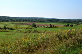
The Musquodoboit Valley is a valley and region in the Halifax Regional Municipality, Nova Scotia, Canada. It is administratively located in the Halifax Regional Municipality's Musquodoboit Valley & Dutch Settlement planning area and the western edge of the valley includes communities that are considered part of the commutershed for the urban area of the Halifax Regional Municipality.

Sheet Harbour is a rural community on the Eastern Shore of Nova Scotia, Canada. It is part of the Halifax Regional Municipality and lies along the Marine Drive on Trunk 7 approximately 117 km (73 mi) northeast of Halifax. The community is located along the shores of Sheet Harbour, which has two arms, the Northwest Arm and the Northeast Arm. Two rivers flow into the harbour: West River into the Northwest Arm, and East River into the Northeast Arm. Grand Lake, a large lake west of Sheet Harbour, empties into the Northwest Arm via Little West River, a minor river. The majority of the land was granted in 1773 and a colony was established in 1784 by Loyalist refugees and British veterans of the American Revolution. Forestry was prominent in Sheet Harbour during its early years. The first sulphide pulp mill in the Dominion of Canada was constructed along the East River in 1885. It was closed in 1891, due to the high prices of importing sulphide. Another pulp mill was constructed beside the West River Falls in 1925, but it was destroyed by Hurricane Beth in August 1971. The economy of the community today relies on forestry, fishing and tourism. Southwest of the community is the Sheet Harbour Industrial Port, an important regional deep-water port.

Musquodoboit Harbour is a natural harbour in Canada on the Eastern Shore of Nova Scotia.

Moser River is a rural community on the Eastern Shore of Nova Scotia, Canada, in the Halifax Regional Municipality. The community lies along the Marine Drive on Trunk 7, 32 km (20 mi) east of Sheet Harbour and 51 km (32 mi) southwest of Sherbrooke. The community is located along the shores of Necum Teuch Harbour, an inlet of the Atlantic Ocean, and is at the mouth of Moser River. The area was called Noogoomkeak in the mi'kmaq language, translating to "soft sand place". The community is named for Henry Moser, who was the son of Jacob Moser, who settled here in 1796. The community used to have a school, Eastern Consolidated School, which served grades primary to six, but it closed in 2015, due to its very low student population. Duncan MacMillan High School in Sheet Harbour serves the community and its surroundings at all grade levels. There is a small seaside park in the community near the former school, as well as a post office.
Port Dufferin is a rural community on the Eastern Shore of Nova Scotia, Canada, in the Halifax Regional Municipality. The community is located on the Marine Drive on Nova Scotia Trunk 7 approximately 15 km (9.3 mi) east of Sheet Harbour. The community was formerly known as Salmon River and was renamed in 1899 by an Act of Parliament for Frederick Blackwood, the 1st Marquis of Dufferin and Governor General of Canada from 1872 to 1878. The community is situated at the mouth of Salmon River, where it empties into Beaver Harbour.
Beaver Harbour is a rural community on the Eastern Shore of Nova Scotia, Canada, in the Halifax Regional Municipality. It is located on the Marine Drive, along Trunk 7 approximately 11 km (6.8 mi) east of Sheet Harbour, Nova Scotia. The community is located on the shores of Beaver Harbour, an inlet of the Atlantic Ocean. The mi'kmaq name for the area was Kobelawakwemoode, translating to "beaver harbour". First Nations legends relay that a large rock in the harbour was thrown by Glooscap, a powerful figure in the First Nations' legends, at the mystical beaver. A Trans-Atlantic cable station is located in the community, for the former CANTAT-2 cable.
Lochaber Mines is a rural community on the Eastern Shore of Nova Scotia, Canada, in the Halifax Regional Municipality. It is located along Route 374 about 14 km (8.7 mi) northeast of Sheet Harbour. The community is located along East River and is near the Marshall Flowage, a large lake at the head of East River. The community is named for Lochaber, located in Scotland. In 1812, Alexander Fraser received a grant of land in the area. Several gold leads were opened by J.H. Anderson in 1887 in the area, however, not much work was done outside of exploratory work.
Watt Section is a rural community on the Eastern Shore of Nova Scotia, Canada, in the Halifax Regional Municipality. The community is located along Nova Scotia Trunk 7 on the Marine Drive, and is located about 5 km (3.1 mi) southeast of Sheet Harbour, Nova Scotia. The community is located along the eastern side of Sheet Harbour, an inlet of the Atlantic Ocean. The community is named for William Watt, who purchased the land at the present day location of the community in 1844. The cookhouse used at the lumber mill at the head of East River in Sheet Harbour was bought by the residents of Watt Section after the closing of the mill in January 1891, and it was floated down to the community.
Popes Harbour is a rural community of the Halifax Regional Municipality in the Canadian province of Nova Scotia, about 20 km (12 mi) west of Sheet Harbour, Nova Scotia. The community is located along the shores of Popes Harbour, an inlet of the Atlantic Ocean. The mi'kmaq names for the area were Kwemoodech and Kwemoodeech, translating to "little loon place" and "small harbour" respectively. Before 1827, the settlement was referred to as Deane Harbour. The present name for the community is in honour of an early pioneer family. Popes Harbour is known for Abriel's Fisheries.
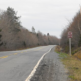
Marinette is a rural community on the Eastern Shore of Nova Scotia, Canada, in the Halifax Regional Municipality. It is located along Route 224, 11 km (6.8 mi) northwest of Sheet Harbour, along West River. The first land grant here was given to David Redmond from Antrim, Ireland, in 1828.
Sheet Harbour Road is a community of the Halifax Regional Municipality in the Canadian province of Nova Scotia. It is located just five minutes south of Upper Musquodoboit, Nova Scotia. Its name is derived from Route 224, which is the primary route from the Musquodoboit Valley to Sheet Harbour, Nova Scotia.
Beaver Lake 17 is a small Mi'kmaq reserve on the Eastern Shore of Nova Scotia, Canada, in the Halifax Regional Municipality. It is located on Route 224 about 21 km (13 mi) northwest of Sheet Harbour and about 20 km (12 mi) southeast of Upper Musquodoboit. The community is located adjacent to Lower Beaver Lake and is located within the community of Beaver Dam.

Island Lake is a settlement in the Unorganized North Part of Algoma District in northeastern Ontario, Canada. It is part of the Aweres local services board and is about 5 kilometres (3 mi) northeast of the community of Heyden on Ontario Highway 17. The settlement is at the junction of Ontario Highway 552 and Ontario Highway 556, and the Algoma Central Railway passes through the community.
West River Sheet Harbour is a river on the Eastern Shore of Nova Scotia, Canada, in the Halifax Regional Municipality. Its headwaters are near the Musquodoboit Valley and the river flows southeast and empties in to the Northwest Arm of Sheet Harbour, Nova Scotia. The river has three main tributaries: West River Main, Killag River and Little River. The river was suffering from acidification, so a lime doser was installed and has been in use since September 2005. It stabilized the river's pH at 5.5, a healthy level for aquatic life.