
Bromham is a village and civil parish in Bedfordshire, England, west of the town of Bedford. It is within commuting distance of London via Bedford railway station.

Stagsden is a small but historic village and civil parish located in northwest Bedfordshire, near the Buckinghamshire border. Situated on the main route between nearby Bedford and Milton Keynes, the village was bypassed by the A422 in April 1992, to allow the increasing amount of traffic to avoid the 30 mph speed limit in Stagsden.
Beadlow Priory was a monastic foundation established between 1140 and 1146 by Robert D'Albini for a community of Benedictine monks.

Millbrook is a small village and civil parish near Bedford, England. It has a population of 130, increasing to 147 at the 2011 Census. Millbrook railway station, on the Marston Vale Line, is about two miles (3 km) from the village. The parish church, dedicated to St Michael and All Angels, is Grade II* listed.

Turvey is a village and civil parish on the River Great Ouse in Bedfordshire, England, about 6 miles (9.7 km) west of Bedford. The village is on the A428 road between Bedford and Northampton, close to the border with Buckinghamshire. The 2011 Census recorded the parish's population as 1,225.

Pavenham is a small village and civil parish on the River Great Ouse in the Borough of Bedford in Bedfordshire, England, about 6 miles (10 km) north-west of Bedford. Village amenities consist of St Peter's Church, a pub, Village hall, tennis Club, Cricket Club and golf club. The village is home to many clubs and societies including an active WI.

Sutton is a rural village and civil parish in the Central Bedfordshire district of Bedfordshire, England. It lies 11 miles (18 km) west of Bedford. At the 2001 Census, its population was 299. Main features are the packhorse bridge over the Potton Brook and the Grade I listed All Saints' Parish Church.

Golf is a club-and-ball sport in which players use various clubs to hit balls into a series of holes on a course in as few strokes as possible.
This is an outline of Sport in Bedfordshire, a county in England.
Great Denham is a village and civil parish located in Bedfordshire, England, on the western outskirts of Bedford. The village is the location of Bedford Golf Course.

Stondon is a civil parish located in the Central Bedfordshire district of Bedfordshire, England. The parish includes the settlements of Lower Stondon and Upper Stondon.

Church of St Leonard is a Grade I listed church in Stagsden, Bedfordshire, England. It became a listed building on 13 July 1964.

Ashridge Golf Club, also Ashridge Artisans Golf Club, is a golf club in Little Gaddesden, on the border of Hertfordshire and Bedfordshire, England, 2.5 miles south along the B4506 road from Dagnall, Buckinghamshire, and five miles northwest of Berkhamsted. It was established in 1932 on the Ashridge Estate. The club has hosted the numerous PGA events and hosted the Open Championship' Regional Qualifying Competition for six years between 2003 and 2008. The course measures 6,663 yards. A new clubhouse was built to accommodate for the Open Championship qualifiers in 2003.

Aylesbury Vale Golf Club is a golf club about four miles to the west of Leighton Buzzard, Bedfordshire, England, to the southeast of Stewkley. It was established in 1989 and opened in 1991. The course measures 6,622 yards.
Bedford & County Golf Club is a golf club to the northeast of Clapham, Bedfordshire, England. It was established in 1912. As of 1995 the course measured 6,290 yards.
John O'Gaunt Golf Club is a golf club, located two-and-a-half miles to the north-east of Biggleswade, Bedfordshire, England, just north of the village of Sutton. It was established in 1948. As of 1995 the course measured 6,513 yards. The Club has 36 Holes at the complex, the original John O'Gaunt course and the newer Carthagena Course which opened in 1980. It hosted the English Golf Union Seniors Championship in 1988 and 2003 and was used as the venue for Final Qualifying for the Women's British Open in 2016.

Dunstable Downs Golf Club is a golf club in the southwest of Dunstable, Bedfordshire, England. It was established in 1906. As of 1995 the course measured 6251 yards. The club has hosted the British PGA Matchplay Championship.
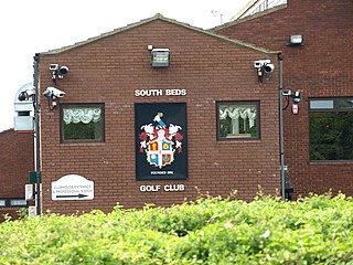
South Beds Golf Club is a golf club in Galley Hill, near Bramingham and north of Luton, Bedfordshire, England. It was established in 1893 and is ranked as the fourth best golf course in the county by the website Top 100 Golf Courses.

Aspley Guise & Woburn Sands Golf Club is a golf club between the villages of Aspley Guise and Woburn Sands, Bedfordshire, England. It was originally established in 1914 as a 9-hole golf course, with a further 9 holes opened in 1974. The course is ranked as the fifth best golf course in the county by the website Top 100 Golf Courses.

Hanger Wood is an ancient woodland and Site of Special Scientific Interest (SSSI) in the parish of Stagsden, Bedfordshire in the United Kingdom. Situated approximately one kilometre east of the village of Stagsden, the 24.12 hectares woodland was declared a SSSI in 1988, being described by Natural England as "one of the best remaining examples of wet ash-maple woodland in Bedfordshire". The name "Hanger" comes from Old English/Anglo-Saxon term for "wood on a hill" or "wooded hill", applied to Hanger Wood due to its situation on a northwest-facing slope of a narrow ridge. Commenting on the wood's character, A. Simco said in 1984 that "It has been strongly influenced by the geology and topography of the area, particularly by the south-west/north-east boulder clay ridge along which the parish boundary runs."
