Gallery
 Village church
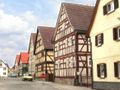 Houses at the 'Manger'
 Town hall
 Primary school
 Former frontier to GDR
 Memorial for border fortification
Behrungen is a former municipality in the district Schmalkalden-Meiningen, in Thuringia, Germany. Since December 1, 2007, it has been part of the Grabfeld district. [1]


50°25′N10°25′E / 50.417°N 10.417°E
| International | |
|---|---|
| National | |
| | This Schmalkalden-Meiningen location article is a stub. You can help Wikipedia by expanding it. |