This article has multiple issues. Please help improve it or discuss these issues on the talk page . (Learn how and when to remove these template messages)
(Learn how and when to remove this template message) Contents |
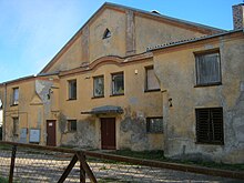
| Beit Medrash Hagadol Synagogue of Jonava | |
|---|---|
 | |
| Basic information | |
| Location | |
| Affiliation | Judaism |
| Status | Not in use |
| Architectural style | Historicism |
The Beit Medrash Hagadol Synagogue of Jonava (Lithuanian : Jonavos Beit Midrash Hagadol sinagoga) is a former synagogue in Jonava.
Lithuanian is a Baltic language spoken in the Baltic region. It is the language of Lithuanians and the official language of Lithuania as well as one of the official languages of the European Union. There are about 2.9 million native Lithuanian speakers in Lithuania and about 200,000 abroad.

A synagogue, is a Jewish or Samaritan house of worship.
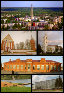
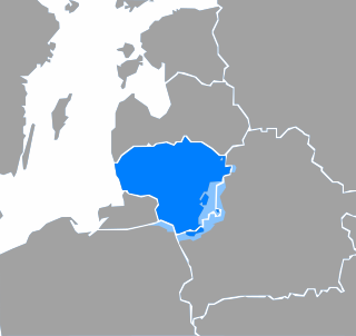
Jonava is the ninth largest city in Lithuania with a population of ca 30,000. It is located in Kaunas County in central Lithuania, 30 km (19 mi) north east of Kaunas, the second-largest city in Lithuania. It is served by Kaunas International Airport. Achema, the largest fertilizer factory in the Baltic states, is located nearby. The city is sometimes called "the capital of midsummer holiday".
In 1941 80% of Jonava's population was Jewish and town had seven synagogues. [1]
At present only two synagogues remain and both are not in use. The other synagogues were destroyed when Jonava was attacked by Nazi Germany. [2]

Nazi Germany is the common English name for Germany between 1933 and 1945, when Adolf Hitler and his Nazi Party (NSDAP) controlled the country through a dictatorship. Under Hitler's rule, Germany was transformed into a totalitarian state that controlled nearly all aspects of life via the Gleichschaltung legal process. The official name of the state was Deutsches Reich until 1943 and Großdeutsches Reich from 1943 to 1945. Nazi Germany is also known as the Third Reich, meaning "Third Realm" or "Third Empire", the first two being the Holy Roman Empire (800–1806) and the German Empire (1871–1918). The Nazi regime ended after the Allies defeated Germany in May 1945, ending World War II in Europe.
Beit Medrash Hagadol Synagogue was one of the two biggest synagogues in Jonava. The main synagogue that was located next to Beit Midrash Hagadol has been destroyed. [3]
The current appearance of the synagogue differs significantly from its previous appearance.