Equatorial Guinea, officially the Republic of Equatorial Guinea, is a country located on the west coast of Central Africa, with an area of 28,000 square kilometres (11,000 sq mi). Formerly the colony of Spanish Guinea, its post-independence name evokes its location near both the Equator and the Gulf of Guinea. Equatorial Guinea is the only sovereign African state in which Spanish is an official language. As of 2015, the country had an estimated population of 1,222,245.

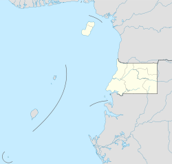
The Republic of Equatorial Guinea is located in west central Africa. Bioko Island lies about 40 kilometers (24.9 mi) from Cameroon. Annobón Island lies about 595 kilometres (370 mi) southwest of Bioko Island. The larger continental region of Rio Muni lies between Cameroon and Gabon on the mainland; it includes the islands of Corisco, Elobey Grande, Elobey Chico, and adjacent islets.
This article is about the demographic features of the population of Equatorial Guinea, including population density, ethnicity, education level, health of the populace, economic status, religious affiliations and other aspects of the population.
Equatorial Guinea is a small nation of 1.2 million located on the west coast of Central Africa which gained independence from Spain in 1968. Thanks to the discovery and exploitation of significant oil reserves in the 1990s, it enjoys a purchasing power parity GDP per capita of more than US$38,699 which is as of 2016 the highest in Africa and the 31st highest in the world. However, the country has been ranked only 138th out of 188 countries on the United Nations Human Development Index in 2015. After the oil price collapsed in 2014, the economy has gone into a free for all which has put growth in a downwards spiral from around 15% to −10%.
This article lists transport in Equatorial Guinea.

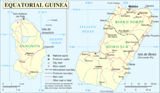
Malabo is the capital of Equatorial Guinea and the province of Bioko Norte. It is located on the north coast of the island of Bioko, formerly known by the Bubis, its indigenous inhabitants, as Etulá, and as Fernando Pó by the Europeans. The city has a population of approximately 187,302 inhabitants.
The Annobonese is a Portuguese creole known to its speakers as Fa d'Ambu or Fá d'Ambô. It is spoken on the Annobón and Bioko Islands off the coast of Equatorial Guinea, mostly by people of mixed African, Portuguese and Spanish descent. It is called annobonense or annobonés in Spanish.
Bioko Sur is a province of Equatorial Guinea. Its capital is Luba. It occupies the southern part of the island of Bioko, the remainder of which is part of Bioko Norte.
Articles related to Equatorial Guinea include:

Equatoguinean Spanish is the variety of Spanish spoken in Equatorial Guinea. This is the only Spanish variety that holds national official status in Sub-Saharan Africa. It is regulated by the Equatoguinean Academy of the Spanish Language and is spoken by about 90% of the population, estimated at 1,170,308 for the year 2010, all of them second-language speakers.

Riaba is a town in Equatorial Guinea. It is also the 30th largest settlement in the country. It was established by the British in 1821.

San Carlos is a shield volcano on the island of Bioko, Equatorial Guinea. With an elevation of 2,261 metres above sea level it is the second highest peak in Equatorial Guinea.
The Mount Cameroon and Bioko montane forests ecoregion, of the tropical and subtropical moist broadleaf forests Biome, are in Afromontane habitats in Cameroon and Equatorial Guinea of Africa.
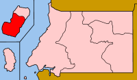
The Insular Region of Equatorial Guinea comprises the former Spanish territory of Fernando Po, together with Annobón island, the latter formerly part of the Spanish territory of Elobey, Annobón and Corisco, which was located in the Gulf of Guinea and in the Corisco Bay.

Equatorial Guinea is divided into seven provinces :
- Annobón Province
- Bioko Norte Province (Malabo)
- Bioko Sur Province (Luba)
- Centro Sur Province (Evinayong)
- Kié-Ntem Province (Ebebiyín)
- Litoral Province (Bata)
- Wele-Nzas Province (Mongomo)
The geological basement of the central and eastern regions Equatorial Guinea is composed of Precambrian rocks which form a part of the Congo craton. They include gneiss, greenstone, schist-amphibolite and granitoids. These older rocks are overlain by sedimentary rocks of Mesozoic, Neogene and Quaternary age in the west and along the coast. The islands of Pagalu and Bioko are of relatively recent volcanic origin, forming a part of the Cameroon Volcanic Line.
The Bioko leaf-toed gecko is a species of forest geckos from Bioko Island.