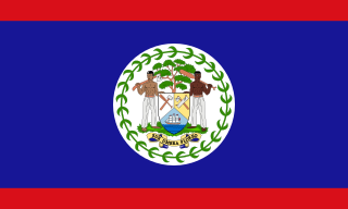
Belize is a country on the north-eastern coast of Central America. It is bordered by Mexico to the north, the Caribbean Sea to the east, and Guatemala to the west and south. It also shares a water boundary with Honduras to the southeast. Belize is a member of the Caribbean Community (CARICOM), and is considered part of the Caribbean region and the historical British West Indies.

Belmopan is the capital city of Belize. Its population in 2010 was 16,451. In addition to being the smallest capital city in the continental Americas by population, Belmopan is the third-largest settlement in Belize, behind Belize City and San Ignacio. Founded as a planned community in 1970, Belmopan is one of the newest national capital cities in the world. Since 2000, Belmopan has been one of two settlements in Belize to hold official city status, along with Belize City.

Xunantunich is an Ancient Maya archaeological site in western Belize, about 70 miles west of Belize City, in the Cayo District. Xunantunich is located atop a ridge above the Mopan River, well within sight of the Guatemala border – which is 0.6 miles (1 km) to the west. It served as a Maya civic ceremonial centre to the Belize Valley region in the Late and Terminal Classic periods. At that time, when the region was at its peak, nearly 200,000 people lived in the Belize Valley.

Belize City is the largest city in Belize. It was once the capital of the former British Honduras. According to the 2010 census, Belize City has a population of 61,461 people. It is at the mouth of the Haulover Creek, which is a distributary of the Belize River. The Belize River empties into the Caribbean Sea eight kilometres from Belize City on the Philip Goldson Highway on the coast of the Caribbean. The city is the country's principal port and its financial and industrial hub. Cruise ships drop anchor outside the port and are tendered by local citizens. The city was almost entirely destroyed in October 1961 when Hurricane Hattie swept ashore. It was the capital of British Honduras until the government was moved to the new capital of Belmopan in 1970.

Dangriga, formerly known as Stann Creek Town, is a town in southern Belize, located on the Caribbean coast at the mouth of the North Stann Creek River. It is the capital of Belize's Stann Creek District. Dangriga is served by the Dangriga Airport. Commonly known as the "culture capital of Belize" due to its influence on punta music and other forms of Garifuna culture, Dangriga is the largest settlement in southern Belize.
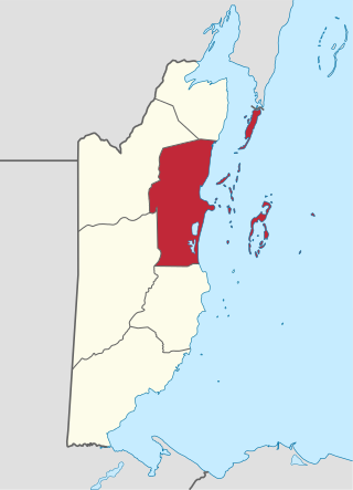
Belize District is a district of the nation of Belize. Its capital is Belize City.
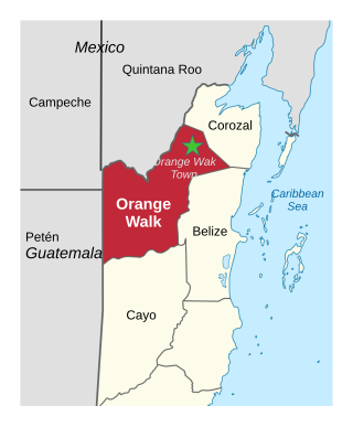
Orange Walk District is a district in the northwest of the nation of Belize, with its district capital in Orange Walk Town.

Cayo District is located in the west part of Belize, and it contains the capital, Belmopan. It is the most extensive, second-most populous and third-most densely populated of the six districts of Belize. The district's capital is the town of San Ignacio.
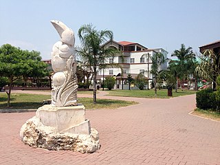
San Ignacio and Santa Elena are towns in western Belize. San Ignacio serves as the cultural-economic hub of Cayo District. It got its start from mahogany and chicle production during British colonisation. Over time it attracted people from the surrounding areas, which led to the diverse population of the town today. San Ignacio is the largest settlement in Cayo District and the second largest in the country, after Belize City.
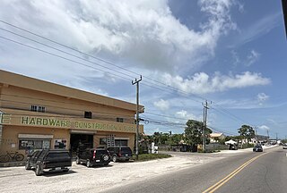
Ladyville is the largest village in the country of Belize, eight miles northwest of Belize City in the Belize District. The Philip Goldson Highway connects Ladyville to Belize City.
Silver Creek may refer to:
Santa Clara may refer to:
Progreso or Progresso may refer to:
Besa or BESA may refer to:
Fort George may refer to:
Belizean Creoles, also known as Kriols, are a Creole ethnic group native to Belize.

There is no active rail transport in Belize, although there were lines in the past.
Belize, on the east coast of Central America, southeast of Mexico, was inhabited by the indigenous peoples who fought off the Spaniards in an attempt to preserve their heritage and to avoid the fate of their neighbors who were conquered and under Spanish rule. While this was going on, British pirates would rob Spanish merchant ships and navigate through the shallow waters and small islands even going up river later to hide their bounty. The indigenous people of Belize did not resist the British like they did the Spanish. In the 17th century, however, the British settlement became a formal British crown colony from 1862 through 1964, where they first achieved self government and later in 1981 became an independent country recognized globally with all its territory intact. The British brought along with them slaves taken from Congo and Angola during the eighteenth century.
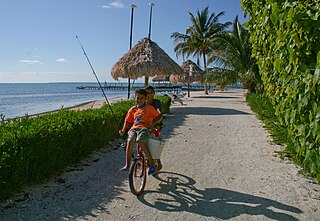
Hispanic and Latin American Belizeans are Belizeans of full or partial Hispanic and Latin American descent. Currently, they account for around 52.9% of Belize's population.
This page is based on this
Wikipedia article Text is available under the
CC BY-SA 4.0 license; additional terms may apply.
Images, videos and audio are available under their respective licenses.


