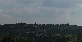
Vogošća is a secondary suburb and municipality of Sarajevo, Sarajevo Canton, the capital of Bosnia, located about 6 kilometers north of the city center and covering some 72 km². As of 2013, it has a population of 27,816 inhabitants.
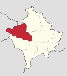
The District of Peć or District of Peja is one of the seven districts of Kosovo; it has its seat in the city of Peć.
Vrbovski is a suburban settlement of Belgrade, the capital of Serbia. It is located in the Belgrade's municipality of Palilula.

The Port of Belgrade is a cargo port on the Danube river in Belgrade, Serbia.

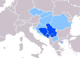
Serbian Carpathians is a mountain range in eastern Central Serbia. It presents an extension of proper Carpathian Mountains across the Danube, connecting them with the Balkan Mountains in the southeast. They stretch in north-south direction in the eastern Serbia, east of the Great Morava valley and west of the White Timok Valley and north of the Nišava Valley. The mountains are 800–1500 m high, and dominated by karst limestone geologic features.
Ormosbánya is a village in Borsod-Abaúj-Zemplén County in northeastern Hungary.
Darosava is a village in the municipality of Aranđelovac, Serbia. According to the 2002 census, the village has a population of 2023 people.

Brusnica is a village in the municipality of Gornji Milanovac, Serbia. According to the 2002 census, the village has a population of 650 people.
Radaljevo is a village in the municipality of Ivanjica, Serbia. According to the 2011 census, the village has a population of 904 inhabitants.

Bugovina is a village in the municipality of Trebinje, Republika Srpska, Bosnia and Herzegovina.
Velja Gora is a village in the municipality of Trebinje, Republika Srpska, Bosnia and Herzegovina.
Žutice is a village in the municipality of Raška, Serbia. According to the 2002 census, the village has a population of 224 people.
Ćirikovac is a village in the municipality of Požarevac, Serbia. According to the 2002 census, the village has a population of 1407 people.
Ćelije is a village situated in Lajkovac municipality, Kolubara District in Serbia.
Nepričava is a village situated in Lajkovac municipality in Serbia.
Stepanje is a village situated in Lajkovac municipality in Serbia.
Rabrovac is a village situated in Mladenovac municipality in Serbia.
Mali Požarevac is a village in the municipality of Beograd, Serbia. According to the 2002 census, the village has a population of 1479 people.
Vinča is a village in the municipality of Topola, Serbia. According to the 2002 census, the village has a population of 1176 people.
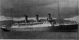
SS Gallia was a transatlantic ocean liner converted into a troopship in 1915. She was torpedoed and sunk in the Mediterranean Sea on 4 October 1916 with great loss of life.