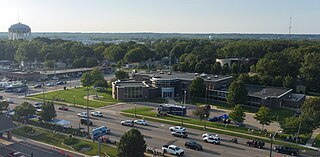
The Belknap Lookout Neighborhood is located in Grand Rapids, Michigan.
Contents
- neighborhood map
The neighborhood is bound by Leonard on the North, College Ave. on the east, Crescent Street on the south, and the Grand River on the west.

The Belknap Lookout Neighborhood is located in Grand Rapids, Michigan.
The neighborhood is bound by Leonard on the North, College Ave. on the east, Crescent Street on the south, and the Grand River on the west.
The name "Belknap Lookout" has two separate derivations. The word Belknap comes from the surname of Charles E. Belknap. Belknap was a Grand Rapids resident who came home from the Civil War in 1871 to serve Grand Rapids as the first commissioner of the Boy Scouts of America, as mayor in 1884 and as a U.S. congressman in 1888. The word Lookout comes from what is perhaps the neighborhood's most prominent feature, Belknap Hill: a 160 ft high bluff overlooking the downtown of the City of Grand Rapids.
The area which forms the Belknap Lookout Neighborhood was purchased from the government in 1831 by Charles Dexter. In 1850 the area was included in the original organization of the city of Grand Rapids.
In its early days, the area was significant for several reasons. First, the neighborhood contained the city's first cemetery. More importantly, the neighborhood contained a spring known as an excellent supply of drinking water. Shortly after the spring's discovery, water pipelines were built connecting the water supply to downtown Grand Rapids through Michigan, Lyon and Monroe Streets. After a disastrous fire in 1873, the citizens of Grand Rapids realized they needed a larger supply of water. A water reservoir, which today holds 6 million US gallons (23,000 m3) of water, was constructed within the neighborhood. This reservoir was intended to be a backup water supply for the City of Grand Rapids. In 1880, the reservoir leaked and flooded Ottawa St. In 1900, the reservoir failed again and flooded Coldbrook, Newberg, Coit, Clancy, and Bradford Streets. The latter flood caused more than a million dollars in damages.
Construction of homes, in significant numbers, did not occur within the neighborhood until 1874. Heavy construction lasted until approximately 1888. Early residents of the Belknap Lookout neighborhood included the mayor, city attorney, school principal, superintendent, bankers, newspaper editors, physicians, musicians, furniture carvers, and factory foreman. The homes on the West side of the neighborhood tend to be larger and more expensive than those on the East side.
Total Population (2000): 4,234 people
Race (2000):
White 52.9%
Black 23.2%
American Indian and Alaska Native 1.3%
Asian or Pacific Islander 1.7%
Some other race 0.3%
Two or more races 5.0%
Hispanic/Latino 15.6%
Age (2000):
32% of population is under 18 -and- 7% of population is over 65
Belknap Lookout is home to several organizations and institutions

Walker is a city in Kent County in the U.S. state of Michigan. The population was estimated to be 25,086 in 2022.

Wyoming is a city in Kent County in the U.S. state of Michigan. The population was 76,501 at the 2020 census. Wyoming is the second most-populated community in the Grand Rapids metropolitan area and is bordered by Grand Rapids on the northeast. After Grand Rapids, it is also the second most-populated city in West Michigan.

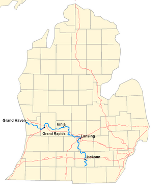
The Grand River is a 252-mile-long (406 km) river in the Lower Peninsula of the U.S. state of Michigan. The longest river in Michigan, the Grand River rises in Hillsdale County, and flows in a generally northwesterly direction to its mouth at Lake Michigan in the city of Grand Haven. The river flows through a number of cities, including Jackson, Lansing, Ionia, and Grand Rapids.

Interstate 296 (I-296) is a part of the Interstate Highway System in the US state of Michigan. It is a north–south state trunkline highway that runs for 3.43 miles (5.52 km) entirely within the Grand Rapids area. Its termini are I-196 near downtown Grand Rapids and I-96 on the north side of Grand Rapids in Walker. For most of its length, the Interstate runs concurrently with U.S. Highway 131 (US 131), which continues as a freeway built to Interstate Highway standards north and south of the shorter I-296. The highway was first proposed in the late 1950s and opened in December 1962, but the Michigan Department of Transportation (MDOT) has since eliminated all signage for I-296 and removed the designation from their official state map. The designation is therefore unsigned, but still listed on the Interstate Highway System route log maintained by the Federal Highway Administration (FHWA).

John Stoughton Newberry was an American industrialist and politician. He served as the first provost marshal for the State of Michigan and as a U.S. Representative from the state of Michigan.

Charles Eugene Belknap was an American politician who served as a U.S. representative from the U.S. state of Michigan.

Maple Leaf is a mostly residential neighborhood located in northeast Seattle.

Mount Tabor is a neighborhood in Southeast Portland that takes its name from the volcanic cinder cone and city park on the volcano that it surrounds, in the U.S. state of Oregon. The name refers to Mount Tabor, Israel. It was named by Plympton Kelly, son of Oregon City pioneer resident Clinton Kelly.

The Grand Rapids and Indiana Railroad at its height provided passenger and freight railroad services between Cincinnati, Ohio, and the Straits of Mackinac in Michigan, USA. The company was formed on January 18, 1854.
Mack Park was the original home field of Detroit's Negro National League baseball franchise, the Detroit Stars. It was constructed in 1914 by Joe Roesink, sponsor of a local semi-professional team, a Dutchman of Jewish descent born in Grand Rapids who owned a chain of haberdasheries.
The Grand Rapids Public Schools is a public school district serving Grand Rapids, Michigan.

Croton Dam is an earth-filled embankment dam and powerplant complex on the Muskegon River in Croton Township, Newaygo County, Michigan. It was built in 1907 under the direction of William D. Fargo by the Grand Rapids - Muskegon Power Company, a predecessor of Consumers Energy. The 40-foot-high (12 m) dam impounds 7.2 billion U.S. gallons (6 billion imp. gal/27 billion L) of water in its 1,209-acre (489 ha) reservoir and is capable of producing 8,850 kilowatts at peak outflow. It was listed on the National Register of Historic Places in 1979.

Grand Rapids Medical Mile is a designated area within the city of Grand Rapids, Michigan. It began with medical-related development in the Hillside District of Grand Rapids, bordering both sides of Michigan Street. More than a decade later it encompasses an area five times larger, expanding east further down Michigan St.and north across Interstate 196. It has also been referred to as Grand Rapids Medical Corridor, Michigan Street Medical Corridor, Health Hill, Medical Hill, and Pill Hill, among other names.

There are six business routes of US Highway 131 in the state of Michigan, and previously there was one bypass route and an additional business route. All of the business routes are former sections of US Highway 131 (US 131). These former sections of the mainline highway, along with the necessary connecting roads, allow traffic to access the downtowns business districts of cities bypassed by sections of US 131 built since the 1950s. The extant business loops connect to Constantine, Three Rivers, Kalamazoo, Big Rapids, Cadillac, and Manton. The former bypass route in Grand Rapids allowed traffic to bypass that city's downtown at a time when US 131 still ran through the heart of the city, and the later business route connected through downtown while US 131 ran on a freeway bypassing the central business district.

College Hill is a neighborhood of the City of St. Louis, Missouri. The name College Hill was given to this area because it was the location of the Saint Louis University College Farm. This area, bounded generally by Warne Ave., O'Fallon Park, I-70, Grand Boulevard, and W. Florissant Ave., was acquired by the University for garden and recreation purposes in 1836. It was subdivided in the early 1870s.

Congress Park is a park and a neighborhood in the City and County of Denver, Colorado, United States. In 2010, the neighborhood had 10,235 residents and 5,724 households.

Grand Rapids is a city and county seat of Kent County in the U.S. state of Michigan. At the 2020 census, the city had a population of 198,893, making it the second-largest city in Michigan, after Detroit. Grand Rapids is the central city of the Grand Rapids metropolitan area, which has a population of 1,087,592 and a combined statistical area population of 1,383,918.

Plaza Towers is a mixed-use highrise building in Grand Rapids, Michigan. At 345 feet (105 m), it was the tallest building in the city until the completion of the River House Condominiums in 2008. The building contains apartments on floors 8–14, individually owned condominiums on floors 15–32, and a 214-room Courtyard by Marriott hotel on floors 1–7.

The 2013 Grand Rapids flood lasted from April 12 to 25, 2013, affecting multiple areas in the Grand Rapids metropolitan area. Sudden heavy rainfall, saturation of the ground from rainwater and the flow of tributaries caused the Grand River to rise dramatically, with the river cresting at 21.85 feet (6.66 m) in Grand Rapids on April 21, 2013. The flooding caused thousands of residents in the area to evacuate their homes.

The Woollahra Reservoir or WS022 is a heritage-listed underground reservoir at 5R Oxford Street, Centennial Park, New South Wales, Australia. It was designed and built by the NSW Public Works Department. The property is owned by Sydney Water. A sign attached to a building on the site states that this is known as "Centennial Park number 1 Water Reservoir Underground WS0022". The reservoir is adjacent to Centennial Park Reservoir. This reservoir is closer to York Street than Centennial Park Reservoir. The area is enclosed by a high fence and a sign on the main gate states: WARNING KEEP OUT" and that trespassers may be prosecuted.