
Yukon is a city in eastern Canadian County, Oklahoma, United States. The population was 23,630 at the 2020 census. Founded in the 1890s, the town was named in reference to a gold rush in Yukon Territory, Canada, at the time. Historically, Yukon served as an urban center for area farmers and the site of a milling operation. Currently, it is primarily a residential community for people who work in the Oklahoma City Metropolitan Area.

Ardmore is the county seat of Carter County, Oklahoma, United States. The population was 24,725 at the time of the 2020 census, a 1.8% increase over the 2010 census figure of 24,283. The Ardmore micropolitan statistical area had an estimated population of 48,491 in 2013. Ardmore is 90 miles (140 km) from both Oklahoma City and Dallas/Fort Worth, Texas, at the junction of Interstate 35 and U.S. Highway 70, and is generally considered the hub of the 13-county region of South Central Oklahoma, also known by state tourism pamphlets as "Chickasaw Country" and previously "Lake and Trail Country". It is also a part of the Texoma region. Ardmore is situated about 9 miles (14 km) south of the Arbuckle Mountains and is located at the eastern margin of the Healdton Basin, one of the most oil-rich regions of the United States.

Healdton is a city in Carter County, Oklahoma, United States. Its population was 2,788 at the 2010 census. It is part of the Ardmore micropolitan statistical area.
Grove is a city in Delaware County, Oklahoma, United States. The population was 6,623 at the 2010 census, an increase of 27.6 percent over the figure of 5,131 recorded in 2000. Grove is surrounded by Grand Lake o’ the Cherokees, a professional bass fishing tournament lake and recreational hotspot during the travel season of Memorial Day to Labor Day.

Chickasha is a city in and the county seat of Grady County, Oklahoma, United States. The population was 16,051 at the 2020 census, a 0.1% increase from 2010. The city is named for and strongly connected to Native American heritage, as "Chickasha" (Chikashsha) is the Choctaw word for Chickasaw. Chickasha is home to the University of Science and Arts of Oklahoma.
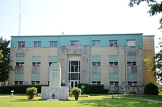
Stigler is a city in and county seat of Haskell County, Oklahoma. The population was 2,685 at the time of the 2010 census, down from 2,731 recorded in 2000.

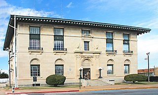
Waurika is the county seat of Jefferson County, Oklahoma, United States. The population was 1,837 as of the 2020 United States census.

Chandler is a city in, and the county seat of, Lincoln County, Oklahoma, United States. and is part of the Oklahoma City Metropolitan Area. The population was 2,858 at the time of the 2020 census. Chandler is located northeast of Oklahoma City on SH-66 and I-44, and north of Shawnee on SH-18.

Broken Bow is a city in McCurtain County, Oklahoma, United States. The population was 4,120 at the 2010 census. It is named after Broken Bow, Nebraska, the former hometown of the city's founders, the Dierks brothers. Other Dierks-associated legacies in town include Dierks Elementary School, Dierks Street, and Dierks Train #227 which is preserved in Broken Bow.

Guymon is a city and county seat of Texas County, in the panhandle of Oklahoma, United States. As of the 2020 census, the city population was 12,965, an increase of 13.3% from 11,442 in 2010, and represents more than half of the population of the county, along with being the largest city in the Oklahoma Panhandle. Cattle feedlots, corporate pork farms, and natural gas production dominate its economy, with wind energy production and transmission recently diversifying landowners' farms. Guymon was the only town or city in Oklahoma in 2010 and 2020 in which the majority of the population was Hispanic.

Chandler is a city in Henderson County, Texas, United States, at the northern end of Lake Palestine. Its population was 3,275 at the 2020 census, up from 2,734 at the 2010 census.

The Turner Turnpike is a controlled-access toll road in central Oklahoma, connecting its two largest cities, Oklahoma City and Tulsa. Authorized by the Oklahoma Legislature in 1947 and opened in May 1953, it is the oldest of the state's twelve turnpikes. The route is signed as Interstate 44 for its entire length, but was constructed prior to its designation as such. The Turner Turnpike was named after Governor Roy J. Turner, who pushed for efforts to build this toll road to connect the state's two largest cities.

Lake Jed Johnson, named for Jed Johnson (1888–1963), is third largest of thirteen small reservoirs in the Wichita Mountains National Wildlife Refuge, located in southwestern Oklahoma. Lawton, Oklahoma, southeast of the lake and the fourth largest city in the state, is the nearest major population center. Smaller communities of Cache, Medicine Park and Meers lie north of the lake.

Greenleaf State Park is located near Braggs, Oklahoma, and is situated around the 930-acre (3.8 km2) Greenleaf Lake. Greenleaf Lake was built in 1939. There is an 18-mile (29 km) hiking trail that begins inside the park and makes its way around Greenleaf lake and into the adjacent government land of Camp Gruber.

Hugo Lake is manmade lake located 7 miles (11 km) east of Hugo, in Choctaw County, Oklahoma, United States. It is formed by Hugo Lake Dam on the Kiamichi River 18 miles (29 km) upstream from the Red River. The dam is visible from U.S. Route 70, which crosses its spillway just west of Sawyer. Lake Hugo features approximately 110 miles (180 km) of shoreline and covers over 13,250 acres (53.6 km2), or 20 square miles (52 km2). Its normal pool elevation is 404.5 feet (123.3 m) above sea level and its normal storage capacity is 157,600 acre-feet (194,400,000 m3). At flood stage its elevation is at 437.5 feet (133.4 m) above sea level and it is capable of storing 966,700 acre-feet (1.1924×10⁹ m3) of flood waters. The lake's primary functions are to provide flood control, water storage, and recreational opportunities.
The Sherman–Denison metropolitan statistical area, as defined by the United States Census Bureau, is an area consisting of one county—Grayson—in North Texas, anchored by the cities of Sherman and Denison. According to the 2010 U.S. census, the MSA had a population of 120,877; according to 2021 estimates, it had a population of 139,336. The Sherman–Denison MSA is a component of the Dallas-Ft. Worth combined statistical area, which covers a 19-county area and had an estimated population of 8,057,796 as of July 1, 2009. It is also a major part of the Texoma region with proximity to both Lake Texoma and the Red River.
Dripping Springs Park is located in Okmulgee County, Oklahoma, near the city of Okmulgee, Oklahoma. Previously Dripping Springs State Park, the lake and park are now owned by Okmulgee, and are approximately 9 miles (14 km) south of the city.

Lake Yahola is a reservoir in Tulsa, Oklahoma. The reservoir was completed in 1924. Its primary purpose is to store raw water for treatment and distribution. This city-owned, 2-billion-US-gallon (7,600,000 m3), concrete-lined lake is an integral part of the Tulsa water supply, and receives water by pipeline from Lake Spavinaw. It is located in Mohawk Park, adjacent to the Mohawk Water Treatment Plant.

Foss Reservoir, also known as Foss Lake, is in Custer County, Oklahoma on the Washita River, about 15 miles (24 km) west of Clinton, Oklahoma. The reservoir was constructed during 1958–1961 by the U. S. Bureau of Reclamation. The project was known originally as the Washita Basin Project. The lake and dam were named for the community of Foss, Oklahoma, about 6 miles (9.7 km) south of the site. Their primary purpose is to regulate flow of the river and to provide water for the cities of Bessie, Clinton, Cordell and Hobart. It is western Oklahoma's largest lake and lies entirely within Foss State Park.
Clear Creek Lake is a reservoir located in Stephens County, Oklahoma, approximately 13 miles (21 km) northeast of Duncan, Oklahoma. It was built in 1948 with an earthen dam. It is one of four lakes that are collectively known as the "Duncan Area Lakes."


