A site of special scientific interest (SSSI) in Great Britain, or an area of special scientific interest (ASSI) in the Isle of Man and Northern Ireland, is a conservation designation denoting a protected area in the United Kingdom and Isle of Man. SSSI/ASSIs are the basic building block of site-based nature conservation legislation and most other legal nature/geological conservation designations in the United Kingdom are based upon them, including national nature reserves, Ramsar sites, Special Protection Areas, and Special Areas of Conservation. The acronym "SSSI" is often pronounced "triple-S I".

Grafham Water is an 806.3-hectare (1,992-acre) biological Site of Special Scientific Interest (SSSI) north of Perry, Huntingdonshire. It was designated an SSSI in 1986. It is a reservoir with a circumference of about 16 km (10 mi), is 21 m (69 ft) deep at maximum, and is the eighth largest reservoir in England by volume and the third largest by area at 6.27 km2. An area of 114 ha at the western end is a nature reserve managed by the Wildlife Trust for Bedfordshire, Cambridgeshire and Northamptonshire.
Polyne Quarry is a 0.1 hectare Site of Special Scientific Interest (SSSI) in Cornwall, England, UK. It is located to the north of Polperro civil parish, 2 miles (3.2 km) to the west of Looe.

Acaster South Ings is a Site of Special Scientific Interest, or SSSI, near York, England. It consists of two alluvial flood-meadows, and was designated in 1988 because it supports diverse fauna and flora, some of which is rare in the Vale of York area. One of the rarities is the tansy beetle, which feeds on the leaves of the tansy plant.
The Bottoms is a Site of Special Scientific Interest in County Durham, England. It lies just south of the A181 road, roughly midway between the villages of Cassop and Wheatley Hill, some 10 km south-east of Durham city.

Biddenham Pit is a gravel pit and Site of Special Scientific Interest (SSSI), 0.41 hectares in size located in Biddenham, Bedfordshire. The pit was notified to Bedford Borough Council and Bedfordshire County Council under the Wildlife and Countryside Act (1981) in 1988, and is also a Geological Conservation Review site. The site is owned by Persimmon Homes and Kier Homes, with management advice given by Natural England.

Riddlesdown Common or Riddlesdown is a 43 hectare area of green space in Kenley, towards the northern end of the North Downs in the London Borough of Croydon. It is owned and maintained by the City of London Corporation, apart from two small areas, one of which is operated by the London Wildlife Trust and the other by Croydon Council. An area of 32 hectares is a biological Site of Special Scientific Interest. The name Riddlesdown also applies to the local district of residential housing. A trig point at the site indicates that it is 525 ft (160 m) above sea level.

Hucclecote Meadows is a 5.74-hectare (14.2-acre) biological Site of Special Scientific Interest divided into two areas on each side of the M5 road in the Severn Vale, Gloucestershire. It was notified in 1984. The western area is also a Local Nature Reserve.

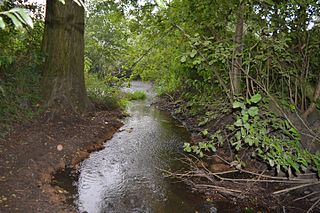
The River Ter SSSI is a stretch of the River Ter and its banks south of Great Leighs in Essex which has been designated a geological Site of Special Scientific Interest. It is a Geological Conservation Review site.

Hay-a-Park Gravel Pit is a Site of Special Scientific Interest, or SSSI, adjacent to the east side of the town of Knaresborough, North Yorkshire, England. Having been a disused and flooded quarry since the 1970s, it now consists of the large Hay-a-Park Lake and three smaller ponds, besides associated reedbeds, scrub, woodland and grassland. It was designated as a SSSI in 1995 because it supports a number of wintering birds, including a large flock of goosander. This site is "one of the most northerly inland breeding populations of reed warbler in Britain." Hay-a-Park was once part of a royal park, an early landowner being Edward II.

Cow Myers is a Site of Special Scientific Interest (SSSI) located in the Nidderdale Area of Outstanding Natural Beauty (AONB), near Ripon, North Yorkshire, England. The site was designated in 1984 for its fen and alder carr habitat, which supports a diversity of wetland plant life. Of particular interest are the bird's eye primrose which is scarce in Yorkshire, and early marsh orchid. There is no public access to this site, no vehicular access, and no public facilities.

Bishop Monkton Ings is a Site of Special Scientific Interest, or SSSI, situated east of Bishop Monkton village in North Yorkshire, England. It consists mostly of marshy, calcareous grassland, with some broadleaved woodland, and some fen alongside the two watercourses which run through the site. This varied wetland forms a habitat for a variety of plants, including the semi-parasitic marsh lousewort (Pedicularis palustris).

Mar Field Fen is a Site of Special Scientific Interest, or SSSI, north of Masham, North Yorkshire, England, in a rural area known as Marfield. It is situated on land containing woodland carr, fen, spring-fed marshy grassland and drier calcareous grassland, between the River Ure to the east and Marfield Wetland nature reserve to the west. As "one of the best examples of fen habitat in the Vale of York," it is a protected habitat for a variety of plants, including the common butterwort, a carnivorous plant. There is no public access to this site.


