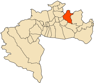
Berkane or is a city in northeastern Morocco,, in the area of Trifa, limited by the Mediterranean to its north, the Kiss Oued and Oujda Province in the east, Nador Province to the west, and Taourirt Province in the south. It is the capital of Berkane Province. The city recorded a population of 109,237 in the 2014 Moroccan census. The inhabitants of Berkane originate primarily from Yat Iznasen, a major tribe which consists of Berber clans. The tribe's descendants are also spread over the rest of eastern Morocco, in cities like Ahfir, Saïdia and Oujda. Because of recent immigration from all over Morocco, the eastern dialect of Moroccan Arabic is spoken by most of the citizens, although Berber is still spoken by many of the adults.

Kapitänleutnant Walther Schwieger was a U-boat commander in the Imperial German Navy during First World War. In 1915, he sank the passenger liner RMS Lusitania with the loss of 1,198 lives.
Magán is a municipality located in the province of Toledo, Castile-La Mancha, Spain. According to the 2006 census (INE), the municipality has a population of 1989 inhabitants.
Meneses de Campos is a municipality located in the province of Palencia, Castile and León, Spain. According to the 2004 census (INE), the municipality has a population of 142 inhabitants.
Chiapeta is a municipality in the state of Rio Grande do Sul, Brazil.
The Tapira River is a river of Paraíba state in western Brazil.
Szakáld is a village in Borsod-Abaúj-Zemplén County in northeastern Hungary.

M'Chouneche is a town and commune in Biskra Province, Algeria.

M'Chouneche District is a district of Biskra Province, Algeria.

Djellal is a town and commune in Khenchela Province, Algeria. According to the 1998 census it had a population of 3,637.
Gueltat Sidi Saad is a town and commune in Laghouat Province, Algeria. According to the 1998 census it has a population of 10,629.

Sidi Lakhdar is a town and commune in Mostaganem Province, Algeria, about 300 km westof the capital, Algiers. It is the capital of Sidi Lakhdar District. According to the 1998 census, it has a population of 30,950. Under French colonial rule, the town was known as Lapasset. It changed its name in 1962.
Oued Rhiou is a town and commune in Relizane Province, Algeria.
Sidi Khettab is a town and commune in Relizane Province, Algeria.
Youb is a town and commune in Saïda Province in north-western Algeria. Youb is 45 km west of the Saïda and has some 17,000 inhabitants. Its post code is 20008.

Aïn Oulmene, the classical Zaraï, is a town and commune in Sétif Province in north-eastern Algeria.

Aïn Tallout is a town and commune in Tlemcen Province in northwestern Algeria.
Hennaya is a town and commune in Tlemcen Province in northwestern Algeria.

HMS Porcupine was a P-class destroyer built by Vickers Armstrong on the River Tyne. She was ordered on 20 October 1939, laid down on 26 December 1939 and launched on 10 June 1941. She was commissioned on 31 August 1942, but had a relatively short active career. She was torpedoed in 1942 but salvaged and not finally broken up until 1947.

HMS Holcombe was a Type III Hunt-class destroyer of the Royal Navy. She was named after the Holcombe Hunt in Lancashire. She was the first and thus far only ship of the Royal Navy named HMS Holcombe.


