
Algeria is divided into 48 wilayas (provinces) and 1541 baladiyahs. The capital city of a baladiyah, daïra, or province always gives those entities their name, even Algiers, the capital of the country gave it its name.
The INSEE code is a numerical indexing code used by the French National Institute for Statistics and Economic Studies (INSEE) to identify various entities, including communes, départements. They are also used as national identification numbers given to people.

Touggourt is a city and commune, former sultanate and capital of Touggourt District, in Ouargla Province, Algeria, built next to an oasis in the Sahara. As of the 2008 census, the commune had a population of 39,409 people, up from 32,940 in 1998, and an annual growth rate of 1.8%. However, Touggourt's urban area includes the communes of Nezla, Tebesbest and Zaouia El Abidia, for a total population of 146,108.

El Oued, Souf or Oued Souf is a city, and the capital of El Oued Province, in Algeria. The oasis town is watered by an underground river, hence its name is El Oued which enables date palm cultivation and the rare use of brick construction for housing. As most roofs are domed, it is known as the "City of a Thousand Domes".

Adrar is the administrative capital of Adrar Province, the second largest province in Algeria. The commune is sited around an oasis in the Tuat region of the Sahara Desert. According to a 2008 census it has a population of 64,781, up from 43,903 in 1998, with an annual growth rate of 4.0%.

Tamanrasset, also known as Tamanghasset or Tamenghest, is an oasis city and capital of Tamanrasset Province in southern Algeria, in the Ahaggar Mountains. It is the chief city of the Algerian Tuareg. It is located an altitude of 1,320 metres (4,330 ft). As of the 2008 census, it has a population of 92,635, up from 72,741 in 1998, with an annual growth rate of 2.5%.
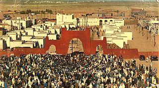
Tindouf is the main town, and a commune in Tindouf Province, Algeria, close to the Mauritanian, Western Saharan and Moroccan borders.The commune has population of around 160,000 but the census and population estimates do not count the Sahrawi refugees making the population as of the 2008 census 45,966, up from 25,266 in 1998, and an annual population growth rate of 6.3%.

Illizi is a town and commune, coextensive with Illizi District, situated in the south-eastern part of Algeria, and capital of Illizi Province. According to the 2008 census it is the largest commune by population in the province, with a population of 17,252, up from 10,163 in 1998, and an annual population growth rate of 5.5%, the highest in the province. It is one of the gates to the Tassili N'Ajjer National Park with caves situated under the sands containing prehistoric drawings dating from 6000 years BC. There is a hotel and two camping sites, as well as many local tourist agencies.

Bois is a commune in the Charente-Maritime department in southwestern France.
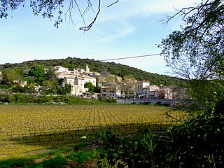
Bidon is a commune in the Ardèche department in southern France.
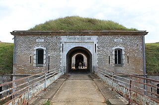
Longvic is a commune in the Côte-d'Or department in eastern France.

Birtouta is a town and commune in Algiers Province, Algeria. As of 2008, the commune had a total population of 30,575.
Ouled Chebel is a town and commune in Algiers Province, Algeria. As of 1998, the commune had a total population of 16,335.
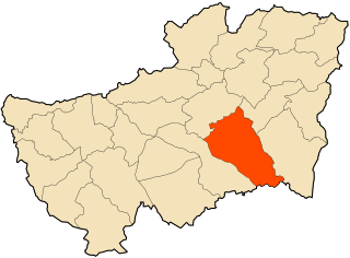
Taoura, known in antiquity as Thagora, is a town and commune in Souk Ahras Province in north-eastern Algeria.
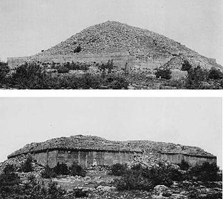
Frenda is a town and commune in Tiaret Province in northwestern Algeria. It is best known for ancient Berber monumental tombs known as Jedars.

Takhemaret is a town and commune in Tiaret Province in north-western Algeria, about 65 km. southwest of the city of Tiaret. The 2008 census population was 34,124 in the commune, with 20,827 in the city.

Aïn El Hammam is a town and commune in Tizi Ouzou Province in northern Algeria.

Akerrou is a town and commune in Tizi Ouzou Province in northern Algeria.
Boghni is a town and commune in Tizi Ouzou Province in northern Algeria.it is located in the south of tizi ouzou ,it is surrounded by Djurdjura mountain and surrounded by Maatekas,Beni Kouffi,Voughardane,Mechtras and other small communes.Boghni is known as the fourth most connected small village to Internet in the world.


