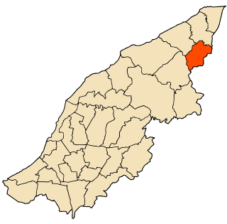
Baalbek District is an administrative district in the Baalbek-Hermel Governorate of the Republic of Lebanon, having the city Baalbek as its capital. It is by far the largest district in the country comprising a total of 2,319 km2 (895 sq mi).

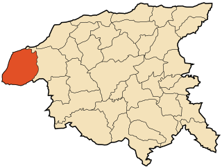
Achacha is a district situated within Mostaganem Province, lying on the Mediterranean Sea, northern Algeria. The district was named after its capital, Achacha.

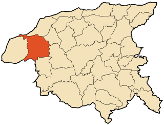
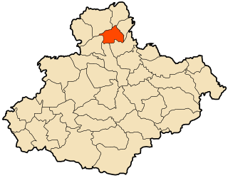
Aïn Merane District is a district of Chlef Province, Algeria.

Taougrit District is a district of Chlef Province, Algeria.

Ain Merane is a town and commune in Chlef Province, Algeria. According to the 1998 census it has a population of 37,142.
Dahra, Algeria is a town and commune in Chlef Province, Algeria. According to the 1998 census it has a population of 21,284.
Taougrit is a town and commune in Chlef Province, Algeria. According to the 1998 census it has a population of 24,267.

Sidi Bellater or Sidi Belattar is a town and commune in Mostaganem Province, Algeria. It is located in Aïn Tédelès District. According to the 1998 census it has a population of 6,670.
Nékmaria is a town and commune in Mostaganem Province, Algeria. It is located in Achacha District. According to the 1998 census it has a population of 9,104.
Khadra is a town and commune in Mostaganem Province, Algeria. It is located in Achacha District. According to the 1998 census it has a population of 12,294.
Aïn Boudinar is a town and commune in Mostaganem Province, Algeria. It is located in Kheïr Eddine District. According to the 1998 census it has a population of 5,241.

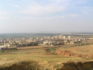
Sidi Lakhdar is a town and commune in Mostaganem Province, Algeria, about 300 km westof the capital, Algiers. It is the capital of Sidi Lakhdar District. According to the 1998 census, it has a population of 30,950. Under French colonial rule, the town was known as Lapasset. It changed its name in 1962.
Beni Zentis is a town and commune in Relizane Province, Algeria.

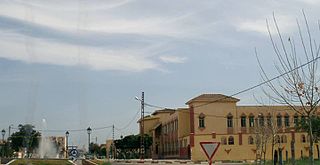
Mazouna is a town and commune in Relizane Province, Algeria, also once was the capital of the ottomans west province,it is known by its vintage mosque "elzawya" which played the role of a well respected school for teaching the Quran.

Mediouna is a town and commune in Relizane Province, Algeria. famous men: Hayoute houcine
Ouarizane is a town and commune in Relizane Province, Algeria.
Sidi M'hamed Ben Ali is a town and commune in Relizane Province, Algeria.

Sidi M'hamed Benaouda is a town and commune in Relizane Province, Algeria.
El Guettar is a town and commune in Relizane Province, Algeria.

Hamri is a town and commune in Relizane Province, Algeria.
