
The Allegheny River is a 325-mile-long (523 km) tributary of the Ohio River that is located in western Pennsylvania and New York in the United States. It runs from its headwaters just below the middle of Pennsylvania's northern border, northwesterly into New York, then in a zigzag southwesterly across the border and through Western Pennsylvania to join the Monongahela River at the Forks of the Ohio at Point State Park in Downtown Pittsburgh, Pennsylvania.

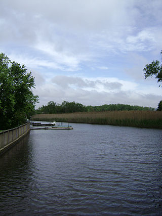
The New York–New Jersey Harbor Estuary, also known as the Hudson-Raritan Estuary, is in the northeastern states of New Jersey and New York on the East Coast of the United States. The system of waterways of the Port of New York and New Jersey forms one of the most intricate natural harbors in the world and one of the busiest ports of the United States. The harbor opens onto the New York Bight in the Atlantic Ocean to the southeast and Long Island Sound to the northeast.

The Chenango River is a 90-mile-long (140 km) tributary of the Susquehanna River in central New York in the United States. It drains a dissected plateau area in upstate New York at the northern end of the Susquehanna watershed.

The Hackensack River is a river, approximately 45 miles (72 km) long, in the U.S. states of New York and New Jersey, emptying into Newark Bay, a back chamber of New York Harbor. The watershed of the river includes part of the suburban area outside New York City just west of the lower Hudson River, which it roughly parallels, separated from it by the New Jersey Palisades. It also flows through and drains the New Jersey Meadowlands. The lower river, which is navigable as far as the city of Hackensack, is heavily industrialized and forms a commercial extension of Newark Bay.

The West Branch Delaware River is one of two branches that form the Delaware River. It is approximately 90 mi (144 km) long, and flows through the U.S. states of New York and Pennsylvania. It winds through a mountainous area of New York in the western Catskill Mountains for most of its course, before joining the East Branch along the northeast border of Pennsylvania with New York. Midway or so it is empounded by the Cannonsville Dam to form the Cannonsville Reservoir, both part of the New York City water supply system for delivering drinking water to the City.

Schoharie Creek is a river in New York that flows north 93 miles (150 km) from the foot of Indian Head Mountain in the Catskills through the Schoharie Valley to the Mohawk River. It is twice impounded north of Prattsville to create New York City's Schoharie Reservoir and the Blenheim-Gilboa Power Project.

The Sacandaga River is a 64-mile-long (103 km) river in the northern part of New York in the United States. Its name comes from the Native American Sa-chen-da'-ga, meaning "overflowed lands".
Sparkill Creek is a tributary of the Hudson River in Rockland County, New York and Bergen County, New Jersey in the United States. It flows through the Sparkill Gap in the Hudson Palisades, which was created by a fault line which provided the only sea-level break in the Palisades.
Sauquoit Creek is a 17.0-mile-long (27.4 km) river in New York, United States. It lies within the southern part of Oneida County. The creek flows eastward, then turns sharply and flows generally northward through the Sauquoit Valley to the Mohawk River, entering the river on the east side of Whitesboro. It is therefore part of the Hudson River watershed.

The Canajoharie Creek is a river that flows into the Mohawk River in the Village of Canajoharie in the U.S. State of New York. The name "Canajoharie" is a Mohawk language term meaning "the pot that washes itself", referring to the "Canajoharie Boiling Pot", a 20-foot (6.1 m) wide and 10-foot (3.0 m) deep pothole in the Canajoharie Creek, just south of the village of Canajoharie. Bowmans Creek is one main tributary that enters the creek east of the Hamlet of Sprout Brook. The other main tributary is Brimstone Creek which enters the creek north-northwest of the Village of Ames.

Steele Creek is a river in Herkimer County in the state of New York. The creek begins in an unnamed swamp south of Cedarville, and flows in a northeast direction before emptying into the Mohawk River in the village of Ilion. Steele Creek travels through the Ilion Gorge and alongside NY-51 for most of its length. Steele Creek derives its name from Rudolph Stahl, who built the first grist mill in Ilion along the creek.
Caroga Creek is a river in Fulton and Montgomery counties in the U.S. State of New York. It begins at East Caroga Lake and flows south passing through Rockwood Lake before converging with the Mohawk River in the Hamlet of Palatine Church.
Ohisa Creek is a river in Herkimer County in the state of New York. The creek begins southeast of Paines Hollow and flows southeast then curves north and eventually converges with Nowadaga Creek in Newville.
Cobleskill Creek is a river in Otsego and Schoharie counties in the state of New York. It starts at Pine Mountain west of West Richmondville and flows east-northeast before converging with Schoharie Creek in Central Bridge. The creek flows through the villages of Richmondville and Cobleskill.
The Schenevus Creek is a river located in southern Otsego County, New York. The creek flows through Worcester and Schenevus before converging with the Susquehanna River in Colliersville, New York.
Red Creek is a river located in central Otsego County, New York. The creek converges with the Susquehanna River south of Cooperstown, New York.
Charlotte Creek is a river located in Delaware County, New York. Charlotte Creek borders the southern border of Otsego County, New York for a few miles near the mouth. The creek converges with the Susquehanna River by Emmons, New York.
Panther Mountain is a mountain located in Central New York of New York near Fly Creek, New York and Schuyler Lake, New York. The east side of Panther Mountain drains into Fly Creek and the west side drains into Oaks Creek and Canadarago Lake.
Gifford Hill is a small mountain chain in the Central New York Region of New York. It is located northeast of Oneonta, New York. It is made of three main peaks the highest being 1928 feet. Gifford Hill is named for the Gifford Family who moved to the area in 1803 and settled along the Oneonta Creek on what is now called Gifford Hill.
Brimstone Creek is a river in Schoharie County and Montgomery County in New York. It begins east of the Village of Sharon Springs and flows mostly in a northwest direction before flowing into Canajoharie Creek north-northwest of the Village of Ames.
