
The English River is a river in Kenora District and Thunder Bay District in Northwestern Ontario, Canada. It flows through Lac Seul to join the Winnipeg River at Tetu Lake as a right tributary. The river is in the Hudson Bay drainage basin, is 615 kilometres (382 mi) long and has a drainage basin of 52,300 square kilometres (20,200 sq mi). Although there are several hydroelectric plants on this river, the English River upstream of Minnitaki Lake is notable as one of the few large river systems in northwestern Ontario with a natural flow and without any upstream source of pollution. It is the fourth longest river entirely in Ontario.

Wainfleet is a rural township in southern Niagara Region, Ontario, Canada.
Lake Doré is a freshwater lake in the township of North Algona-Wilberforce, Renfrew County, Ontario, Canada, about 6 kilometres (3.7 mi) north of the community of Eganville in the neighbouring township of Bonnechere Valley.

Wolfe Island is an island at the entrance to the Saint Lawrence River in Lake Ontario near Kingston, Ontario. Wolfe Island is part of Frontenac County, Ontario and the Township of Frontenac Islands. It is the largest of the Thousand Islands. The largest community on the island is Marysville.
The Black Sturgeon River is a river in Thunder Bay District, Northwestern Ontario, Canada, located west of the Nipigon River, that flows to Lake Superior.
King City is an unincorporated Canadian community in the township of King, Ontario, located 40 kilometres (25 mi) north of Toronto. It is the largest community in King township, with 2,730 dwellings and a population of 8,396 as of the 2021 Canadian census.
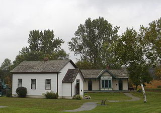
Cooper's Falls is a Dispersed rural community and unincorporated place in geographic Rama Township in the municipality of Ramara, Simcoe County, in Central Ontario, Canada. The community is located at the eponymous Coopers Falls waterfall on the Black River, about 5 kilometres (3.1 mi) northeast of the community of Washago on Ontario Highway 11, and is named after Thomas Cooper, the first settler. There are a few families living in Coopers Falls.

The Mount Meager massif is a group of volcanic peaks in the Pacific Ranges of the Coast Mountains in southwestern British Columbia, Canada. Part of the Cascade Volcanic Arc of western North America, it is located 150 km (93 mi) north of Vancouver at the northern end of the Pemberton Valley and reaches a maximum elevation of 2,680 m (8,790 ft). The massif is capped by several eroded volcanic edifices, including lava domes, volcanic plugs and overlapping piles of lava flows; these form at least six major summits including Mount Meager which is the second highest of the massif.
Brown's Corners is an unincorporated community in Markham, Regional Municipality of York in the Greater Toronto Area of Ontario, Canada and located near the corner of Woodbine Avenue and Highway 7. The community, founded in 1842, was named for local settler Alexander Brown Sr. (1771–1851) who acquired 100 acres (40 ha) in 1838. Beaver Creek flows through it.

Plummer Additional is a township and single tier municipality located in Algoma District in Northeastern Ontario, Canada. The township had a population of 660 in the Canada 2016 Census.
Kashabowie is an unincorporated place and Compact Rural Community in southwestern Thunder Bay District in Northwestern Ontario, Canada. It is on the Canadian National Railway Kashabowie Subdivision main line, built originally as the Canadian Northern Railway transcontinental main line, between the Planet flag stop to the west and the Postans flag stop to the east, and has a passing siding.
Camborne is an unincorporated place and dispersed rural community in Hamilton Township, Northumberland County in Central Ontario, Canada. It is located on County Road 18 about 6.5 km (4 mi) north of Ontario Highway 401 exit 472 and 10 km (6 mi) north of Cobourg. The village has a population of approximately 350.
Unorganized West Part Manitoulin District is an unorganized area in Manitoulin District in northeastern Ontario, Canada, encompassing the portion of Manitoulin Island which is not part of an organized municipality. It comprises the geographic townships of Robinson and Dawson.
Victoria Road is an unincorporated community in the Canadian province of Ontario, located within the single-tier municipality of Kawartha Lakes. The village was built around a station on the Toronto and Nipissing Railway, which was constructed in 1872 where the line crossed Victoria Colonization Road, which was built between 1859 and 1861, named after the county that was named after Queen Victoria, and passes through the village. For a time, the village was known as "The City of Peace" and "The Road." The station—the second last on the line—served the community and area until the last train passed through in 1965, after which the tracks were lifted.
Although the United Church of Canada is one of the few mainstream Christian denominations to both ordain LGBTQ clergy and consecrate same-sex marriages, support for these issues have caused deep divisions within the church.
Bervie is an unincorporated place and Compact Rural Community in the municipality of Kincardine, Bruce County in southwestern Ontario, Canada. It is located on Ontario Highway 9, and is on the Penetangore River, which flows to Lake Huron at the town centre of Kincardine.
Superior Junction is a community in the town of Sioux Lookout, Kenora District in northwestern Ontario, Canada. It is on the Marchington River downstream of Botsford Lake and upstream of the river's mouth at Abram Lake on the English River.
Black Bay Peninsula is a volcanic peninsula in Unorganized Thunder Bay District in Northwestern Ontario, Canada, located on the North Shore of Lake Superior. It separates Black Bay and Nipigon Bay and consists of over 300 flood basalt lava flows. Porphyry Island, an island entirely encompassed within Porphyry Island Provincial Park, lies off the tip of the peninsula. A 49-square-kilometre (19 sq mi) portion of the peninsula has been set aside as the Black Bay Peninsula Enhanced Management Area.

The St. Joseph Channel is a strait in Algoma District, Northwestern Ontario, Canada and Chippewa County, Michigan, United States. It is in the Great Lakes Basin and connects the St. Marys River flowing through the Middle Neebish Channel between Neebish Island and Sugar Island at the northwest and Lake George/ East Neebish Channel between Sugar Island and the Ontario mainland at the north, with the North Channel between St. Joseph Island and the Ontario mainland at the east, and with the Munuscong Channel between Neebish Island and St. Joseph Island at the southwest. All of these waterbody elements are part of Lake Huron.
Lake George is a lake in Chippewa County, Michigan, United States, and Algoma District, Northwestern Ontario, Canada, that lies between Sugar Island in Michigan on the west and the Ontario mainland on the east.
