Berkshire (soil)

Last updated

Berkshire soil series is the name given to a well-drained loam or sandy loam soil which has developed on glacial till in parts of southern Quebec, eastern New York State and New England south to Massachusetts. It belongs to the podzol soil group and is one of the most important soils in its area of occurrence, supporting extensive forests and a fair number of farms. Many Berkshire soils lack the eluvial (E) horizon characteristic of podzols because they have a history of being cleared for cultivation.

Loam Soil composed of similar proportions of sand and silt, and somewhat less clay

Loam is soil composed mostly of sand, silt, and a smaller amount of clay. By weight, its mineral composition is about 40–40–20% concentration of sand–silt–clay, respectively. These proportions can vary to a degree, however, and result in different types of loam soils: sandy loam, silty loam, clay loam, sandy clay loam, silty clay loam, and loam. In the USDA textural classification triangle, the only soil that is not predominantly sand, silt, or clay is called "loam". Loam soils generally contain more nutrients, moisture, and humus than sandy soils, have better drainage and infiltration of water and air than silt and clay-rich soils, and are easier to till than clay soils. The different types of loam soils each have slightly different characteristics, with some draining liquids more efficiently than others. The soil's texture, especially its ability to retain nutrients and water are crucial. Loam soil is suitable for growing most plant varieties.

Quebec Province of Canada

Quebec is one of the thirteen provinces and territories of Canada. It is bordered to the west by the province of Ontario and the bodies of water James Bay and Hudson Bay; to the north by Hudson Strait and Ungava Bay; to the east by the Gulf of Saint Lawrence and the province of Newfoundland and Labrador; and to the south by the province of New Brunswick and the U.S. states of Maine, New Hampshire, Vermont, and New York. It also shares maritime borders with Nunavut, Prince Edward Island, and Nova Scotia. Quebec is Canada's largest province by area and its second-largest administrative division; only the territory of Nunavut is larger. It is historically and politically considered to be part of Central Canada.

New England Region of the United States

New England is a region composed of six states in the northeastern United States: Maine, Vermont, New Hampshire, Massachusetts, Rhode Island, and Connecticut. It is bordered by the state of New York to the west and by the Canadian provinces of New Brunswick to the northeast and Quebec to the north. The Atlantic Ocean is to the east and southeast, and Long Island Sound is to the south. Boston is New England's largest city, as well as the capital of Massachusetts. The largest metropolitan area is Greater Boston with nearly a third of the entire region's population, which also includes Worcester, Massachusetts, Manchester, New Hampshire, and Providence, Rhode Island.

Contents

Geology

The deep glacial till which provides the foundation of the Berkshire series contains material derived from mica schist with fragments of gneiss, granite and phyllite also present in some areas. These rocks are not high in mineral nutrients but provide enough fine-grained material to produce a loamy soil.

Gneiss A common high-grade metamorphic rock

Gneiss is a common and widely distributed type of metamorphic rock. Gneiss is formed by high temperature and high-pressure metamorphic processes acting on formations composed of igneous or sedimentary rocks. Orthogneiss is gneiss derived from igneous rock. Paragneiss is gneiss derived from sedimentary rock. Gneiss forms at higher temperatures and pressures than schist. Gneiss nearly always shows a banded texture characterized by alternating darker and lighter colored bands and without a distinct foliation.

Granite A common type of intrusive, felsic, igneous rock with granular structure

Granite is a common type of felsic intrusive igneous rock that is granular and phaneritic in texture. Granites can be predominantly white, pink, or gray in color, depending on their mineralogy. The word "granite" comes from the Latin granum, a grain, in reference to the coarse-grained structure of such a holocrystalline rock. Strictly speaking, granite is an igneous rock with between 20% and 60% quartz by volume, and at least 35% of the total feldspar consisting of alkali feldspar, although commonly the term "granite" is used to refer to a wider range of coarse-grained igneous rocks containing quartz and feldspar.

Phyllite foliated metamorphic rock

Phyllite is a type of foliated metamorphic rock created from slate that is further metamorphosed so that very fine grained white mica achieves a preferred orientation. It is primarily composed of quartz, sericite mica, and chlorite.

Agriculture

Cleared areas of the Berkshire series support a livestock industry with an emphasis on dairying. Grasses, legumes and silage corn are raised for cattle food. These crops are likely to need lime and fertilizer for optimum growth. Potatoes are also grown; they are well adapted to the Berkshire's natural acidity. Many Berkshire soils, however, are too rough and stony for easy cultivation and have been allowed to revert to forest.

Dairy business enterprise established for the processing of animal milk

A dairy is a business enterprise established for the harvesting or processing of animal milk – mostly from cows or goats, but also from buffaloes, sheep, horses, or camels – for human consumption. A dairy is typically located on a dedicated dairy farm or in a section of a multi-purpose farm that is concerned with the harvesting of milk.

Grasse Subprefecture and commune in Provence-Alpes-Côte dAzur, France

Grasse is a commune in the Alpes-Maritimes department, on the French Riviera.

Legume Plant in the family Fabaceae

A legume is a plant in the family Fabaceae, or the fruit or seed of such a plant. Legumes are grown agriculturally, primarily for human consumption, for livestock forage and silage, and as soil-enhancing green manure. Well-known legumes include alfalfa, clover, beans, peas, chickpeas, lentils, lupins, mesquite, carob, soybeans, peanuts, and tamarind. Legumes produce a botanically unique type of fruit – a simple dry fruit that develops from a simple carpel and usually dehisces on two sides. A common name for this type of fruit is a pod, although the term "pod" is also applied to a number of other fruit types, such as that of vanilla and of the radish.

Forestry

Most of the Berkshire series supports mixed forest. Several species of maple, birch and pine are prominent among the trees, along with beech, spruce, fir, ash and basswood.

Maple genus of plants

Acer is a genus of trees and shrubs commonly known as maple. The genus is placed in the family Sapindaceae. There are approximately 128 species, most of which are native to Asia, with a number also appearing in Europe, northern Africa, and North America. Only one species, Acer laurinum, extends to the Southern Hemisphere. The type species of the genus is the sycamore maple, Acer pseudoplatanus, the most common maple species in Europe. The maples have easily recognizable palmate leaves and distinctive winged fruits. The closest relatives of the maples are the horse chestnuts.

Birch genus of plants

A birch is a thin-leaved deciduous hardwood tree of the genus Betula, in the family Betulaceae, which also includes alders, hazels, and hornbeams. It is closely related to the beech-oak family Fagaceae. The genus Betula contains 30 to 60 known taxa of which 11 are on the IUCN 2011 Red List of Threatened Species. They are a typically rather short-lived pioneer species widespread in the Northern Hemisphere, particularly in northern areas of temperate climates and in boreal climates.

Pine genus of plants

A pine is any conifer in the genus Pinus of the family Pinaceae. Pinus is the sole genus in the subfamily Pinoideae. The Plant List compiled by the Royal Botanic Gardens, Kew and Missouri Botanical Garden accepts 126 species names of pines as current, together with 35 unresolved species and many more synonyms.

Related Research Articles

Prairie ecosystems considered part of the temperate grasslands, savannas, and shrublands biome

Prairies are ecosystems considered part of the temperate grasslands, savannas, and shrublands biome by ecologists, based on similar temperate climates, moderate rainfall, and a composition of grasses, herbs, and shrubs, rather than trees, as the dominant vegetation type. Temperate grassland regions include the Pampas of Argentina, Brazil and Uruguay, and the steppe of Ukraine, Russia and Kazakhstan. Lands typically referred to as "prairie" tend to be in North America. The term encompasses the area referred to as the Interior Lowlands of Canada, the United States, and Mexico, which includes all of the Great Plains as well as the wetter, hillier land to the east.

Podzol soil type

In soil science, Podzols are the typical soils of coniferous or boreal forests. They are also the typical soils of eucalypt forests and heathlands in southern Australia. In Western Europe, Podzols develop on heathland, which is often a construct of human interference through grazing and burning. In some British moorlands with Podzolic soils, Cambisols are preserved under Bronze Age barrows.

Quadra Island island in British Columbia, Canada

Quadra Island is an island off the eastern coast of Vancouver Island, British Columbia, Canada, part of the Discovery Islands located within the Strathcona Regional District. Quadra Island is about 35 kilometres from its northernmost point to its southernmost point. The island at its narrowest point, on its southern peninsula, is less than 2 km (1.24 mi) wide, and at its widest point, about 15 km (9 mi) wide. Quadra island is about 310 square kilometres in area. The population of island and surrounding mainland inlets, as of the 2006 federal census, was 2,472, down from the 2001 federal census count of 2,548. In 1903 it was named after the Spanish navigator Juan Francisco de la Bodega y Quadra, who explored and settled the Vancouver Island area in the late 18th century. It is separated from Vancouver Island by Discovery Passage, and from Cortes Island, and is linked to that island by a ferry from Heriot Bay on its eastern shore. The island has many beaches, trails, lakes, and parks. Main Lake Provincial Park is located on the northern part of the island, and Rebecca Spit Marine Provincial Park is on the eastern shore, near Heriot Bay.

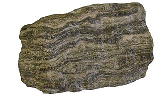
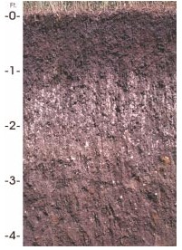
Parent material is the underlying geological material in which soil horizons form. Soils typically inherit a great deal of structure and minerals from their parent material, and, as such, are often classified based upon their contents of consolidated or unconsolidated mineral material that has undergone some degree of physical or chemical weathering and the mode by which the materials were most recently transported.

Hornby Island island in British Columbia, Canada

Hornby Island of British Columbia, Canada, is a Salish Sea island located near Vancouver Island's Comox Valley.

Hubbard Brook Experimental Forest protected area in New Hampshire, USA, and former biosphere reserve (1976-2017)

Hubbard Brook Experimental Forest is an area of land in the towns of Woodstock and Thornton in the White Mountains of New Hampshire that functions as an outdoor laboratory for ecological studies. It was initially established in 1955 by the United States Forest Service for the study of the relationship between forest cover and water quality and supply.

Brome Lake, Quebec Town in Quebec, Canada

The Town of Brome Lake is a town in southern Quebec, Canada. It is located in the Brome-Missisquoi Regional County Municipality of the Montérégie administrative region. The population as of the Canada 2011 Census was 5,609.

Cecil (soil) soil type

Originally mapped in Cecil County, Maryland in 1899, more than 10 million acres (40,000 km²) of the Cecil soil series are now mapped in the Piedmont region of the southeastern United States. It extends from Virginia through North Carolina, South Carolina, Georgia and Alabama, with the typic Cecil pedon actually located in Franklin County, NC. A map showing the actual extent of the Cecil series is available at the Center for Environmental Informatics

Fieldstone

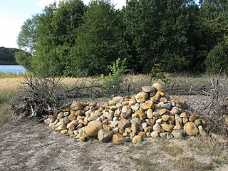
Fieldstone is a naturally occurring type of stone, which lies at or near the surface of the Earth. Fieldstone is a nuisance for farmers seeking to expand their land under cultivation, but at some point it began to be used as a construction material. Strictly speaking, it is stone collected from the surface of fields where it occurs naturally. Collections of fieldstones which have been removed from arable land or pasture to allow for more effective agriculture are called clearance cairns.

Eagle Heights

Eagle Heights is an elevated area located south of Koksilah Ridge on Vancouver Island, British Columbia, Canada. It is centered at 48°40′N, 123°46′W. Its summit lies about 836 meters above sea level. Populated areas where it is visible include North Saanich, Sidney, and Shawnigan Lake.

The Canadian System of Soil Classification is more closely related to the American system than any other, but they differ in several ways. The Canadian system is designed to cover only Canadian soils. The Canadian system dispenses with the sub-order hierarchical level. Solonetzic and Gleysolic soils are differentiated at the order level.

Houdek (soil) type of soil, unique to South Dakota, USA

Houdek is a type of soil composed of glacial till and decomposed organic matter. It is found only in the U.S. state of South Dakota where it is the state soil. The soil series was established in 1955 in Spink County, South Dakota. It is unique to the United States, but in particular to South Dakota where it is the state soil.

Charlottetown soil series is the name given to a deep fine sandy loam soil which has developed under forest vegetation on glacial till. This series occurs only on Prince Edward Island, where it is widespread and so important for agriculture that it has been designated as the Provincial Soil.

Blandford soil series is the name given to a loam or sandy loam soil which has developed on glacial till in parts of southern Quebec and northern New England. It belongs to the brown podzolic soil group and occurs in hilly areas of the Green Mountains in Vermont plus the adjoining Sutton Mountains in Quebec. In recent years the USDA has deactivated this series, which remains on active status in Canada.

Jory (soil) soil type

The Jory series consists of very deep, well-drained soils that formed in colluvium derived from basic igneous rock. These soils are in the foothills surrounding the Willamette Valley of the United States. They have been mapped on more than 300,000 acres (1,200 km2) in western Oregon. They are named after Jory Hill, Marion County, Oregon, which itself is named for the Jory family, who settled in the area in 1852, after traveling along the Oregon Trail.

Harvard Forest

Harvard Forest is an ecological research area of 3,000 acres (12 km2) owned and managed by Harvard University and located in Petersham, Massachusetts. The property, in operation since 1907, includes one of North America's oldest managed forests, educational and research facilities, a museum, and recreation trails. Harvard Forest is open to the public.

Yamaska National Park is a provincial park centered on the man-made Choiniere Reservoir. It is located in the municipalities of Roxton Pond and Saint-Joachim-de-Shefford in La Haute-Yamaska Regional County Municipality, just northeast of Granby, Quebec. Its undulating hilly landscape is supported by slate and sandstone bedrock. The main soil is a stony sandy loam podzol which has been mapped as the Racine series—one of the most acidic soils in the area.

Holmesville Soil Series is the name given to a gravelly sandy loam or gravelly loam soil which has developed on glacial till in western New Brunswick, Canada. It belongs to the podzol soil group. The bedrock from which the parent material was derived is largely quartzite but includes considerable admixtures of argillite, slate, schist, and locally shale. This diversity of bedrock sources contributes to the fertility of this soil series, which is well drained yet moisture-retentive -- an ideal combination for farmers.

Little River Nature Park is a protected area on the eastern shore of Vancouver Island in the Comox Valley Regional District. It is home to beaches, man-made ponds, an estuarine marsh, and well-drained forests dominated by Douglas-fir. The park is underlain by sand and gravel which was locally extracted in open pits; these have since become the ponds.

References