Related Research Articles

Dumpdon Hill is an Iron Age Hill Fort near Honiton in Devon. Somewhat overshadowed by its better known neighbour Hembury Fort it is nonetheless as impressive an earthwork.
Berry Castle is an earthwork probably dating to the Iron Age close to Black Dog in Devon north of Crediton and west of Tiverton. It does not fit the traditional pattern of an Iron Age Hill fort. Although the earthwork would seem to be an incomplete enclosure, it is not at the top of a hill, although it is on the south east slope of a major hill which peaks at 199 Metres above Sea Level.

Prestonbury Castle is an Iron Age Hill fort on the north east edge of Dartmoor in Devon, England. Situated on a massive hilltop some 240 metres above sea level overlooking the Teign Valley, it is located near two other hill forts both of which lie about 2 km (1 mi) away.

Berry Camp or Berry Cliff, is an Iron Age Hill fort on a partially eroded cliff top close to Branscombe in Devon. The cliff is situated some 140 metres (460 ft) above sea level.

Hawkesdown Hill is an Iron Age Hill fort close to Axmouth in Devon situated on a prominent hillside above the Axe Estuary. It is approximately 130 metres (430 ft) above sea level.
Membury Castle is an Iron Age hill fort situated above the village of Membury in Devon. The fort occupies a commanding hilltop position some 204 metres above sea level with views across both the Yarty and Axe valleys.

Musbury Castle is an Iron Age Hill fort situated above the Village of Musbury in Devon. The fort occupies a commanding hill top approx 175 Metres above Sea Level overlooking the Axe valleyat Ordnance Survey grid reference SY282941.
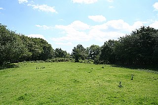
Berry Castle is an Iron Age Hill fort in the civil parish of Huntshaw, close to Weare Giffard in Devon, England, to the north of Great Torrington. The fort takes the form of an oval enclosure situated on a promontory in Huntshaw Wood some 95 Metres above Sea Level. Recent tree clearance (2015) has revealed that the 'fort' is rectangular in shape with entrances at either end, and may be a Roman camp or a local example of a neolithic sky burial enclosure.

Castle Dyke is an Iron Age hill fort situated between Chudleigh and Dawlish in Devon, England. The fort is situated on a Hilltop at approx 140 metres above sea level.
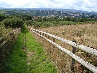
Milber Down is an Iron Age hill fort on the hill above the suburb of Milber, Newton Abbot in Devon, England. The fort is situated on the north-western slope of Milber Down at about 110 metres above sea level, and is bisected by the minor ridge road that leads to Barton, Torquay. One Iron Age artefact discovered there was a figurine of a stag.
Hembury Castle is an Iron Age hillfort about a mile north-west of the village of Buckfast on the south-eastern edge of Dartmoor in Devon, England. The fort is about 178 metres above sea level on a promontory between the River Dart on the east and the Holy Brook, south-west. The slope down to the River Dart is very steep and is covered by Hembury Woods which is now a Site of Special Scientific Interest.
Holne Chase Castle is an Iron Age hill fort situated close to Buckland-in-the-Moor in Devon, England. The fort is situated on a promontory on the Northern slopes of Holne Chase in Chase Wood at approx 150 Metres above Sea Level overlooking the River Dart.

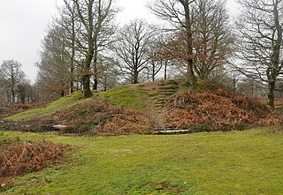
Brent Hill is the site of an Iron Age hill fort situated close to South Brent in Devon, England. The fort occupies the top of Brent Hill at approx 311 Metres above Sea Level.
Yellowberries Copse is an Iron Age enclosure, or possibly hill fort situated South of South Brent in Devon, England. The fort is situated on the North West slope of Cutwell Hill at approx 155 Metres above Sea Level.

Halwell Camp is an Iron Age hill fort situated close to the village of Halwell in Devon, England. The fort is situated on a pass between two hilltops to the east of the village at approx 185 metres above sea level.
Noss is the name given to an Iron Age hill fort situated close to Dartmouth in Devon, England. The fort is situated on the South Western slope of a promontory on the Eastern side of a hill west of the Village of Hillhead some 65-80 Metres above Sea Level overlooking Noss Point in the Dart Estuary.
Wasteberry Camp is an Iron Age hill fort situated close to the hamlet of Blackpool, southeast of Plympton, Devon, England. The fort is situated on a hilltop in Warren Wood at approximately 90 metres (300 ft) above sea level, overlooking Silverbridge Lake.
Holbury is an Iron Age hill fort situated close to Holbeton in Devon, England. The fort is situated on a hilltop east of the Village approximately 95 metres above sea level overlooking the Erme Estuary.
Yarrowbury is an Iron Age hill fort situated close to Bigbury in Devon, England. The fort is situated on Hilltop to the north east of the village at approximately 80 metres above sea level, overlooking the Avon Estuary.

Bremridge Wood formerly part of the Domesday Book estate of Bremridge near South Molton, Devon, England, is the site of an Iron Age enclosure or hill fort. The earthwork is situated in woodland on a Hillside forming a promontory above the River Bray to the West of the Town at approx 175 Metres above Sea Level.
References
- ↑ Sellman, R.R. (1985). "The Iron Age in Devon (ch.2)". Aspects of Devon History. Exeter: Devon Books. pp. 11 (Map of Iron Age hill forts in Devon including Berry's Wood). ISBN 0-86114-756-1.
- ↑ Beavis, Derek (1985). Newton Abbot, The Story of the Town's Past. Buckingham: Barracuda Books. p. 19. ISBN 0-86023-236-0.