Related Research Articles

Perth is a city in central Scotland, on the banks of the River Tay. It is the administrative centre of Perth and Kinross council area and the historic county town of Perthshire. It had a population of about 47,430 in 2018.

Icknield Street or Ryknild Street is a Roman road in England, with a route roughly south-west to north-east. It runs from the Fosse Way at Bourton on the Water in Gloucestershire to Templeborough in South Yorkshire. It passes through Alcester, Studley, Redditch, Metchley Fort, Birmingham, Sutton Coldfield, Lichfield, Burton upon Trent and Derby.

Strathearn or Strath Earn is the strath of the River Earn, in Scotland, extending from Loch Earn in the West to the River Tay in the east. Strathearn was one of the original provinces of the Kingdom of Alba, and was led by a mormaer and then an Earl. The province was bounded on the north by Atholl, north west by Breadalbane, south west by Menteith, south east by Fife, and on the east by Perthia.

The Gask Ridge is the modern name given to an early series of fortifications, built by the Romans in Scotland, close to the Highland Line. Modern excavation and interpretation has been pioneered by the Roman Gask Project, with Birgitta Hoffmann and David Woolliscroft. The ridge fortifications: forts, fortlets and watchtowers were only in operation for a few years, probably less than ten.

Aberfeldy is a burgh in Perth and Kinross, Scotland, on the River Tay. A small market town, Aberfeldy is located in Highland Perthshire. It was mentioned by Robert Burns in the poem The Birks Of Aberfeldy.

Ardoch Roman Fort is an archaeological site just outside the village of Braco in Perthshire, Scotland, about seven miles south of Crieff.

York has, since Roman times, been defended by walls of one form or another. To this day, substantial portions of the walls remain, and York has more miles of intact wall than any other city in England. They are known variously as York City Walls, the Bar Walls and the Roman walls. The walls are generally 13 feet (4m) high and 6 feet (1.8m) wide.

Segedunum was a Roman fort at modern-day Wallsend, North Tyneside in North East England. The fort lay at the eastern end of Hadrian's Wall near the banks of the River Tyne, forming the easternmost portion of the wall. It was in use as a garrison for approximately 300 years, from around 122 AD, almost up to 400AD. Today, Segedunum is the most thoroughly excavated fort along Hadrian's Wall, and is operated as Segedunum Roman Fort, Baths and Museum. It forms part of the Hadrian's Wall UNESCO World Heritage Site.

Dunkeld is a town in Perth and Kinross, Scotland. The location of a historic cathedral, it lies on the north bank of the River Tay, opposite Birnam. Dunkeld lies close to the geological Highland Boundary Fault, and is frequently described as the "Gateway to the Highlands" due to its position on the main road and rail lines north. Dunkeld has a railway station, Dunkeld & Birnam, on the Highland Main Line, and is about 25 kilometres north of Perth on what is now the A9 road. The main road formerly ran through the town, however following modernisation of this road it now passes to the west of Dunkeld.

Bridge of Earn is a small town in Perthshire, Scotland. Often referred to simply as 'The Brig'. The village grew up on the south bank of an important crossing of the River Earn, whose sandstone bridge existed from at least the early 14th century, when it is known to have been repaired by order of King Robert I of Scotland (1306–1329). Substantial remains of the medieval bridge survived into the 1970s, when almost all the stonework was demolished, for (allegedly) being in a dangerously ruinous condition. This ancient bridge was a major landmark on the road between Edinburgh and Perth for several centuries. The village's oldest houses are to be found lining the road leading south from the site of the demolished bridge. Among them are some with 18th-century datestones.

The River Eden is a river in Fife in Scotland, and is one of Fife's two principal rivers, along with the Leven. It is nearly 30 miles (48 km) long and has a fall of around 300 feet (91 m). It flows from Burnside, near the border with Perth & Kinross, then slowly across the Howe of Fife and through the market town of Cupar to Guardbridge, where it enters the North Sea via the Eden Estuary, a nature reserve and an important conservation area for wading birds. The river holds a good stock of wild brown trout and hosts a fair run of sea trout and Atlantic salmon.

The Antonine Wall, known to the Romans as Vallum Antonini, was a turf fortification on stone foundations, built by the Romans across what is now the Central Belt of Scotland, between the Firth of Forth and the Firth of Clyde. Built some twenty years after Hadrian's Wall to the south, and intended to supersede it, while it was garrisoned it was the northernmost frontier barrier of the Roman Empire. It spanned approximately 63 kilometres and was about 3 metres high and 5 metres wide. Lidar scans have been carried out to establish the length of the wall and the Roman distance units used. Security was bolstered by a deep ditch on the northern side. It is thought that there was a wooden palisade on top of the turf. The barrier was the second of two "great walls" created by the Romans in Great Britain in the second century AD. Its ruins are less evident than those of the better-known and longer Hadrian's Wall to the south, primarily because the turf and wood wall has largely weathered away, unlike its stone-built southern predecessor.
Perth is a city and former royal burgh in central Scotland. There has been a settlement at Perth since prehistoric times. Finds in and around Perth show that it was occupied by the Mesolithic hunter-gatherers who arrived in the area more than 8,000 years ago. Nearby Neolithic standing stones and circles followed the introduction of farming from about 4000 BC, and a remarkably well preserved Bronze Age log boat dated to around 1000 BC was found in the mudflats of the River Tay at Carpow to the east of Perth. Carpow was also the site of a Roman legionary fortress.
Mellor hill fort is a prehistoric site in North West England, that dates from the British Iron Age—about 800 BC to 100 AD. Situated on a hill in Mellor, Greater Manchester, on the western edge of the Peak District, the hill fort overlooks the Cheshire Plain. Although the settlement was founded during the Iron Age, evidence exists of activity on the site as far back as 8,000 BC; during the Bronze Age the hill may have been an area where funerary practices were performed. Artefacts such as a Bronze Age amber necklace indicate the site was high status and that its residents took part in long-distance trade. The settlement was occupied into the Roman period. After the site was abandoned, probably in the 4th century, it was forgotten until its rediscovery in the 1990s.
Carpow is a diffuse hamlet in Perth and Kinross, Scotland. It is situated immediately to the east of the confluence of the River Tay and River Earn, 2 km north east of Abernethy.

The fort of Clatchard Craig was located on a hill of the same name by the Tay. A human presence on the site has been identified from the neolithic period onward and the fort itself was occupied from the sixth century AD until at least the eighth century. It stood close to several places which were centres of secular and religious power during the early Middle Ages including Abernethy, Forteviot, Scone and Moncreiffe. As such it seems to have been an important stronghold of the Picts.

The architecture of Scotland in the Roman era includes all building within the modern borders of Scotland, from the arrival of the Romans in northern Britain in the first century BCE, until their departure in the fifth century CE. Ptolemy indicated that there were 19 "towns" in Caledonia, north of the Roman province of Britannia, but no clear evidence of urban settlements has been found and these were probably hillforts. There is evidence of over 1,000 such forts, most south of the Clyde-Forth line, but the majority seem to have been abandoned in the Roman period. There is also evidence of distinctive stone wheelhouses and small underground souterrains.
The Inner Tay Estuary is the inner, western part of the Firth of Tay, from the Tay Railway Bridge in the east to the Queen's Bridge over the River Tay in Perth and the bridge in Bridge of Earn on the River Earn. It is one of the largest estuaries in eastern Scotland, and is up to 2.5 km wide. It consists primarily of intertidal sand and mud flats extending seaward to the main channel, most of which are on the northern shore. Landward of these are salt marsh and Phragmites reedbeds. The estuary contains two large islands: Mugdrum Island, opposite Newburgh; and Moncreiffe Island, immediately below Perth. The estuary's narrow form, and the large volume of freshwater from the Rivers Tay and Earn, restrict the influence of saltwater west of the Tayport narrows. Much of the tidal water is freshwater or mildly brackish.

The Bulwarks, Porthkerry is a promontory fort in Rhoose, Vale of Glamorgan, on the southern coast of Wales overlooking the Bristol Channel. It probably dates to the Iron Age and continued to be occupied during the Roman period in Britain. The ramparts and ditches along the west side are well preserved, but the fortifications are heavily overgrown.
Perth Lade is an historic 4.5 mi (7.2 km)-long watercourse in Perth and Kinross, Scotland. Created in the 11th century or earlier, it has been used to power several watermills, such as those that functioned at Perth's Lower City Mills, that have existed since the 18th century. Over its course, at least nineteen industrial sites existed; today, the remains of nine of these can be seen, the rest lost to inner-city development and housing schemes of the 20th and 21st centuries. A footpath follows the majority of the lade's course.
References
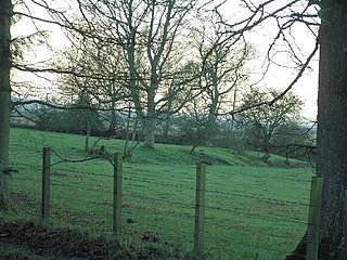
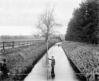
- ↑ Historic Environment Scotland. "Bertha,Roman fort (SM2403)" . Retrieved 15 February 2019.
- ↑ "Perth and Bertha". Senchus - Notes on early medieval Scotland. Retrieved 14 September 2009.
- ↑ "Perth". Undiscovered Scotland. 2000–2009. Retrieved 14 September 2009.
- 1 2 "Bertha, Perth, Tayside". Roman Fort and Camps. 27 January 2016. Archived from the original on 1 March 2019. Retrieved 16 March 2016.
Coordinates: 56°25′29″N3°27′53″W / 56.4248°N 3.4647°W
| | This Scotland-related article is a stub. You can help Wikipedia by expanding it. |
| | This article about an Ancient Roman building or structure is a stub. You can help Wikipedia by expanding it. |