Related Research Articles

Lake Agassiz was a very large glacial lake in central North America. Fed by glacial meltwater at the end of the last glacial period, its area was larger than all of the modern Great Lakes combined though its mean depth was not as great as that of many major lakes today.

The River Usk rises on the northern slopes of the Black Mountain, Wales, in the westernmost part of the Brecon Beacons National Park. Initially forming the boundary between Carmarthenshire and Powys, it flows north into Usk Reservoir, then east by Sennybridge to Brecon before turning southeast to flow by Talybont-on-Usk, Crickhowell and Abergavenny after which it takes a more southerly course.

A jökulhlaup is a type of glacial outburst flood. It is an Icelandic term that has been adopted in glaciological terminology in many languages. It originally referred to the well-known subglacial outburst floods from Vatnajökull, Iceland, which are triggered by geothermal heating and occasionally by a volcanic subglacial eruption, but it is now used to describe any large and abrupt release of water from a subglacial or proglacial lake/reservoir.
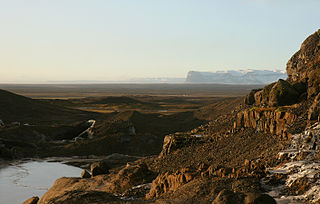
An outwash plain, also called a sandur, sandr or sandar, is a plain formed of glacial sediments deposited by meltwater outwash at the terminus of a glacier. As it flows, the glacier grinds the underlying rock surface and carries the debris along. The meltwater at the snout of the glacier deposits its load of sediment over the outwash plain, with larger boulders being deposited near the terminal moraine, and smaller particles travelling further before being deposited. Sandurs are common in Iceland where geothermal activity accelerates the melting of ice flows and the deposition of sediment by meltwater.

The Black Mountains are a group of hills spread across parts of Powys and Monmouthshire in southeast Wales, and extending across the England–Wales border into Herefordshire. They are the easternmost of the four ranges of hills that comprise the Brecon Beacons National Park, and are frequently confused with the westernmost, which is known as the Black Mountain. The Black Mountains may be roughly defined as those hills contained within a triangle defined by the towns of Abergavenny in the southeast, Hay-on-Wye in the north and the village of Llangors in the west. Other gateway towns to the Black Mountains include Talgarth and Crickhowell. The range of hills is well known to walkers and ramblers for the ease of access and views from the many ridge trails, such as that on the Black Hill (Herefordshire) at the eastern edge of the massif.

A tunnel valley is a U-shaped valley originally cut under the glacial ice near the margin of continental ice sheets such as that now covering Antarctica and formerly covering portions of all continents during past glacial ages. They can be as long as 100 km (62 mi), 4 km (2.5 mi) wide, and 400 m (1,300 ft) deep.
Lake Pickering was an extensive proglacial lake of the Devensian glacial. It filled the Vale of Pickering between the North York Moors and the Yorkshire Wolds, when the ice blocked the drainage, which had flowed north-eastwards past the site of Filey towards the Northern North Sea basin. The lake surface rose until it overflowed southwards and cut an exit between the Howardian Hills and the Yorkshire Wolds at Kirkham Priory between Malton and Stamford Bridge, so creating the River Derwent.

The Traverse Gap is an ancient river channel occupied by Lake Traverse, Big Stone Lake and the valley connecting them at Browns Valley, Minnesota. It is located on the border of the U.S. states of Minnesota and South Dakota. Traverse Gap has an unusual distinction for a valley: it is crossed by a continental divide, and in some floods water has flowed across that divide from one drainage basin to the other. Before the Anglo-American Convention of 1818 it marked the border between British territory in the north and U.S. – or earlier, French – territory in the south.
Glacial River Warren, also known as River Warren, was a prehistoric river that drained Lake Agassiz in central North America between about 13,500 and 10,650 BP calibrated years ago. A part of the uppermost portion of the river channel was designated a National Natural Landmark in 1966.
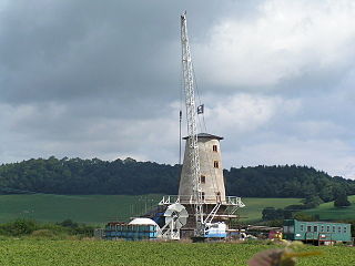
Llancayo is a village in Monmouthshire, south east Wales, United Kingdom. It is located two miles north of Usk on the B4598 road to Abergavenny, in the community of Gwehelog Fawr.

Llantrisant is a village in Monmouthshire, south east Wales, United Kingdom. The community population at the 2011 census was 475.

The River Gavenny or sometimes the Gavenny River is a short river in Monmouthshire in south Wales. It rises 1 mile (1.6 km) southwest of the village of Llanvihangel Crucorney from springs near Penyclawdd Court, supplemented by springs in Blaen-Gavenny Wood and tributary streams there and within the Woodland Trust-owned Great Triley Wood. It flows south for about 4 miles (6.4 km) to its confluence with the River Usk towards the eastern end of Castle Meadows at Abergavenny. The town derives its English-language name from the Gavenny's confluence with the River Usk. Of the buildings on the banks of the river, the Gothic Decorated style church of St Teilo at Llantilio Pertholey is especially notable. Parts of the church date from the thirteenth century with multiple additions since. Blaengavenny Farm, the name of which signifies the 'head of the Gavenny', is a sixteenth century farmhouse near the river's source.

The Afon Crai is a river in Powys, Wales rising in the Fforest Fawr section of the Brecon Beacons National Park and flowing north into the River Usk. The headwaters known as Blaen-crai flow north from Bwlch Bryn-rhudd, a col between the Crai valley and the upper Swansea Valley for 2 km into the Cray Reservoir. The river emerges from below the dam to flow a further 8 km through the dispersed settlement of Crai.

The Afon Senni is a river in Powys, Wales which rises in the Fforest Fawr section of the Brecon Beacons National Park and flows northwards for 11 kilometres (7 mi) to a confluence with the River Usk at Sennybridge.

The Grwyne Fawr is a river in the Brecon Beacons National Park in south Wales. A section of it forms the administrative border between Powys and Monmouthshire and also of the historic counties of Brecon and Monmouth. The river and its major tributary the Grwyne Fechan flow into the River Usk at Glangrwyney.

The River Honddu is a river in the county of Powys, mid Wales. Early recorded versions of the name are of the form Hothenei and hodni which are believed to contain the Welsh adjective 'hawdd', meaning 'pleasant' or 'easy', together with a suffix -ni. Later forms such as Honddey and Honthy have undergone metathesis whereby -ddn- became -ndd-.
Usk (GWR) railway station is a disused railway station in the town of Usk, Monmouthshire, Wales. The station is now barely recognisable with the remains of the platforms beneath undergrowth, but the trackbed, the adjacent Usk Tunnel and road and river bridges remain extant and can be walked.
The geology of Monmouthshire in southeast Wales largely consists of a thick series of sedimentary rocks of different types originating in the Silurian, Devonian, Carboniferous, Triassic and Jurassic periods.

The Clyne River is a river in Swansea, south Wales. It has a total length of 6.5 miles (10.5 km), and flows through the Clyne Valley Country Park for much of its length.
The Olway Brook is a left bank tributary of the River Usk in Monmouthshire in south Wales. Arising from the confluence of several brooks in the vicinity of Llansoy including the Llangofen, Penarth and Pontyrhydan brooks, it flows west to Llandenny, where it is joined by the Nant y Wilcae from Raglan, then southwest to be joined by the waters of the Pill brook and Llan-gwm-isaf Brook. Approaching the edge of the town of Usk it does not join the River Usk here but flows south, sub-parallel to the major river for over 3 km before joining it 750m south of the hamlet of Llanllowell. The catchment of the brook is almost wholly Old Red Sandstone.
References
- ↑ Proceedings | Volume 19. Cotteswold Naturalists' Field Club. 1918. pp. 131–133.
- ↑ Lewis, Colin A.; Richards, Andrew E. (2005). The glaciations of Wales and adjacent areas (First ed.). Little Logaston, Herefordshire: Logaston Press. pp. 117–119. ISBN 1904396364.