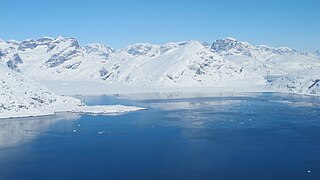
Jørgen Brønlund Fjord or Bronlund Fjord is a fjord in southern Peary Land, northern Greenland.

Peary Land is a peninsula in northern Greenland, extending into the Arctic Ocean. It reaches from Victoria Fjord in the west to Independence Fjord in the south and southeast, and to the Arctic Ocean in the north, with Cape Morris Jesup, the northernmost point of Greenland's mainland, and Cape Bridgman in the northeast.
Hendrik Island is an island in far northern Greenland. Its area is 583 km2. It is part of the Northeast Greenland National Park.

King Frederick VI Coast is a major geographic division of Greenland. It comprises the coastal area of Southeastern Greenland in Sermersooq and Kujalleq municipalities fronting the Irminger Sea of the North Atlantic Ocean. It is bordered by King Christian IX Land on the north and the Greenland Ice Sheet to the west.

Adolf S. Jensen Land is a peninsula in the southern limit of King Frederick VIII Land, northeastern Greenland. Administratively it belongs to the NE Greenland National Park area.

The Denmark expedition, also known as the Denmark Expedition to Greenland's Northeast Coast and the Danmark Expedition after the ship's name, was an expedition to northeastern Greenland in 1906–1908.
Newman Bay or Newman Fjord is a fjord in northern Greenland. To the northwest, the fjord opens into the Robeson Channel of the Lincoln Sea. It is a part of the Northeast Greenland National Park.
Nyeboe Land is a peninsula in far northwestern Greenland. It is a part of the Northeast Greenland National Park.

Freuchen Land is a peninsula in far northwestern Greenland. It is a part of the Northeast Greenland National Park.
Wulff Land is a peninsula in far northwestern Greenland. Administratively it is a part of the Northeast Greenland National Park.

Petermann Fjord is a fjord in northwestern Greenland. Administratively it marks the boundary between the Avannaata municipality and the Northeast Greenland National Park.
Granville Fjord is a fjord in Avannaata municipality, Northwest Greenland.
Griffenfeld Island, Griffenfeldt Island, or Umanaq, after the name of the highest peak. is an uninhabited island in the Sermersooq municipality in southern Greenland.

The Dijmphna Sound is a sound in King Frederick VIII Land, Northeast Greenland. Administratively it is part of the Northeast Greenland National Park zone.

Navarana Fjord is a fjord in Peary Land, far northern Greenland. It is named after an Inuit woman.

Nansen Land is a peninsula in far northwestern Greenland. It is a part of the Northeast Greenland National Park.

Melville Land is an area in Peary Land, North Greenland. Administratively it is part of the Northeast Greenland National Park.

Herluf Trolle Land is an area in Peary Land, North Greenland. Administratively it is part of the Northeast Greenland National Park.

O.B. Bøggild Fjord is a fjord in Peary Land, far northern Greenland.


