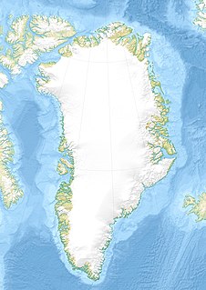
Kennedy Channel is an Arctic sea passage between Greenland and Canada's most northerly island, Ellesmere Island.

Hall Basin is an Arctic waterway between Hall Land in Greenland to the west and Canada's northernmost island to the east, Ellesmere Island.

Hendrik Island is an island in far northern Greenland. Its area is 583 km2. It is part of the Northeast Greenland National Park.

Kaiser Franz Joseph Fjord is a major fjord system in the NE Greenland National Park area, East Greenland.

Wollaston Foreland is a peninsula in King Christian X Land, East Greenland. Administratively it belongs to the NE Greenland National Park area.

Foster Bay is a large bay of the Greenland Sea in King Christian X Land, Eastern Greenland. Administratively it belongs to the NE Greenland National Park area.

Cape Morton is a headland in North Greenland in the Avannaata municipality. The cape is named after Arctic explorer William Morton, who surveyed the Nares Strait area together with Hans Hendrik in June 1854 during the Second Grinnell Expedition.

Peabody Bay is a large bay in northwestern Greenland. Administratively it is part of the Qaasuitsup municipality.

Cass Fjord is a fjord in northern Greenland. To the southwest, the fjord opens into the Kane Basin of the Nares Strait.

Pikiulleq is a bay in eastern Greenland. It is part of the Sermersooq municipality.

Dove Bay is a bay in King Frederick VIII Land, northeastern Greenland. It is part of the Northeast Greenland National Park area.

Newman Bay or Newman Fjord is a fjord in northern Greenland. To the northwest, the fjord opens into the Robeson Channel of the Lincoln Sea. It is a part of the Northeast Greenland National Park.

Wulff Land is a peninsula in far northwestern Greenland. Administratively it is a part of the Northeast Greenland National Park.

Bessel Fjord, also known as Bessels Bay, is a fjord in northwestern Greenland. Administratively it belongs to the Avannaata municipality.

Petermann Fjord is a fjord in northwestern Greenland. Administratively it marks the boundary between the Avannaata municipality and the Northeast Greenland National Park.

Granville Fjord is a fjord in Avannaata municipality, Northwest Greenland.

Lockwood Island is an island of the Lincoln Sea, Greenland. Administratively it belongs to the Northeast Greenland National Park.

Hunt Fjord is a fjord in Peary Land, northern Greenland. To the north the fjord has its mouth in the Lincoln Sea of the Arctic Ocean. Administratively it belongs to the Northeast Greenland National Park.

Cape Washington is a headland in North Greenland. Administratively it belongs to the Northeast Greenland National Park.

Nansen Land is a peninsula in far northwestern Greenland. It is a part of the Northeast Greenland National Park.


