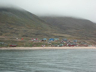
Greenland is located between the Arctic Ocean and the North Atlantic Ocean, northeast of Canada and northwest of Iceland. The territory comprises the island of Greenland—the largest island in the world—and more than a hundred other smaller islands. Greenland has a 1.2 kilometre long border with Canada on Hans Island. A sparse population is confined to small settlements along certain sectors of the coast. Greenland possesses the world's second-largest ice sheet.

Ellesmere Island is Canada's northernmost and third largest island, and the tenth largest in the world. It comprises an area of 196,236 km2 (75,767 sq mi), slightly smaller than Great Britain, and the total length of the island is 830 km (520 mi).

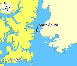
Smith Sound is an uninhabited Arctic sea passage between Greenland and Canada's northernmost island, Ellesmere Island. It links Baffin Bay with Kane Basin and forms part of the Nares Strait.

Peary Land is a peninsula in northern Greenland, extending into the Arctic Ocean. It reaches from Victoria Fjord in the west to Independence Fjord in the south and southeast, and to the Arctic Ocean in the north, with Cape Morris Jesup, the northernmost point of Greenland's mainland, and Cape Bridgman in the northeast.
Wolstenholme Fjord is a fjord in Avannaata municipality, Northwest Greenland. It is located to the north of the Thule Air Base and adjacent to the abandoned Inuit settlement of Narsaarsuk.

Hall Basin is an Arctic waterway between Hall Land in Greenland to the east and Canada's northernmost island, Ellesmere Island, to the west.
Qeqertarsuaq or Herbert Island is an island in Baffin Bay near Qaanaaq in the Avannaata municipality, NW Greenland. The island has an area of 223 km2.
Nuussuaq Peninsula is a mainland peninsula in northwestern Greenland, located at the northern end of Upernavik Archipelago, approximately 70 km (43 mi) to the south of Melville Bay. It is much smaller than its namesake in western Greenland.
The Bonsall Islands is a small coastal island cluster in the Avannaata municipality, off northwest Greenland.
The McGary Islands is a small coastal island group in Avannaata municipality, off NW Greenland.
Peabody Bay is a large bay in northwestern Greenland. Administratively it is part of Avannaata municipality.

Hiawatha Glacier is a glacier in northwest Greenland, with its terminus in Inglefield Land. It was mapped in 1922 by Lauge Koch, who noted that the glacier tongue extended into Lake Alida. Hiawatha Glacier attracted attention in 2018 because of the discovery of a crater beneath the surface of the ice sheet in the area. A publication noted in 1952 that Hiawatha Glacier had been retreating since 1920.
Washington Land is a peninsula in northwestern Greenland. It is a part of the Avannaata municipality.

Inglefield Gulf or Inglefield Fjord is a fjord in northwestern Greenland. To the west, the fjord opens into the Baffin Bay. Administratively it belongs to the Avannaata municipality.

Siorapaluup Kangerlua, also known as Robertson Fjord and Robertson Bay, is a fjord in northern Greenland. To the southwest, the fjord opens into the Murchison Sound of the Baffin Bay. Administratively it belongs to the Avannaata municipality.

The Roosevelt Range or Roosevelt Mountains is a mountain range in Northern Greenland. Administratively this range is part of the Northeast Greenland National Park. Its highest peak is the highest point in Peary Land.

Herluf Trolle Land is an area in Peary Land, North Greenland. Administratively it is part of the Northeast Greenland National Park.

Cape Kane is a headland in North Greenland. Administratively it belongs to the Northeast Greenland National Park.

Dodge Glacier, is a glacier in northwestern Greenland. Administratively it belongs to the Avannaata municipality.


