
Bavaria, officially the Free State of Bavaria, is a state in the southeast of Germany. With an area of 70,550.19 km2 (27,239.58 sq mi), it is the largest German state by land area, comprising roughly a fifth of the total land area of Germany. With over 13 million inhabitants, it is the second most populous German state behind North Rhine-Westphalia, but due to its large land area its population density is below the German average. Major cities include Munich, Nuremberg, and Augsburg.

Swabia is one of the seven administrative regions of Bavaria, Germany. It consists of ten districts and 340 municipalities.

Upper Franconia is a Regierungsbezirk of the state of Bavaria, southern Germany. It forms part of the historically significant region of Franconia, the others being Middle Franconia and Lower Franconia, which are all now part of the German Federal State of Bayern (Bavaria).
Aichach-Friedberg is a Landkreis (district) in Bavaria, Germany. It is bounded by the districts of Augsburg, Donau-Ries, Neuburg-Schrobenhausen, Pfaffenhofen, Dachau, Fürstenfeldbruck and Landsberg, as well as by the city of Augsburg.

Upper Bavaria is one of the seven administrative regions of Bavaria, Germany.

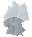
Lower Bavaria is one of the seven administrative regions of Bavaria, Germany, located in the east of the state. It consists of nine districts and 258 municipalities.

The Upper Palatinate is an administrative district in the east of Bavaria, Germany. It consists of seven districts and 226 municipalities, including three cities.

The Iller is a river of Bavaria and Baden-Württemberg in Germany. It is a right tributary of the Danube, 146 kilometres (91 mi) long.
Altötting is a Landkreis (district) in Bavaria, Germany. It is bounded by Austria and the Bavarian districts of Traunstein, Mühldorf and Rottal-Inn.

The Isar is a river in Austria and in Bavaria, Germany. Its source is in the Karwendel mountain range of the Alps. The Isar river enters Germany near Mittenwald and flows through Bad Tölz, Munich, and Landshut before reaching the Danube near Deggendorf. With 295 km length, it is among the longest rivers in Bavaria. It is Germany's second most important tributary of the Danube.
Freyung-Grafenau is a Landkreis (district) in Bavaria, Germany. It is bounded by the districts of Passau, Deggendorf and Regen, the Czech Republic and by Austria.

Landshut is a town in Bavaria in the south-east of Germany. Situated on the banks of the River Isar, Landshut is the capital of Lower Bavaria, one of the seven administrative regions of the Free State of Bavaria. It is also the seat of the surrounding district and has a population of more than 75,000. Landshut is the largest city in Lower Bavaria, followed by Passau and Straubing, and Eastern Bavaria's second after Regensburg.

Kelheim is a town and municipality in Bavaria, Germany. It is the capital of the district Kelheim and is situated at the confluence of the rivers Altmühl and Danube. Kelheim has a population of around 16,750 (2020).

The Duchy of Bavaria was a frontier region in the southeastern part of the Merovingian kingdom from the sixth through the eighth century. It was settled by Bavarian tribes and ruled by dukes (duces) under Frankish overlordship. A new duchy was created from this area during the decline of the Carolingian Empire in the late ninth century. It became one of the stem duchies of the East Frankish realm which evolved as the Kingdom of Germany and the Holy Roman Empire.
Southern Germany is a region of Germany that included the areas in which Upper German dialects are spoken, which includes the stem duchies of Bavaria and Swabia in present-day Bavaria, Baden-Württemberg, and the southern portion of Hesse and Rhineland-Palatinate that were part of the Duchy of Franconia.

Bessenbach is a community in the Aschaffenburg district in the Regierungsbezirk of Lower Franconia (Unterfranken) in Bavaria, Germany.

Hohe Wart is a wooded hill of the Spessart range in Bavaria, Germany. It is located in the unincorporated area Forst Hohe Wart, between the districts of Aschaffenburg and Miltenberg.

Michelbach is a river of Bavaria, Germany. It is a right tributary of the Bessenbach near Keilberg.
