Bhimber is the southernmost of the ten districts of Pakistan administered Kashmir. It borders Indian-administered Kashmir to the east. The district is located between Latitude: 32-48 to 33-34 and Longitude: 73.55 to 74-45, and has an area of 1516 km². The chief town is Bhimber.

Pulwama is a city and a notified area council in Pulwama district, in India’s northern state of Jammu and Kashmir. It is almost 25 km (16 mi) from the summer capital of Srinagar. Pulwama is often called the "Anand of Kashmir", but also the "Dudha-Kul of Kashmir" on account of its high milk production.
Islam Nagar is one of the neighbourhoods of Baldia Town in Karachi, Sindh, Pakistan.

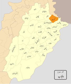
Gujranwala Division is an administrative division of Punjab Province, Pakistan and is considered the largest division of the Punjab province, taking into accounts its area and population. The division, headquartered at the city of Gujranwala, covers an area of 17,206 km2. According to the 1981 census, the population was 7,522,352, and rose by almost four 4 million to 11,431,058 according to the 1998 census.
Mozang Chungi or Mozang is an area in Lahore, Pakistan. Nearby areas are Jail Road, Choubarji, Shama and famous Anarkali Bazar. It is located at 31°32'55N 74°18'54E. The area came under attention after the controversial Raymond Allen Davis incident took place here.

Kodasalli Dam is built across the Kali River (Kalinadi) in Yellapura taluk of Uttara Kannada district of Karnataka state, India. This dam was built by Karnataka Power Corporation Limited. This electric power generating station is classified as hydroelectric power station. It also is a major source of irrigation.

The Kali River or Kali nadi is a river flowing through Uttara Kannada district of Karnataka state in India. The river rises near Diggi, a small village in Uttar Kannada district. The river is the lifeline to some 4 lakh people in the Uttara Kannada district and supports the livelihoods of tens of thousands of people including fishermen on the coast of Karwar. There are many dams built across this river for the generation of electricity. One of the important dams build across Kali river is the Supa Dam at Ganeshgudi. The river runs 184 kilometers before joining Arabian Sea.
Hassan Town is a neighbourhood located within union council 110 in Iqbal Tehsil of Lahore, Punjab, Pakistan.

Bhadana is a town in Gujar Khan Tehsil Punjab, Pakistan. Bhadana is a clan of Gurjar in India. Bhadana is also chief town of Union Council Bhadana which is an administrative subdivision of the Tehsil.
Marala, also known as Murala, is town in Gujrat District of Punjab province, Pakistan. It is located at 32°38'60N 74°30'0E and has an altitude of 234 metres.

Achh is a village and union council of Gujrat District, in the Punjab province of Pakistan. It is part of Kharian Tehsil and is located at 32°52'0N 74°8'0E with an altitude of 311 metres.
Ajnala is a town and union council of Gujrat District, in the Punjab province of Pakistan. It is located at 32°48'0N 74°15'0E with an altitude of 277 metres.
Miana Chak is a town and union council of Gujrat District, in the Punjab province of Pakistan. It is part of Kharian Tehsil and is located at 32°43'20N 74°8'0E with an altitude of 247 metres.
Qila Mihan Singh, is a town of Gujranwala District in the Punjab province of Pakistan. It is located at 32°6'0N 74°5'0E with an altitude of 222 metres.
Lokur is a village in Athni tehsil, Belgaum district, in the state of Karnataka, India. According to Census 2011 information the location code or village code of Lokur village is 597287. It is 32 kilometres (20 mi) from the sub-district headquarters at Athni and 122 kilometres (76 mi) from the district headquarters at Belgaum. As per 2009 stats, Mangasuli is the gram panchayat of Lokur village.
Mendil is a village in Belgaum district of Karnataka, India.
Heggeri is a village in Dharwad district of Karnataka, India.
Deona Juliani railway station is located in Deona Juliani village, Gujrat district of Punjab province, Pakistan.
Haripur Band railway station is located in Haripur band, Gujranwala district of Punjab province, Pakistan.

Hitoyoshi is a 12th century castle, now ruins, located in Hitoyoshi, Kumamoto Prefecture. It is recognized as one of Japan's top 100 castles.