
East Godavari is a district in the Coastal Andhra region of Andhra Pradesh, India. Its district headquarters is at Rajamahendravaram.

Bhadrachalam is a census town in Bhadradri Kothagudem district in the Indian state of Telangana. It is an important Hindu pilgrimage town with the Bhadrachalam Temple of Lord Rama, situated on the banks of Godavari river. It is located 312 kilometres (194 mi) east of state capital, Hyderabad,115 kilometres (71 mi) from Khammam,178 kilometres (111 mi) from Suryapet,180 kilometres (112 mi) from Warangal,187 kilometres (116 mi) from Vijayawada,220 kilometres (137 mi) and 350 kilometres (217 mi) from Visakhapatnam.

Kovvur is a town in the East Godavari district of the Indian state of Andhra Pradesh. It is a municipality and the mandal headquarters of Kovvur mandal in Kovvur revenue division.

Palakollu is a city and the administrative headquarters of Palakollu Mandal in Narasapuram revenue division in West Godavari district of the Indian state of Andhra Pradesh. Palakollu is situated in Coastal Andhra region of the state. It occupies 4.685 square kilometres (1.809 sq mi). As of 2011 census, it had a population of about 61,284 and a Metro population of about 81,199. Palakollu Municipality merged five Grama panchayats of Seven village's on 7 January 2020. The Seven Villages' had a population of 42,932 as of 2011 Census. It around occupies 20.08 square kilometres (7.75 sq mi) and after merged palakollu municipality, It around occupies 24.68 square kilometres (9.53 sq mi) with 35 election wards it is total population of 1,04,216 and making it the third most populous urban area in West Godavari District in Andhra Pradesh. It is a part of Eluru Urban Development Authority.

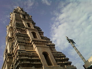
Amalapuram is a town in the Indian state of Andhra Pradesh. It is the district headquarters and the third largest town of Dr. B. R. Ambedkar Konaseema district. It is the mandal and divisional headquarters of Amalapuram mandal and Amalapuram revenue division respectively. The town is situated in the delta of konaseema.
Bandarulanka is a census town in Amalapuram Mandal, Dr. B.R. Ambedkar Konaseema district of the Indian state of Andhra Pradesh.

Hindupuram is a city in Sri Sathya Sai district of the Indian state of Andhra Pradesh. It is located to the edge of the Andhra–Karnataka border and is the headquarters of Hindupuram mandalam. Hindupuram is the Parliamentary Constituency in the newly formed District Sri Sathya Sai. It is located about 67 km from district headquarters Puttaparthi, 100 km from Bengaluru the capital of Karnataka, 95 km From Kadiri.
Rayachoti is a Municipality and District headquarters of Annamayya district which is formed after Rajampet of the Indian state of Andhra Pradesh. Also It is the headquarters of Rayachoti revenue division. It is one of the oldest towns in Andhra Pradesh.
Bikkavolu is a village in East Godavari district in the state of Andhra Pradesh in India. The village is known for its famous Subrahmanya Swamy Temple.
Malikipuram is a town of Dr. B.R. Ambedkar Konaseema district in Andhra Pradesh, India. It is located in the Amalapuram revenue division.
National Highway 216 is a National Highway in the Indian state of Andhra Pradesh. The former highways of NH 214 and 214A were merged and renumbered as NH 216. It starts from NH 16 junction at Kattipudi and passes through Kakinada, Amalapuram, Digamarru (Palakollu), Narasapuram, Machilipatnam, Repalle, Cherukupalle, Bapatla, Chirala before it junctions NH 16 again at Ongole. Visakhapatnam–Kakinada Petro Chemical Corridor, is a proposed project along the highway.
A. Vemavaram is a village in Amalapuram Mandal, Dr. B. R. Ambedkar Konaseema district in the state of Andhra Pradesh in India.
Amalapuram mandal is one of the 22 mandals in Dr. B.R. Ambedkar Konaseema district of Andhra Pradesh. As per census 2011, there are 17 villages in this mandal.
Edarapalle is a village in Amalapuram Mandal, Dr. B.R. Ambedkar Konaseema district in the state of Andhra Pradesh in India.
Immidivarappadu is a village in Amalapuram Mandal, Dr. B.R. Ambedkar Konaseema district in the state of Andhra Pradesh in India.
Indupalle is a village in Amalapuram Mandal, Dr. B.R. Ambedkar Konaseema district in the state of Andhra Pradesh in India.
Nadipudi is a village in Amalapuram Mandal, Dr. B.R. Ambedkar Konaseema district in the state of Andhra Pradesh in India.
Palagummi is a village in Amalapuram Mandal, Dr. B.R. Ambedkar Konaseema district in the state of Andhra Pradesh in India.
Sakuru is a village in Amalapuram Mandal, Dr. B.R. Ambedkar Konaseema district in the state of Andhra Pradesh in India.

Konaseema district, is one of the 26 districts in the Indian state of Andhra Pradesh. It is situated between the tributaries of the Godavari river in the Konaseema region of Coastal Andhra. It was carved out of East Godavari district on 4 April 2022 by the Government of Andhra Pradesh. Amalapuram is the district headquarters and the largest city in this district. The district shares boundaries with West Godavari, East Godavari and Kakinada districts.

