Bhauwapar

Last updated

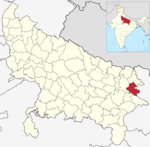
Bhauwapar is a village in the Gorakhpur district, Uttar Pradesh in India, near the border with Nepal.It is situated 15 km apart from Gorakhpur city. This village played very significant role in Indian freedom. ancient Mungeshwar nath temple is the heritage of Bhauwapar.

Gorakhpur district District of Uttar Pradesh in India

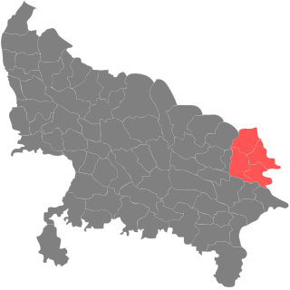
Gorakhpur is a district of Uttar Pradesh in India. It is one of the major and largest districts of Uttar Pradesh. Gorakhpur is the administrative headquarters of the district.

Uttar Pradesh State in India

Uttar Pradesh is a state considered to be part of central, northern and north-central India. Abbreviated as UP, it is the most populous state in the Republic of India as well as the most populous country subdivision in the world. It is located in the north-central region of the Indian subcontinent, has over 200 million inhabitants. It was created on 1 April 1937 as the United Provinces of Agra and Oudh during British rule, and was renamed Uttar Pradesh in 1950. The state is divided into 18 divisions and 75 districts with the capital being Lucknow. The main ethnic group is the Hindavi people, forming the demographic plurality. On 9 November 2000, a new state, Uttarakhand, was carved out from the state's Himalayan hill region. The two major rivers of the state, the Ganga and Yamuna, join at Allahabad (Prayagraj) and then flow as the Ganges further east. Hindi is the most widely spoken language and is also the official language of the state.

India Country in South Asia

India, also known as the Republic of India, is a country in South Asia. It is the seventh largest country by area and with more than 1.3 billion people, it is the second most populous country as well as the most populous democracy in the world. Bounded by the Indian Ocean on the south, the Arabian Sea on the southwest, and the Bay of Bengal on the southeast, it shares land borders with Pakistan to the west; China, Nepal, and Bhutan to the northeast; and Bangladesh and Myanmar to the east. In the Indian Ocean, India is in the vicinity of Sri Lanka and the Maldives, while its Andaman and Nicobar Islands share a maritime border with Thailand and Indonesia.
Related Research Articles

Deoria district District of Uttar Pradesh in India

Deoria district is one of the districts of Uttar Pradesh, India. Deoria is the district headquarters. Deoria district is a part of Gorakhpur division. Deoria district came into existence on 16 March 1946 from Gorakhpur district.

Gorakhpur division division of Uttar Pradesh, India

Gorakhpur division is an administrative geographical unit of Uttar Pradesh state in northern India. Gorakhpur is the administrative headquarters of the division. Currently (2017), the division consists of four districts:

Kushinagar district District of Uttar Pradesh in India

Kushinagar is a district of Uttar Pradesh state in northern India situated in the easternmost part of the state. It has the administrative headquarters at Ravindra Nagar Dhoos in Padrauna. The district is named such after the town Kushinagar, a Buddhist pilgrimage site where Gautama Buddha attained parinirvana in the 5th century BCE. Since the independence of India, Kushinagar district was a part of Deoria District and came into existence on 13 May 1994 as a separate district division. It was earlier known as Padrauna and thereafter was renamed Kushinagar on 19th June 1997.

Nautanwa Town in Uttar Pradesh, India

Nautanwa is a town and Nagar Palika in Maharajganj district in the state of Uttar Pradesh, India. It is about 87 km from Gorakhpur, NH24 and 68 km NH730 from Maharajganj and 7 km from Sonauli Indo-Nepal Border.

Nižná Hutka municipality of Slovakia

Nižná Hutka is a village and municipality in Košice-okolie District in the Kosice Region of eastern Slovakia.

Den Dungen Place in North Brabant, Netherlands

Den Dungen is a village in the Dutch province of North Brabant. It is located in the municipality of Sint-Michielsgestel next to the village Maaskantje.

Hata, India Town in Uttar Pradesh, India

Hata is a town having 25 wards and a Nagarpalika in Kushinagar district in the Indian state of Uttar Pradesh. It is situated 36 km away from Gorakhpur in east. It is a major town of Kushinagar district situated on NH -28. Nearest railway station is Gauri Bajar, which is 17 km away from the town and the next major market of Kaptanganj is located 23 km away from it. The gram panchayat of Dhadha Bujurg is located 3 km west from the town. Hata is the main market for wholesaler, local vendors & retailers.

Gorakhpur is a Lok Sabha parliamentary constituency in Gorakhpur, Eastern Uttar Pradesh, India.

Cyprki Village in Podlaskie, Poland

Cyprki is a village in the administrative district of Gmina Grajewo, within Grajewo County, Podlaskie Voivodeship, in north-eastern Poland. It lies approximately 6 kilometres (4 mi) west of Grajewo and 81 km (50 mi) north-west of the regional capital Białystok.

Suchynicze Village in Podlaskie, Poland

Suchynicze is a village in the administrative district of Gmina Szudziałowo, within Sokółka County, Podlaskie Voivodeship, in north-eastern Poland, close to the border with Belarus. It lies approximately 8 kilometres (5 mi) north of Szudziałowo, 12 km (7 mi) east of Sokółka, and 44 km (27 mi) north-east of the regional capital Białystok.

Łabunie Village in Lublin, Poland

Łabunie is a village in Zamość County, Lublin Voivodeship, in eastern Poland. It is the seat of the gmina called Gmina Łabunie. It lies some 10 kilometres (6 mi) southeast of Zamość and 86 km (53 mi) southeast of the regional capital, Lublin.

Məlikzadə is a village in the municipality of Hənifə in the Balakan Rayon of Azerbaijan.

Wymój Village in Warmian-Masurian, Poland

Wymój is a village in the administrative district of Gmina Stawiguda, within Olsztyn County, Warmian-Masurian Voivodeship, in northern Poland. It lies approximately 3 kilometres (2 mi) west of Stawiguda and 16 km (10 mi) south-west of the regional capital Olsztyn.

Dublovice is a village and municipality in Příbram District in the Central Bohemian Region of the Czech Republic.

Seljametsa Village in Pärnu County, Estonia

Seljametsa is a village in Paikuse Parish, Pärnu County in southwestern Estonia.

Hoffman Glacier is a narrow glacier, 10 nautical miles (19 km) long, flowing eastward from Mount Miller in the Holland Range of Antarctica to enter Lennox-King Glacier south of Rhodes Peak. It was named by the Advisory Committee on Antarctic Names for Lieutenant Commander Robert D. Hoffman, U.S. Navy, commanding officer of USS Mills during Operation Deep Freeze, 1965.

Shuklapuri or Shukul Puri is a village and gram panchayat in Barhalganj, Gorakhpur district, Uttar Pradesh, India. It has a post office with pin code 273402.

Azamgarh railway station

Azamgarh railway station is located in Azamgarh, Uttar Pradesh, India.

References

    Coordinates: 26°40′N83°22′E / 26.667°N 83.367°E / 26.667; 83.367

    Geographic coordinate system Coordinate system

    A geographic coordinate system is a coordinate system that enables every location on Earth to be specified by a set of numbers, letters or symbols. The coordinates are often chosen such that one of the numbers represents a vertical position and two or three of the numbers represent a horizontal position; alternatively, a geographic position may be expressed in a combined three-dimensional Cartesian vector. A common choice of coordinates is latitude, longitude and elevation. To specify a location on a plane requires a map projection.