Gorakhpur district | |
|---|---|
 | |
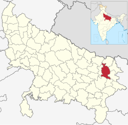 Location of Gorakhpur district in Uttar Pradesh | |
| Country | |
| State | Uttar Pradesh |
| Division | Gorakhpur |
| Headquarters | Gorakhpur |
| Tehsils | 7 |
| Government | |
| • Lok Sabha constituencies | Gorakhpur, Bansgaon |
| • Commissioner | Anil Dhingra IAS [1] |
| • D.M | Krishna Karunesh IAS [1] |
| • SSP | Gaurav Grover IPS [1] |
| Area | |
• Total | 3,448 km2 (1,331 sq mi) |
| Population (2011 Census) [3] | |
• Total | 4,440,895 |
| • Density | 1,300/km2 (3,300/sq mi) |
| • Urban | 836,129 |
| Demographics | |
| • Literacy | 77.83%. |
| • Sex ratio | 950 |
| Time zone | UTC+05:30 (IST) |
| Vehicle registration | UP-53 |
| Major highways | NH 28, NH 233B, NH 29 |
| Languages | Hindi, Bhojpuri, Urdu |
| Website | gorakhpur |
Gorakhpur district is one of the 75 districts of Uttar Pradesh state in northern India. This district is a part of the Gorakhpur division. The city of Gorakhpur, or Gorakhpur is the administrative headquarters of this district and Gorakhpur division. It borders Sant Kabir Nagar district to the west, Kushinagar and Deoria districts to the east, and Maharajganj and Azamgarh districts to the north and south.