Chandauli district | |
|---|---|
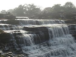 Rajdari Waterfalls | |
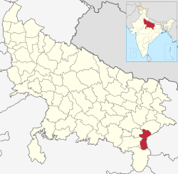 Location of Chandauli district in Uttar Pradesh | |
| Country | |
| State | Uttar Pradesh |
| Division | Varanasi |
| Established | 20 May 1997 |
| Headquarters | Chandauli |
| Government | |
| • District Magistrate | Sh. ChandraMohan Garg, IAS |
| • Lok Sabha constituencies | Chandauli |
| • Member of Parliament, Lok Sabha | Virendra Singh (Varanasi) |
| Area | |
• Total | 2,484.70 km2 (959.35 sq mi) |
| Population (2011) | |
• Total | 1,952,756 |
| • Density | 785.912/km2 (2,035.50/sq mi) |
| • Urban | 242,553 |
| Demographics | |
| • Literacy | 80.9% |
| • Sex ratio | 984 |
| Languages | |
| • Official language | Hindi |
| • Additional official | Urdu |
| • Regional | Bhojpuri |
| Time zone | UTC+05:30 (IST) |
| Vehicle registration | UP-67 |
| Website | chandauli |
Chandauli district is a district of Uttar Pradesh state of India, and Chandauli town is the district headquarters. Chandauli district, a part of Varanasi Division, became a separate district on 20 May 1997.Chandauli district is located in south eastern Uttar Pradesh.
Contents
- Economy
- Demographics
- Languages
- Administrative divisions
- Politics
- Chandauli Loksabha
- Vidhan Sabha segments
- Notable people
- Geographical indication
- References
- External links
Pt. Deen Dayal Upadhyay Nagar, a city in the district has the busiest railway station in the North East of Uttar Pradesh. The district includes the Chandraprabha (nature) Sanctuary and a number of waterfalls, including at Devdari and Rajdari. The District contributes to Indian GDP by providing the various cereals from the district including paddy and wheat. Popularly known as the "Dhaan Ka Katora of Uttar Pradesh" ("rice bowl of Uttar Pradesh") because of fertile lands of the Gangetic Plain. Chanduali district made big contributions at the time of freedom movements.[ citation needed ] In Chanduali there is a village named Ghoswan and Khakhara which is known for the protest against the British for the freedom of India. Chandauli district has its own railway station named Chandauli Majhwar railway station near to district headquarters.
The district has five Vidhan Sabha seats and one member of parliament seat.