Kanpur Dehat district

Last updated

Kanpur Dehat district
Akbarpur kanpur dehat temple and places 5.jpg
Dharma Garh Temple Rasulabad.jpg
Parhul Devi Temple (west view).jpg
Rind River.JPG
Clockwise from top-left: Temple in Akbarpur, Dharmagarh Temple in Rasulabad, Parhul Devi Temple, Rind River, Kali Devi Mandir in Arahriyamau Bhognipur, Dehat
India Uttar Pradesh districts 2012 Kanpur Dehat.svg
Location of Kanpur Dehat district in Uttar Pradesh
Coordinates(Akbarpur, Kanpur Dehat): 26°20′39″N79°58′02″E / 26.3443°N 79.96718°E / 26.3443; 79.96718
CountryFlag of India.svg India
State Uttar Pradesh
Division Kanpur
Headquarters Akbarpur
Tehsils 1. Akbarpur, 2. Bhognipur, 3. Rasulabad, 4. Derapur, 5. Sikandara,
Government
   Lok Sabha constituencies 1. Akbarpur (Lok Sabha constituency)- Akbarpur-Raniya
2. Kannauj (Lok Sabha constituency)- Rasulabad
3. Etawah (Lok Sabha constituency)- Sikandra
4. Jalaun (Lok Sabha constituency)- Bhognipur
   Vidhan Sabha constituencies 1. Rasulabad
2. Akbarpur-Raniya
3. Sikandra
4. Bhognipur
Area
  Total
3,021 km2 (1,166 sq mi)
Population
 (2011) [1]
  Total
1,796,184
  Density590/km2 (1,500/sq mi)
   Urban
173,423
Demographics
   Literacy 65.15%
Time zone UTC+05:30 (IST)
Vehicle registration UP-77
Website kanpurdehat.nic.in

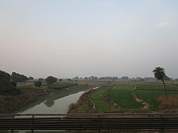
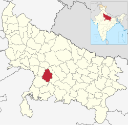
Kanpur Dehat district is a district in Uttar Pradesh state in northern India. The administrative headquarters of the district are at Mati-Akbarpur. This district is part of Kanpur division. Kanpur was formerly spelled Cawnpore.

Contents

History

The Battle of Madarpur, which occurred in 1528 CE, was fought between the Bhuinhar Brahman zamindars and the Mughal Empire. [2] [3] It took place in what is now the Greater Kanpur district. This land is home to the patriotic Sachan community, who provided both blood and wealth in support of Nana Saheb and Tatya Tope during the 1857 Revolt. They willingly relinquished their zamindaries in the name of the struggle for independence. Sachan people are predominantly located in the Bhognipur Tehsil and its surrounding areas.

Kanpur District was divided into two districts, namely Kanpur and Greater Kanpur in year 1977. The two were reunited again in 1979 and again separated in 1981. Uttar Pradesh government decided to rename Kanpur Dehat district as Ramabai Nagar district on 1 July 2010. [4] In July 2012, it was returned to Kanpur Dehat.

Administrative Subdivisions

Tehsils in Kanpur Dehat district

  1. Akbarpur
  2. Bhognipur
  3. Derapur
  4. Rasulabad
  5. Sikandara

Block in Kanpur Dehat district

  1. Akbarpur
  2. Maitha
  3. Sarvankheda
  4. Derapur
  5. Jhinjhak
  6. Rasulabad
  7. Amraudha
  8. Malasa
  9. Sandalpur
  10. Rajpur

Political representatives

Legislative Council

NameMember [5] Party
Kanpur Graduate Constituency Arun Pathak Bharatiya Janata Party

Legislative Assembly

NameMember [6] Party
Akbarpur-Raniya Pratibha Shukla [7] Bharatiya Janta Party
Bhognipur Rakesh Sachan [8] Bharatiya Janta Party
Sikandra Ajit Singh Pal [9] Bharatiya Janta Party
Rasulabad Poonam Sankhwar [10] Bharatiya Janta Party

Parliamentary constituencies

NameMember [11] Party
Akbarpur Devendra Singh Bhole Bharatiya Janta Party
Kannauj Akhilesh Yadav Samajwadi party
Etawah Jitendra Kumar Dohare Samajwadi party
Jalaun Narayan Das Ahirwar Samajwadi party

Transport

An aeroplane at Kanpur Dehat's Marhamtabad Airstrip (2018) VT-UPR at Kanpur Dehat Marhamtabad Airport.jpg
An aeroplane at Kanpur Dehat's Marhamtabad Airstrip (2018)

The district is well connected by railways. Three rail tracks run through Greater Kanpur district. The railway route connecting Delhi to Hawrah belonging to North Central zone of Indian Railways is passing through centre of the district. This railway track is broad gauge and fully electrified. The railway stations on this route through the district are Bhaupur, Maitha, Roshan Mau Halt, Rura, Ambiyapur, Jhinjhak and Parjani Halt. Rura Railway Station is the main railway Station of Kanpur Dehat District.

The second track is Kanpur to Jhansi railway line. The railway stations on this route are Binaur, Rasulpur Gogumau, Tilaunchi, Paman, Lalpur, Malasa, Pukhrayan and Chaunrah. This broad gauge railway track is electrified also belongs to North Central zone.

The third railway line converted to broad gauge belongs to North Eastern Railway zone. The track runs parallel to the Ganges river. This track is also electrified.

Greater Kanpur is also equipped with Metro station corridor having Red, Orange,Silver in Bhaupur, Akbarpur,Maitha etc. of UPMRC

Notable residents

Locations

Religious

Waneshwar Mahadev Mandir Waneshwar Mahadev Mandir.JPG
Waneshwar Mahadev Mandir

Villages

Educational institutions

Demographics

Historical population
YearPop.±% p.a.
1901398,550    
1911361,641−0.97%
1921363,659+0.06%
1931383,790+0.54%
1941492,694+2.53%
1951614,143+2.23%
1961734,347+1.80%
1971897,068+2.02%
19811,087,032+1.94%
19911,303,232+1.83%
20011,563,336+1.84%
20111,796,184+1.40%
source: [15]
Religions in Kanpur Dehat district (2011) [16]
ReligionPercent
Hinduism
89.80%
Islam
9.82%
Other or not stated
0.38%
Distribution of religions

According to the 2011 census Kanpur Dehat district has a population of 1,795,092, [1] roughly equal to the nation of The Gambia [17] or the US state of Nebraska. [18] This gives it a ranking of 268th in India (out of a total of 640 districts). [1] The district has a population density of 594 inhabitants per square kilometre (1,540/sq mi). [1] Its population growth rate over the decade 2001-2011 was 14.82%. [1] Kanpur Dehat has a sex ratio of 862 females for every 1000 males, [1] and a literacy rate of 77.52%. 9.66% of the population lives in urban areas. Scheduled Castes make up 25.66% of the population. [1]

Languages of Kanpur Dehat district (2011) [19]
  1. Hindi (98.97%)
  2. Urdu (0.94%)
  3. Others (0.09%)

Kos Minars

Since the Mughal Road passes through Greater Kanpur district, there are many Kos Minar (mile pillars) in the district. Some of them are protected monuments, notable ones are at Bhognipur, Chapar Ghata, Deosar, Gaur, Halia, Jallapur Sikandara, Pailwaru, Pitampur, Raigawan, Rajpur, Sankhiln Buzurg, Sardarpur.

International airport proposal

An international airport named Rasoolabad International Airport was proposed in 2015 to be constructed in Kanpur Dehat district about 50 km from Kanpur. [20] The airport will serve the region from Agra division, Jhansi division, Kanpur division, Aligarh division, Allahabad division, Banda division and Lucknow division. It would have direct link road with Agra Lucknow Expressway. [21] [22]

References

  1. 1 2 3 4 5 6 7 "District Census Handbook: Kanpur Dehat" (PDF). censusindia.gov.in. Registrar General and Census Commissioner of India. 2011.
  2. Shri Janta Book Stall, Kanpur. Kanya Kubja Vanshavali ( Devanagari) By Sri Pt. Lalmani Dharma Shastri Ji Shri Janta Book Stall, Kanpur.
  3. "सैयद वंश व मुगलकालीन खंडहरों के ध्वंसावशेष -". Jagran (in Hindi). Retrieved 24 April 2025.
  4. "Kanpur Dehat". District administration. Archived from the original on 21 July 2011. Retrieved 18 August 2010.
  5. भाजपा के अरुण पाठक ने तोड़ी स्वरूप परिवार की विरासत [BJP's Arun Pathak ends the dynasty of Swaroop Faimly] (in Hindi). Dainik Jagran . Retrieved 1 January 2017.
  6. "STATISTICAL REPORT ON GENERAL ELECTION, 2012 TO THE LEGISLATIVE ASSEMBLY OF UTTAR PRADESH" (PDF). Election Commission of India . Retrieved 1 January 2017.
  7. "Pratibha Shukla(Bharatiya Janata Party(BJP)):Constituency- AKBARPUR-RANIYA(KANPUR DEHAT) - Affidavit Information of Candidate".
  8. "Vinod Kumar Katiyar(Bharatiya Janata Party(BJP)):Constituency- BHOGNIPUR(KANPUR DEHAT) - Affidavit Information of Candidate".
  9. "Mathura Prasad Pal(Bharatiya Janata Party(BJP)):Constituency- SIKANDRA(KANPUR DEHAT) - Affidavit Information of Candidate".
  10. "Poonam Sankhwar(Bharatiya Janata Party(BJP)):Constituency- RASULABAD (SC)(KANPUR DEHAT) - Affidavit Information of Candidate".
  11. "Sixteenth Lok Sabha". Lok Sabha . Retrieved 1 January 2017.
  12. "Ram Nath Kovind elected Indias 14th President, to take oath on July 25" . Retrieved 20 July 2017.
  13. 1 2 3 4 5 6 7 8 9 "Profile of Kanpur-Dehat". Archived from the original on 7 May 2015. Retrieved 8 September 2015.
  14. Retrieved from Indiawater.gov.in: 33rd entry - List of villages in Kanpur Dehat District [ permanent dead link ]
  15. Decadal Variation In Population Since 1901
  16. "Table C-01 Population by Religion: Uttar Pradesh". censusindia.gov.in. Registrar General and Census Commissioner of India. 2011.
  17. US Directorate of Intelligence. "Country Comparison:Population". Archived from the original on 13 June 2007. Retrieved 1 October 2011. Gambia, The 1,797,860 July 2011 est.
  18. "2010 Resident Population Data". U. S. Census Bureau. Archived from the original on 17 August 2011. Retrieved 30 September 2011. Nebraska 1,826,341
  19. 1 2 "Table C-16 Population by Mother Tongue: Uttar Pradesh". www.censusindia.gov.in. Registrar General and Census Commissioner of India.
  20. "International airport proposed near Kanpur | Kanpur News - Times of India". The Times of India . 7 February 2015.
  21. "शासन स्तर पर प्रस्ताव को मंजूरी मिलने के बाद रसूलाबाद मे एयरपोर्ट स्थापना का रास्ता साफ". www.ufhnews.in. Archived from the original on 12 October 2016.
  22. "Archived copy". Archived from the original on 23 January 2019. Retrieved 30 October 2016.{{cite web}}: CS1 maint: archived copy as title (link)