Kaushambi district

Last updated

Kaushambi district
Ghoshitaram monastery in Kosambi.jpg
Ruins of Ghoshtiram Buddhist monastery in Kosambi
India Uttar Pradesh districts 2012 Kaushambi.svg
Location of Kaushambi district in Uttar Pradesh
CountryFlag of India.svg  India
State Uttar Pradesh
Division Prayagraj
Headquarters Manjhanpur
Tehsils 3
Government
   Lok Sabha constituencies Kaushambi (Lok Sabha constituency)
   Vidhan Sabha constituencies 1. Chail 2. Manjhanpur 3. Sirathu
Area
  Total1,903.17 km2 (734.82 sq mi)
Population
 (2011)
  Total1,599,596
  Density840/km2 (2,200/sq mi)
   Urban
124,456
Demographics
   Literacy 63.69 %
Time zone UTC+05:30 (IST)
Website kaushambi.nic.in

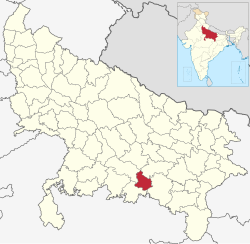
Kaushambi district is a district in the state of Uttar Pradesh in India. Manjhanpur is the district headquarters. The district was carved from Prayagraj district on 4 April 1997. Manauri Bajar connects Prayagraj and Kaushambi districts by railway over a bridge on SH-95. Manjhanpur is south-west of Prayagraj on the north bank of the Yamuna river, about 55 kilometres (34 mi) from the city. It is surrounded by Chitrakoot district on the south, Pratapgarh district on the north, Prayagraj district on the east and Fatehpur district on the west. Kaushambi is part of Prayagraj division. The nearest railway station, in Bharwari, connects with Delhi, Prayagraj, Kolkata, Gaya and Kanpur.

Contents

Mythology and history

Kaushambi was the capital of the ancient Indian Vatsa Mahajanapada, [1] [2] [3] one of 16 such kingdoms. According to the Puranas, Vatsa was named after a Kāśī king. [4] The Ramayana and the Mahabharata attribute the founding of its capital' Kauśāmbī, to a Chedi prince (Kuśa or Kuśāmba). The Puranas state that after Hastinapur was washed away by the Ganges, the Bharata king Nicakṣu (great-great grandson of Janamejaya), abandoned the city and settled in Kauśāmbī. This is supported by the Svapnavāsavadattā and the Pratijñā-Yaugandharāyaṇa, attributed to Bhāsa. Both described the king, Udayana, as a scion of the Bhārata family (Bhārata-kula). The Puranas contain a list of Nicakṣu’s successors which ends with the king Kṣemaka. [5] Gautama Buddha visited Kaushambi several times during the reign of Udayana in his effort to spread the dharma, the Noble Eightfold Path and the Four Noble Truths, and Udayana was a Buddhist upāsaka. According to the Chinese translation of the Buddhist canonical text Ekottara Āgama , the first image of the Buddha (carved from sandalwood) was made at Udayana's request. The Puranas state that his four successors were Vahināra, DanḍapāṇI, Niramitra and Kṣemaka. Vatsa was later annexed by Avanti, and Maniprabha (Pradyota's great-grandson) ruled at Kauśāmbī as a prince of Avanti. Ashoka considered Kaushambi important, and placed a pillar there with inscriptions in Pali; a Jain temple was also constructed. The pillar and temple still stand, and Vatsa is being excavated by archaeologists.

Kaushambi district was carved from Allahabad district on 4 April 1997. In 2006, the Ministry of Panchayati Raj named Kaushambi one of India's 250 most backward districts (out of a total of 640). [6] It is one of the 34 districts in Uttar Pradesh receiving funds from the Backward Regions Grant Fund (BRGF). [6]

Demographics

Historical population
YearPop.±% p.a.
1901346,185    
1911340,788−0.16%
1921326,230−0.44%
1931346,458+0.60%
1941420,798+1.96%
1951475,525+1.23%
1961555,870+1.57%
1971644,994+1.50%
1981813,788+2.35%
19911,021,653+2.30%
20011,291,993+2.38%
20111,599,596+2.16%
source:Government of India [7]
Religions in Kaushambi district (2011) [8]
ReligionPercent
Hinduism
85.80%
Islam
13.78%
Other or not stated
0.42%
Distribution of religions

According to the 2011 census, Kaushambi district had a population of 1,599,596, [9] (comparable to the population of Guinea-Bissau [10] and the US state of Idaho); [11] this ranks it 313th of India's 640 districts. [9] The district has a population density of 897 inhabitants per square kilometre (2,320/sq mi). [9] Its population growth rate from 2001 to 2011 was 23.49 percent. [9] Kaushambi has a sex ratio of 905 females to 1,000 males, [9] and a literacy rate of 63.69 percent. 7.78% of the population live in urban areas. Scheduled Castes make up 34.72% of the population. [9]

Languages of Kaushambi district (2011) [12]

   Hindi (98.57%)
   Urdu (1.10%)
  Others (0.33%)

At the time of the 2011 Census of India, 98.57% of the population in the district spoke Hindi and 1.10% Urdu as their first language. [12]

Kaushambi district: mother-tongue of population, according to the 2011 Census. [12]
Mother tongue codeMother tonguePeoplePercentage
006030 Awadhi 1,1990.07%
006102 Bhojpuri 2,6450.17%
006240 Hindi 1,576,77698.57%
015043 Odia 3280.02%
022015 Urdu 217,6701.10%
022016Bhansari4400.03%
N.A. Others 5380.03%
Total1,599,596100.00%

Transportation

Closest Airport to Kaushambi is in Prayagraj Airport which is 56 kilometers (34.7 miles) away from district headquarters and has flights to major destinations such as Delhi, Bengaluru, Mumbai, Kolkata etc.

Manjhanpur Roadways bus depot connects the headquarter by road to all major cities and towns.

Major railway station is in neighboring Prayagraj (56 km). Kaushambi district also has several railway stations:

Sports

Mohamed Aslam was a heavyweight boxer from Bharwari who was a silver medalist at the Asian Amateur Boxing Championships in 1973 and 1975. [13] [14] Aslam won the Indian national championship in the heavyweight category for five consecutive years (1973–1978).

Related Research Articles

<span class="mw-page-title-main">Prayagraj district</span> District of Uttar Pradesh in India

Prayagraj district, also known as Allahabad district, is the most populous district in the Indian state of Uttar Pradesh. Prayagraj city is the district headquarters of this district. The District is divided into blocks within tehsils. As of 2011, there are 20 blocks in eight tehsils. The Prayagraj division includes the districts of Pratapgarh, Fatehpur, Kaushambi and Prayagraj, with some western parts that had previously part of Allahabad District becoming part of the new Kaushambi District. The administrative divisions are Phulpur, Koraon, Meja, Sadar, Soraon, Handia, Bara, Shringverpur and Karchana.

<span class="mw-page-title-main">Chandauli district</span> District in Uttar Pradesh, India

Chandauli district is a district of Uttar Pradesh state of India, and Chandauli town is the district headquarters. Chandauli district is a part of Varanasi Division. Chandauli became a separate district on 20 May 1997.

<span class="mw-page-title-main">Pratapgarh district, Uttar Pradesh</span> District of Uttar Pradesh in India

The Pratapgarh district is one of the districts of Uttar Pradesh state of India, and Pratapgarh city is the district headquarters. Pratapgarh district is a part of Prayagraj division. The total area of Pratapgarh district is 3730 Sq. km.

<span class="mw-page-title-main">Mahoba district</span> District of Uttar Pradesh in India

Mahoba district is one of the districts of Uttar Pradesh state of India and Mahoba city is the district headquarters. Mahoba district is a part of Chitrakoot Division. The district occupies an area of 2884 km². It has a population of 875,958. As of 2011 it is the least populous district of Uttar Pradesh. Mahoba District is also known as Alha-Udal Nagari.

<span class="mw-page-title-main">Shravasti district</span> District of Uttar Pradesh in India

Shravasti district is one of the districts of the Uttar Pradesh state of India, with Bhinga town as its district headquarters. Shravasti district is a part of Devipatan Division. According to Government of India, it is among the 121 minority concentrated districts in India. It is the fourth most backward district in India, according to the 2018 Niti Aayog ranking. This district is the most poverty stricken district in the country.

<span class="mw-page-title-main">Maharajganj district</span> District of Uttar Pradesh in India

Maharajganj district is one of the 75 districts of Uttar Pradesh state in northern India, and the town of Maharajganj is the district headquarters. District is a part Gorakhpur division. It is located in Terai region of Himalayas, bordering Nepal in North. Gandak, Rapti, Rohin are some major river flowing through the district.

<span class="mw-page-title-main">Vatsa</span> Historical region in modern India

Vatsa or Vamsa was one of the sixteen Mahajanapadas of Uttarapatha of ancient India mentioned in the Aṅguttara Nikāya.

<span class="mw-page-title-main">Lalitpur district, India</span> District in Uttar Pradesh, India

Lalitpur District is one of the districts of Uttar Pradesh state of India. Lalitpur district is a part of Jhansi Division. Lalitpur is the main town and administrative headquarters. The district occupies an area of 5,039 km².

<span class="mw-page-title-main">Kushinagar district</span> District of Uttar Pradesh in India

Kushinagar is a district of the state of Uttar Pradesh in India situated in the easternmost part of the state. It has the administrative headquarters at Ravindra Nagar Dhoos. The district is named such after the town Kushinagar, a Buddhist pilgrimage site where Gautama Buddha attained parinirvana in the 5th century BCE. Since the independence of India, Kushinagar district was a part of Deoria District and came into existence on 13 May 1994 as a separate district division. It was earlier known as Padrauna and thereafter was renamed Kushinagar on 19 June 1997.

<span class="mw-page-title-main">Bharwari</span> City in Uttar Pradesh, India

Bharwari is a small city and Municipal Board in the Kaushambi district located in the state of Uttar Pradesh, India that includes 29 villages in its surrounding area.

Manjhanpur is a town, nagar palika and the district headquarters of Kaushambi district in the Indian state of Uttar Pradesh. It is very old Town. The nearest railway station is Bharwari which is 11 km (6.8 mi) from Manjhanpur.Bharwari and Sirathu are two main railway stations in Kaushambi district & it is well connected to major cities like Delhi, Kolkata, Prayagraj, Varanasi, Kanpur, Lucknow etc. There are so many autos, taxis& buses are available to reach Bharwari railway station. The Nearest Airport is Bamrauli which is 45 km (28 mi) away from Manjhanpur. Manjhanpur also has several Quality Hospital. District Hospital and several hospital are equipped with state of art technology. A newly inaugurated bus stop has started the services of transportation, it is well connected with Prayagraj, Rajapur, chitrakoot, Kanpur etc.

Sirathu is a town and Nagar Panchayat in Kaushambi district in the Indian state of Uttar Pradesh. It is one of oldest town in Kaushambi district. The town has a population of approximately 2700.

<span class="mw-page-title-main">Chitrakoot district</span> District of Uttar Pradesh in India

Chitrakoot district is one of the districts of Uttar Pradesh state of India in the Bundelkhand region and Chitrakoot city is the district headquarters. Chitrakoot district is a part of Chitrakoot Division. The district occupies an area of 3,216 km².The district has a population of 991,730. As of 2011 it is the second least populated district of Uttar Pradesh, after Mahoba.

Chail is a town and a nagar panchayat in Kaushambi district in the state of Uttar Pradesh, India. Nearest Market - Manauri bajar

Jhandapur is a village in Sirathu Tehsil of Kaushambi District in Uttar Pradesh, India. Jhandapur is situated between the main railway line of the Delhi-Howrah route and the Grand Trunk Road. Shujatpur Railway Station is the nearest railway station. It is 1 km from Shujatpur Railway Station, 10 km from Manjhanpur, the district headquarters of Kaushambi District,Nearest city is Prayagraj(Allahabad) around 50km and around 600 km from New Delhi. Jhandapur has a population of around 10000. Main income source of people is farming,business and jobs in Gulf countries.

Khajuri Kalan is a village in Koraon Tehsil in Prayagraj district, Uttar Pradesh, India. It is about 1.5 km by road south of the village of Pathertal, and about 1.5 km by road north of the village of Khajuri Khurd. Administratively, it is under the gram panchayat of Khajuri Khurd.

Khajuri Khurd is a panchayat village in Koraon Tehsil in Prayagraj district, Uttar Pradesh, India. Khajuri means Date Palm and Khurd means small. Khurd and Kalan Persian language word which means small and Big respectively when two villages have same name then it is distinguished as Kalan means Big and Khurd means Small with Village Name.It is approximately 1.5 km south of the village of Khajuri Kalan, and about 2 km northeast of the village of Kukurhata. Administratively, it is a gram panchayat under Koraon Tehsil. There are six villages in the Khajuri Khurd gram panchayat: Khajuri Khurd, Chak Dadar, Khajuri Kalan, Koilariha, Pachauha, and Patka Bodaha.

<span class="mw-page-title-main">Udayana (king)</span> Legendary 6th-century BC Indian King

Udayana was a king of Vatsa in India, a contemporary of Gautama Buddha. He is a popular figure in Indian literature, for both his romantic and military stories, but though he probably existed, little is known for certain about his life or reign.

Manauri is a town of Prayagraj, Uttar Pradesh state of India. It is a market, 18 km west of Prayagraj city headquarter. It lies on the border of Prayagraj and Kaushambi district of Uttar Pradesh. On this town, a Railway Station lying nearby on the New Delhi - Howrah main line and an Air Force Station nearby on NH-2 is also named. Due to proximity of the Town with main Railway line and National highway, it has developed into a local trade market. The town has a huge population of more than 15 thousand, both of Hindus and Muslims. The main occupation is grains, vegetable and fruits agriculture along with traditional works like metal works, blacksmith, carpenter, glass works, and construction labours.

Manauri railway station is situated in Manauri bajar, Prayagraj district, Uttar Pradesh, India. Its station code is MRE. It is one of the major railway stations for Kaushambi district and west area of Prayagraj district

References

  1. Geographical Review of India. Original from the University of Michigan: Geographical Society of India. 1951. p. 27.
  2. Hermann Kulke, Dietmar Rothermund (2004). A History of India. Routledge. p. 52. ISBN   0-415-32920-5.
  3. Dr.K.K.Sharma (1 January 2009). Civil Services Pre.Exam.Indian History ( From Earliest Times To 1964 A.D.). Upkar Prakashan. ISBN   9788174828880.
  4. Pargiter, F.E. (1972) Ancient Indian Historical Tradition, Motilal Banarasidass, Delhi, pp.269-70
  5. Raychaudhuri, Hemchandra (1972) Political History of Ancient India, University of Calcutta, Calcutta, p.117-8
  6. 1 2 Ministry of Panchayati Raj (8 September 2009). "A Note on the Backward Regions Grant Fund Programme" (PDF). National Institute of Rural Development. Archived from the original (PDF) on 5 April 2012. Retrieved 27 September 2011.
  7. "Decadal Variation In Population Since 1901". Office of the Registrar General & Census Commissioner. Archived from the original on 8 August 2019. Retrieved 15 September 2019.
  8. "Table C-01 Population by Religion: Uttar Pradesh". censusindia.gov.in. Registrar General and Census Commissioner of India. 2011.
  9. 1 2 3 4 5 6 "District Census Handbook: Kaushambi" (PDF). censusindia.gov.in. Registrar General and Census Commissioner of India. 2011.
  10. US Directorate of Intelligence. "Country Comparison:Population". Archived from the original on 13 June 2007. Retrieved 1 October 2011. Guinea-Bissau 1,596,677 July 2011 est.
  11. "2010 Resident Population Data". U. S. Census Bureau. Archived from the original on 1 January 2011. Retrieved 30 September 2011. Idaho 1,567,582
  12. 1 2 3 C-16 Population By Mother Tongue – Uttar Pradesh (Report). Office of the Registrar General & Census Commissioner, India. Retrieved 15 July 2020.
  13. "Asian Championships - Bangkok, Thailand - May 3-9 1973". Archived from the original on 28 December 2018. Retrieved 16 September 2019.
  14. "Asian Championships - Yokohama, Japan - September 23-28 1975". Archived from the original on 22 May 2017. Retrieved 16 September 2019.

25°31′51″N81°22′38″E / 25.530744°N 81.377292°E / 25.530744; 81.377292