This article needs additional citations for verification .(March 2019) |
Prayagraj division Allahabad division | |
|---|---|
 | |
| Coordinates(Prayagraj (city)): 25°27′00″N81°51′00″E / 25.4500°N 81.8500°E | |
| Country | |
| State | Uttar Pradesh |
| Government | |
| • Divisional Commissioner | Sanjay Goyal, IAS [1] |
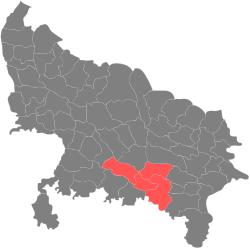
Prayagraj division, formerly and colloquially known as Allahabad division, is one of the 18 administrative geographical units (i.e. division) of the northern Indian state of Uttar Pradesh, with the city of Prayagraj being the administrative divisional headquarters. [2]
Contents
In 2000, when Uttar Pradesh was reorganised by forming Uttaranchal out of its northern areas, Allahabad division and the district was majorly reorganised too. The Etawah, Farrukhabad, Kanpur Nagar and Kanpur Dehat districts of the Allahabad division were made into a separate Kanpur division. Parts of the western areas of Allahabad district were carved out to create a new district named Kaushambi. At the same time, Pratapgarh district, that falls in the Awadh region, was included in the Allahabad division.
Since 2000, Prayagraj division consists of the following districts:-
Prior to 2000, Allahabad division consisted of all the districts of the lower Doab:-