
Dhanpat Rai Srivastava, better known as Munshi Premchand based on his pen name Premchand, was an Indian writer famous for his modern Hindustani literature.

Jhinjhak is a town and a Municipal council in Kanpur Dehat district, India. The town is situated on the Lower Ganges Canal and is approximately 20 kilometres (12 mi) from the industrial city of Dibiyapur.

Koilwar or Koelwar is a nagar panchayat (town) and one of the 14 community development block in Bhojpur district in the Indian state of Bihar. As of 2011, the population of Koilwar town was 17,725, in 2,893 households. Koilwar lies on the Arrah-Patna highway (NH-922).

Rajapur is a town and tehsil of Chitrakoot district in the Indian state of Uttar Pradesh. It is situated along the bank of the river Yamuna. It has the nickname "Tulsi Dhaam" after the Hindi poet Goswami Tulsidas, who is the writer of holy "Ram Charit Manas" along with many other religious books of Hindus. There is a temple devoted to Tulsidas where part of the original "Handwritten Scripture" of Ramcharitmanas is still available, although some pages may be missing. Rajapur is linked with Kaushambi district on the opposite bank of the river Yamuna.
Bahoriband is a tehsil and gram panchayat in Katni district in the Indian state of Madhya Pradesh. The headquarters is located in Bahoriband. It belongs to Jabalpur Division. It is located 44 km west of Katni and 320 km west of the state capital Bhopal. Bahoriband Tehsil is bounded by Sihora and Majhouli Tehsils to the south, Rithi Tehsil to the north and Murwara Tehsil to the east. Nearby cities include Jabalpur, Umaria and Katni.
Kudra, formerly known as Jahanabad, is a town and corresponding community development block in Kaimur district in the state of Bihar, India. It is the third largest town in Kaimur district. It is situated about 18 km from District Headquarter Bhabua. As of 2011, the population of Kudra was 30986. The railway station in Kudra is connected to all major railway routes.

Pallikkal is a T-shaped town, village and gram panchayat in Kondotty Taluk, Malappuram district in the state of Kerala, India.

Purathur is a sandy coastal village and a Grama Panchayat in Tirur Taluk, Malappuram district in the state of Kerala, India. Bharathappuzha river and Tirur River merges together in Purathur and join with the Arabian Sea at Padinjarekara Azhimukham, which is also the southernmost tip of Purathur Gram panchayat. Opposite to Padinjarekara Azhimukham is Ponnani port. The village is located at the southernmost tip of Tirur Taluk and is bordered by historically important Ponnani port in Ponnani Municipality of Ponnani taluk to south.
Bharkhar is a village near Mohania in the state of Bihar, India.

Bhidauni is a village and Gram panchayat of two villages, Kewat Nagla and Bhidauni officially known as Bhidauni Bangar located between the Yamuna river and Yamuna Expressway in the Mat Tehsil of Mathura district, Uttar Pradesh, India. It is situated approximately 45 kilometers away from Mathura City, on the Raya Road connecting via Mant to Naujheel Road.

Aahi is a village in Mirzapur district of Uttar Pradesh state. It is the headquarter of Aahi gram panchayat. It comes under Majhawa assembly constituency and Mirzapur Lok Sabha constituency area. Jamua Bazar is the postal office of this village and Kachhwa is the police station. According to Census 2011, its population is 4936. The literacy of the village is 65%. It is situated at border of Mirzapur and Varanasi District.Even though it is in Mirzapur district but it is painted in the manner locality Banarasi culture. Nearby village is Jamua Bazar (1 km), Narayanpur(2 km), Jakhini(5 km), PM Modi adopted village Jayapur (3 km) under Sansad Adarsh Gram Yojana.
Gangadharpur is a census town in the Chanditala I CD block located in the Srirampore subdivision of the Hooghly district in the state of West Bengal, India.
Atru is a town in the Baran district in Rajasthan, India. It is located in the southeast of northern Indian state of Rajasthan. It is a tehsil of Baran. It is located around 30 kilometres south of the Baran district. Atru tehsil is the biggest tehsil of the Baran district and has 141 villages under its administration. There are many facilities like a railway station, a hospital, schools, markets, well equipped roads for traffic. The most famous festival is Dhanush lila on the occasion there is a fair is organized for 3 days.
Adampur is a village in Varanasi tehsil of Varanasi district in the Indian state of Uttar Pradesh. The village falls under the Adampur gram panchayat. Adampur Village is about 1 kilometre (0.62 mi) southeast of Varanasi railway station, 267 kilometres (166 mi) southeast of Lucknow and 214 kilometres (133 mi) west of Patna.

Saifai is a large village and university town in the Etawah district of the Indian state of Uttar Pradesh. It is also a sub-division (Tehsil) and Block of the Etawah district. It is the birthplace of Mulayam Singh Yadav, the founding president of the Samajwadi Party, former Minister of Defence in India, and former Chief Minister of Uttar Pradesh.
Khanda is a big and historical village in Kharkhoda tehsil of Sonipat district in Haryana, India. It is located 2 miles (3.2 km) from Kharkhoda and 7 miles (11 km) from Sonipat. It is a part of the Delhi NCR. Khanda has two Gram Panchayats Khanda Khas and Khanda Alman. Two Sarpanchs elects from the village in every five years. Khanda is the head of 12 villages of Dahiya Khap mainly known as.

Bisauri is a village of the Jaunpur district, Uttar Pradesh, Northern India. Bisauri's Postal Index Number is 222129 and its post office is at Patrahi. The village is also a Gram Panchayat, comprising itself and the village of Tiwaripur.
Niwari district is one of the 52 districts of the Madhya Pradesh state in India. Niwari is administrative headquarter of Niwari district.
Prempura is a tribal village in Lalsot Tehsil of Dausa district in the Indian state of Rajasthan.
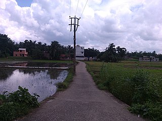
Jalpura Tapa is a village and gram panchayat in Koilwar block, Bhojpur district in the Indian state of Bihar. Situated close to the Sone River, it is a large village with more than 12,000 residents. Population-wise it is the largest village and area-wise, it is the 2nd-largest village of Koilwar block.


