Agra district

Last updated

Agra district
20191204 Taj Mahal Agra 0622 6533 DxO.jpg
Agra Itimad-ud-Daula 1.jpg
Diwan-I-Khas Fatehpur Sikri India - panoramio (9).jpg
Bateshwar Jain temple 09.jpg
NH 11-Kiraoli-Water buffalos-20131018.jpg
Clockwise from top-left: Taj Mahal, Tomb of Itimad-ud-Daula, Yamuna River besides Bateshwar Jain Temple, Water buffalos in Kiraoli, Diwan-i-Khas in Fatehpur Sikri
India Uttar Pradesh districts 2012 Agra.svg
Location of Agra district in Uttar Pradesh
CountryFlag of India.svg  India
State Uttar Pradesh
Division Agra
Headquarters Agra
Tehsils 6
Government
   Lok Sabha constituencies
  1. Agra (shared with Jalesar-Awagarh, Etah district),
  2. Fatehpur Sikri
  Vidhan Sabha constituencies9
Area
  Total4,027 km2 (1,555 sq mi)
Population
 (2011) [1]
  Total4,418,797
  Density1,100/km2 (2,800/sq mi)
Demographics
   Literacy 69.44% [1]
   Sex ratio 875
Language
  Official Hindi [2]
  Native Braj [2]
Time zone UTC+05:30 (IST)
Vehicle registration UP-80
Major highways NH 2
Website Official Website

Agra is one of the 75 districts in the northern Indian state of Uttar Pradesh. The district headquarters is the historical city of Agra. Agra district is a part of Agra division.

Contents

Geography

Kos Minar #793 at 12 mile on Agra-Fatehpur Sikri Road section of National Highway 21. Kos Minar 793.jpg
Kos Minar #793 at 12 mile on Agra-Fatehpur Sikri Road section of National Highway 21.

The district lies in the cultural region of Braj. Agra district is bounded by Mathura district on the north, Dholpur district of Rajasthan state on the south, Firozabad district on the east and Bharatpur district of Rajasthan State on the west. The area of the district is 4,027 km².

Administration

Agra division which consists of four districts, and is headed by the divisional commissioner of Agra, who is an IAS officer, the commissioner is the head of local government institutions (including municipal corporations) in the division, is in charge of infrastructure development in his division, and is also responsible for maintaining law and order in the division. [3] [4] [5] [6] The district magistrate of Agra reports to the divisional commissioner.

Agra district administration is headed by the district magistrate and collector (DM) of Agra, who is an IAS officer. The DM is in charge of property records and revenue collection for the central government and oversees the elections held in the city. The DM is also responsible for maintaining law and order in the city. [3] [7] [8] [9] The DM is assisted by a chief development officer; six additional district magistrates for finance/revenue, city, administration, land acquisition, civil supply, and protocol; one city magistrate; and three additional city magistrates. [10]

Divisions

Agra district comprises 6 tehsils. The tehsils are Etmadpur, Agra, Kiraoli, Kheragarh, Fatehabad and Bah. The headquarters of the district is Agra city. The district consists of 15 blocks, namely Etmadpur, Khandauli, Shamsabad, Fatehabad, Jagner, Kheragarh, Saiyan, Achhnera, Akola, Bichpuri, Fatehpur Sikri, Barauli Ahir, Bah, Pinahat and Jaitpur Kalan. [11]

The division comprises 2 constituencies namely Agra and Fatehpur Sikri. There are 9 Vidhan Sabha constituencies in the district. They are Bah, Fatehabad, Etmadpur, Dayal Bagh, Agra Cantonment, Agra North, Agra South, Kheragarh and Fatehpur Sikri, Awagarh and Jalesar in Etah District.

Demographics

Historical population
YearPop.±% p.a.
1901867,149    
1911835,418−0.37%
1921755,552−1.00%
1931857,072+1.27%
19411,054,327+2.09%
19511,228,534+1.54%
19611,506,110+2.06%
19711,852,458+2.09%
19812,258,070+2.00%
19912,752,150+2.00%
20013,621,702+2.78%
20114,418,797+2.01%
source: [12]
Religions in Agra district (2011) [13]
ReligionPercent
Hinduism
88.77%
Islam
9.31%
Jainism
0.49%
Other or not stated
1.43%
Distribution of religions

According to the 2011 census Agra district has a population of 4,418,797, [1] roughly equal to the nation of Moldova [14] or the US state of Kentucky. [15] This gives it a ranking of 41st in India (out of a total of 640). [1] The district has a population density of 1,084 inhabitants per square kilometre (2,810/sq mi) [1] Hindus are 88.77% and Muslims are 9.30% in Agra district. [16] Its population growth rate over the decade 2001-2011 was 21%. [1] Agra has a sex ratio of 859 females for every 1000 males, [1] and a literacy rate of 69.44%. 45.81% of the population lives in urban areas. Scheduled Castes made up 22.43% of the population. [1]

Hindus are the majority population in the district, and predominate in rural areas. A large number of people did not state their religion during the census, and there are significant populations of Jains, Sikhs and Christians in Agra city. [13]

Languages of Agra district (2011) [17]

   Hindi (97.38%)
   Braj Bhasha (1.27%)
  Others (1.35%)

At the time of the 2011 Census of India, 97.38% of the population spoke Hindi and 1.27% Braj Bhasha as their first language. [17]

The language of Agra is Braj Bhasha, which is a Western Hindi language, predominant in the nebulous Braj region centred on Mathura and Agra in Uttar Pradesh and Dholpur & Bharatpur in Rajasthan. It is the predominant language in the central stretch of the Ganges-Yamuna Doab.

Related Research Articles

<span class="mw-page-title-main">Fatehpur Sikri</span> Town in Uttar Pradesh, India

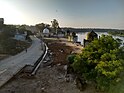
Fatehpur Sikri is a town in the Agra District of Uttar Pradesh, India. Situated 35.7 kilometres (22.2 mi) from the district headquarters of Agra, Fatehpur Sikri itself was founded as the capital of the Mughal Empire in 1571 by Emperor Akbar, serving this role from 1571 to 1585, when Akbar abandoned it due to a campaign in Punjab and was later completely abandoned in 1610.

<span class="mw-page-title-main">Agra</span> Metropolis in Uttar Pradesh, India

Agra is a city on the banks of the Yamuna river in the Indian state of Uttar Pradesh, about 230 kilometres (140 mi) south-east of the national capital Delhi and 330 km west of the state capital Lucknow. With a population of roughly 1.6 million, Agra is the fourth-most populous city in Uttar Pradesh and twenty-third most populous city in India.

<span class="mw-page-title-main">Kanpur</span> City in Uttar Pradesh, India

Kanpur, formerly anglicized as Cawnpore, is a large industrial city located in the central-western part of the state of Uttar Pradesh, India. Founded in 1207, Kanpur became one of the most important commercial and military stations of British India. Kanpur is also the financial capital of Uttar Pradesh and part of upcoming Bundelkhand Industrial Development Authority i.e. BIDA Nestled on the banks of Ganges River, Kanpur has been the major financial and industrial centre of North India and also the ninth-largest urban economy in India. Today it is famous for its colonial architecture, gardens, IT parks and fine quality leather, plastic and textile products which are exported mainly to the West.

<span class="mw-page-title-main">Noida</span> Metropolis in Uttar Pradesh, India

Noida, short for New Okhla Industrial Development Authority, is a city located in Gautam Buddha Nagar district of the Indian state of Uttar Pradesh. Noida is a satellite city of Delhi and is a part of the National Capital Region. As per provisional reports of Census of India, the population of Noida in 2011 was 642,381. The city is managed by New Okhla Industrial Development Authority (NOIDA). The district's administrative headquarters are in the nearby city of Greater Noida.

<span class="mw-page-title-main">District magistrate</span> Executive head of an Indian district

The district magistrate, also known as the district collector or deputy commissioner, is a career civil servant who serves as the executive head of a district's administration in India. The specific name depends on the state or union territory. Each of these posts has distinct responsibilities, and an officer can assume all of these roles at once. The district magistrate is primarily responsible for maintaining law and order, while the district collector focuses on revenue administration, and the deputy commissioner is in charge of overseeing developmental activities and coordinates government departments. Additionally, they also serve as election officers, registrar, marriage officer, licensing authority, and managing disaster responses, among other things. While the specific scope of duties may vary from state to state, they are generally similar. The district magistrate comes under the general supervision of divisional commissioner.

<span class="mw-page-title-main">Braj Bhasha</span> Western Hindi language of India

The Braj language, Braj Bhasha, also known as Vraj Bhasha or Brij Bhasha or Braj Boli, is a Western Hindi language. Along with Awadhi, it was one of the two predominant literary languages of North-Central India before the switch to Hindustani in the 19th century.

<span class="mw-page-title-main">Aligarh district</span> District in Uttar Pradesh, India

Aligarh is one of the 75 districts in the northern Indian state of Uttar Pradesh. This district is a part of Aligarh Division. The districts which adjoin Aligarh are Gautam Buddha Nagar, Bulandshahr, Sambhal, Badaun, Kasganj, Hathras and Mathura.

<span class="mw-page-title-main">Etah district</span> District of Uttar Pradesh in India

Etah district is one of the districts of Uttar Pradesh, India, since 1854. Etah City is the district headquarters. Etah district is a part of Aligarh Division.

<span class="mw-page-title-main">Bijnor</span> City in Uttar Pradesh, India

Bijnor is a city and a municipal board in Bijnor district in the state of Uttar Pradesh, India

<span class="mw-page-title-main">Firozabad district</span> District of Uttar Pradesh in India

Firozabad district forms one of the western districts of the Indian state of Uttar Pradesh, which has Firozabad city as its district headquarters. The district is a part of the Agra division.

<span class="mw-page-title-main">Mahoba district</span> District of Uttar Pradesh in India

Mahoba district is one of the districts of Uttar Pradesh state of India and Mahoba city is the district headquarters. Mahoba district is a part of Chitrakoot Division. The district occupies an area of 2884 km². It has a population of 875,958. As of 2011 it is the least populous district of Uttar Pradesh. Mahoba District is also known as Alha-Udal Nagari.

<span class="mw-page-title-main">Bharatpur district</span> District of Rajasthan in India

Bharatpur District is a district in Rajasthan state in western India. The city of Bharatpur is the District Headquarters, Division Headquarters and Headquarters of Bharatpur Police Range of Rajasthan Police. Bharatpur District is a part of National Capital Region of India Delhi.

<span class="mw-page-title-main">Greater Noida</span> City in Uttar Pradesh, India

Greater Noida is a planned city located in the Gautam Buddha Nagar district of the Indian state of Uttar Pradesh. The city was created as an extension of the area under the UP Industrial Area Development Act, of 1976. Situated 30 km (19 mi) southeast of the capital city of New Delhi, it takes around 30 minutes to travel between the cities via the Noida-Greater Noida Expressway. The city is administered by the Greater Noida Industrial Development Authority (GNIDA). It is the part of Meerut Division in Uttar Pradesh.

Etmadpur is a town (tehsil) in Agra district in the state of Uttar Pradesh, India. It is located eastward 19 km from Agra. It is 274 km far from state capital Lucknow.

Rajakhera is a city and a municipality situated near the banks of the Chambal River in Dholpur district in the Eastern part of the Indian state of Rajasthan. Its part of Braj region and the local language has Braj Bhasha dialect. The culture is fused with Rajasthan and its border states.

The Government of Uttar Pradesh is the subnational government of the Indian state of Uttar Pradesh with the governor as its appointed constitutional head of the state by the President of India. The Governor of Uttar Pradesh is appointed for a period of five years and appoints the Chief Minister of Uttar Pradesh and their council of ministers, who are vested with the executive powers of the state. The governor remains a ceremonial head of the state, while the chief minister and their council are responsible for day-to-day government functions.

Fatehpur Sikri Lok Sabha constituency is one of the 80 Lok Sabha (parliamentary) constituencies in the Indian state of Uttar Pradesh. This constituency in Agra district came into existence in 2008 as a part of the implementation of delimitation of parliamentary constituencies based on the recommendations of the Delimitation Commission of India constituted in 2002.

Fatehpur, Fatepur, or Phattepur may refer to any of a number of places:

Fatehabad Assembly constituency is one of the 403 constituencies of the Uttar Pradesh Legislative Assembly, India. It is a part of the Agra district and one of the five assembly constituencies in the Fatehpur Sikri Lok Sabha constituency. First election in this assembly constituency was held in 1957 after the "DPACO (1956)" was passed in 1956. After the "Delimitation of Parliamentary and Assembly Constituencies Order" was passed in 2008, the constituency was assigned identification number 93.

Girraj Singh Dharmesh is an Indian politician from the Bharatiya Janata Party. Dharmesh is a Member of the Uttar Pradesh Legislative Assembly from Agra Cantonment Constituency in Agra district.

References

  1. 1 2 3 4 5 6 7 8 "District Census Handbook: Agra" (PDF). censusindia.gov.in. Registrar General and Census Commissioner of India. 2011.
  2. 1 2 "52nd REPORT OF THE COMMISSIONER FOR LINGUISTIC MINORITIES IN INDIA" (PDF). nclm.nic.in. Ministry of Minority Affairs. Archived from the original (PDF) on 25 May 2017. Retrieved 7 December 2018.
  3. 1 2 "CONSTITUTIONAL SETUP". Government of Uttar Pradesh . Archived from the original on 31 August 2017. Retrieved 30 August 2017.
  4. Maheshwari, S.R. (2000). Indian Administration (6th ed.). New Delhi: Orient Blackswan Private Ltd. pp. 563–572. ISBN   9788125019886.
  5. Singh, G.P. (1993). Revenue administration in India: A case study of Bihar. Delhi: Mittal Publications. pp. 26–129. ISBN   978-8170993810.
  6. Laxmikanth, M. (2014). Governance in India (2nd ed.). Noida: McGraw Hill Education. pp. 5.1–5.2. ISBN   978-9339204785.
  7. Maheshwari, S.R. (2000). Indian Administration (6th ed.). New Delhi: Orient Blackswan Private Ltd. pp. 573–597. ISBN   9788125019886.
  8. Laxmikanth, M. (2014). Governance in India (2nd ed.). Noida: McGraw Hill Education. pp. 6.1–6.6. ISBN   978-9339204785.
  9. Singh, G.P. (1993). Revenue administration in India: A case study of Bihar. Delhi: Mittal Publications. pp. 50–124. ISBN   978-8170993810.
  10. "Administration". Agra district website. Archived from the original on 28 August 2017. Retrieved 12 September 2018.
  11. "General Administration". Agra district Official website. Archived from the original on 29 October 2011. Retrieved 2 November 2010.
  12. Decadal Variation In Population Since 1901
  13. 1 2 "Table C-01 Population by Religion: Uttar Pradesh". censusindia.gov.in. Registrar General and Census Commissioner of India. 2011.
  14. US Directorate of Intelligence. "Country Comparison:Population". Archived from the original on 13 June 2007. Retrieved 1 October 2011. Moldova 4,314,377 July 2011 est.
  15. "2010 Resident Population Data". U. S. Census Bureau. Archived from the original on 25 December 2010. Retrieved 30 September 2011. Kentucky 4,339,367
  16. Qureshi, Siraj (26 August 2015). "Muslim growth outsmarts Hindus for the first time in Mughal city Agra". India Today. Retrieved 24 July 2019.
  17. 1 2 "Table C-16 Population by Mother Tongue: Uttar Pradesh". www.censusindia.gov.in. Registrar General and Census Commissioner of India.


27°05′N77°58′E / 27.083°N 77.967°E / 27.083; 77.967