Bharatpur district

Last updated

Bharatpur district
Purana mehal.jpg
Bayana Cliffs (50750620657).jpg
STATUE OF MAHARAJA SURAJMAL.jpg
Bharatpur museums.jpg
Keoladeo National Park-Plan d'eau (4).jpg
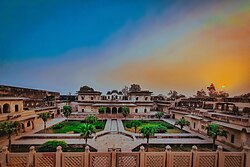
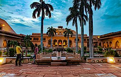
Clockwise from top-left: Deeg Palace, cliffs at Bayana, Government Museum, Bharatpur, Keoladeo National Park, Statue of Maharaja Surajmal at Lohagarh Fort
Bharatpur in Rajasthan (India).svg
Location of Bharatpur district in Rajasthan
CountryFlag of India.svg India
State Rajasthan
Division Bharatpur
Headquarters Bharatpur
Government
   Divisional Commissioner Sanwar Mal Verma, IAS [1]
   District Collector & Magistrate Dr. Amit Yadav, IAS [2]
Area
  Total
5,066 km2 (1,956 sq mi)
Population
 (2011) [3]
  Total
2,548,462
  Density500/km2 (1,300/sq mi)
Time zone UTC+05:30 (IST)
Website Bharatpur District

Bharatpur District is a district in Rajasthan state in western India. The city of Bharatpur is the District Headquarters, Division Headquarters and Headquarters of Bharatpur

Contents

History

Vedic era

Bharatpur is a place with association with vedic era importance. In common belief, the Pandavas had spent their 13th year of exile at this place around 3,500 years ago. [4] In June 2025, excavations at bajna village, 3 km east of Deeg city, by the Rajasthan State Government Department of Archaeology found the artifacts belonging to mahabharta-era (vedic era), Maurya Empire and Shunga Empire which included pottery and terracotta statues some of which could be as old as 2500 to 2700 years old. A human skeleton was also found, which has been sent to Israel for the further scientific studies to determine the age and culture of the specimen. This area is part of Mahabharta era 84-kos Vraja Parikrama associated with the Lord Krishna. [5]

Sultanate era

In early medieval times, the Bharatpur region was ruled under the Mewat State under the Khanzadas of Mewat from 1372 to 1527 AD who are mostly rajput converted to Islam.

Hindu Jat era

The area in later medieval times was ruled by the Sinsinwar clan of the Hindu Jats. In 1733 AD, Maharajah Suraj Mal built the city of Bharatpur as a well-fortified city which was carved out from the Mewat region and named it after the Bharat, Lord Rama's younger brother. [6] Jat conquered Agra and ruled it over decade.

As recorded by the historian Aziz Ahmad, [7] Jats led by Rajaram Jat attacked and plundered Akbar's the tomb in 1685 during the reign of Aurangzeb after defeating Mughal forces. [8] [9] Jats looted gold, silver, and gems from the tomb, damaged the mausoleum, and destroyed items they could not carry. [10] [11] According to Niccolao Manucci, the Jats also burned Akbar’s remains and bones, further plundered nearby villages that maintained the Taj Mahal, setting them ablaze, and attacked Mughal officials at Palwal while ransacking the Khurja pargana. [12]

Geography

Topography

Bharatpur, also known as ‘Eastern Gate of Rajasthan’, is located in the Braj region 180 km away from Delhi. Geographically, the district is situated between 26° 22' and 27° 83' N and 76° 53' and 78° 17' E and its average height above sea level is around 183 m. Bharatpur city is the district headquarters and is also known by the name of Lohagarh. It is situated very close to the main cities of Rajasthan and other states. Distance between Jaipur and Bharatpur is around 178 km whereas Agra lies at a distance of 55 km from the district. Mathura is located at a distance of 34 km. Bharatpur touches Deeg district of Rajasthan in the north, Mathura in the east, Agra of Uttar Pradesh and Dholpur of Rajasthan in the south and Dausa and Alwar in the west. [13]

Hydrology

There are only three main seasonal rivers in this District, namely Ban Ganga, Rooparel and Gambhir. Ban Ganga starts from Ramgarh Dam of Jaipur district, passes from Bharatpur and meets in river Gambhir near tehsil Bayana of District Bharatpur. Gambhir river starts from Panchna Dam of district Karauli and after passing from Bharatpur meets River Yamuna in Uttar Pradesh. Rooparel River starts from hills of district Alwar and enters into Bharatpur from tehsil Kaman. Instead of this, a Dam, namely, Bandh Baretha, is situated near the village Baretha on river Kakund, which starts from the hills of district Karauli. The water of this dam is used for drinking and irrigation purpose for this district. The capacity of this dam is 684.00 million cubic feet (29 Gaze feet). [14]

Demographics

Population

Historical population
YearPop.±% p.a.
1901597,736    
1911547,233−0.88%
1921483,536−1.23%
1931493,852+0.21%
1941574,192+1.52%
1951604,896+0.52%
1961785,805+2.65%
19711,029,930+2.74%
19811,298,278+2.34%
19911,650,724+2.43%
20012,100,020+2.44%
20112,548,462+1.95%
2020 est.2,861,513+1.30%
source: [15]

In the 2011 census, the Bharatpur District had a population of 2,548,462, [3] roughly equal to the nation of Kuwait [16] or the US state of Nevada. [17] This gave it a ranking of 166th among districts of India (out of a total of 640). [3] The district had a population density of 503 inhabitants per square kilometre (1,300/sq mi). [3] Its population growth rate over the decade 2001-2011 was 21.32%. [3] Bharatpur had a sex ratio of 877 females for every 1000 males, [3] and a literacy rate of 71.16%. [3]

Religions in residual Bharatpur district (2011) [18]
ReligionPercent
Hinduism
97.23%
Islam
1.97%
Other or not stated
0.80%

After the separation of Deeg district, the residual Bharatpur district has a population of 1,475,707. The district has a sex ratio of 869 females per 1000 males. 362,948 (24.59%) lived in urban areas. Scheduled Castes and Scheduled Tribes made up 394,106 (26.71%) and 43,421 (2.94%) of the population respectively. [3]

Languages

Languages of Bharatpur district (2011) [19]
  1. Hindi (71.5%)
  2. Braj Bhasha (27.6%)
  3. Others (0.91%)

Governemnt and politics

Administrative divisions

Bharatpur District has many revenue subdivisions and tehsils. They have the same names and borders, except that Weir Subdivision is divided into Weir and Bhusawar. The other ten tehsils are: Bayana, Bharatpur, Nadbai, Uchchain and Roopwas (Rupbas). [20]

Bharatpur District: Revenue Scheme [20]
SubdivisionLand Record
Circles (ILRCs)
Patwar CirclesVillages
Occupied
Villages
Abandoned
Villages
Total
Bayana65118116197
Bharatpur65718521206
Kumher5471287135
Nadbai5471214125
Roopwas54914816164
Weir5511548162
Uchchain
Bhusawar

Economy

Industrial areas

Bharatpur District has been divided in six industrial areas: [21]

  1. Old Industrial Area Bharatpur
  2. Brij Industrial Area Bharatpur
  3. Industrial Area Bayana
  4. I.I.D. Center Bayana

Oil industries

Bharatpur district is known not only for agriculture production but also known for oil industries. Mustard seeds and other agriculture products come to the market through mandies established by Krishi Upaj Mandi Samiti and transported all over the country. These Krishi Upaj Mandies are in Bharatpur, Nadbai, Weir, Bayana, Roopwas and Bhusawar.

There are total 554 oil mills registered in which 2317 persons are employed and Rs. 2690.84 lacs was invested. Out of these mills 78 are big units having AGMARK and rest are small oil expeller units. [21]

Other

In some areas of Bharatpur District like- Hindaun & Karauli etc. stone quarrying is also practised. Many of nearby State's Forts like The Red Fort of Delhi, Agra Fort, and Fatehpur Sikari were built using local stone. [22]

Notable people

Transport

Air

Agra Airport at Agra, 55 km east of Bharatpur is the nearest airport. [23]

Rail

Bharatpur Junction railway station, 5 Km north of Keoladeo National Park, has regular rail services connecting Bharatpur with all the major cities such as Delhi, Mumbai, Jaipur and Agra.

Road

By road, SH-33 connects it to Mathura (40 km northeast) and then via NH-44 to Delhi (184 Km from Bharatpur), Agra-Jaipur Road to Agra (55 km east) and Jaipur (190 km west), SH-43 to Chambal region in the south, SH-1 (via SH-43) to Hindaun city (80 km southwest). [23] [24]

See also

References

  1. "Administration : Bharatpur District". 24 June 2024.
  2. "Administration : Bharatpur District". 24 June 2024.
  3. 1 2 3 4 5 6 7 8 "District Census Handbook 2011 - Bharatpur" (PDF). Census of India . Registrar General and Census Commissioner of India.
  4. "Historical Events". bharatpur.rajasthan.gov.in.
  5. भरतपुर की धरती से निकला इतिहास का खजाना... महाभारत से मौर्य काल तक के अवशेष बरामद, aajtak, 28 June 2025.
  6. "History". bharatpur.rajasthan.gov.in.
  7. Ahmad, Aziz (1964). Studies in Islamic Culture in the Indian Environment. Oxford University Press. p. 95. OCLC   682954.
  8. Dwivedi, Girish Chandra (1989). The Jats: Their Role in the Mughal Empire. Arnold Publishers. p. 36. ISBN   978-81-7031-150-8.
  9. Richards, John F. (2001) [1993]. The Mughal Empire. The New Cambridge History of India: The Mughals and their Contemporaries. Vol. 5. Cambridge University Press. p. 251. ISBN   978-0-52-125119-8.
  10. Dwivedi, Girish Chandra (1989). The Jats: Their Role in the Mughal Empire. Arnold Publishers. p. 37. ISBN   978-81-7031-150-8.
  11. Asher, Catherine B. (2001) [1992]. Architecture of Mughal India. The New Cambridge History of India: The Mughals and their Contemporaries. Vol. 4 (1st ed.). Cambridge University Press. p. 108. ISBN   978-0-521-26728-1.
  12. Pande, Ram (1970). Bharatpur up to 1826: A Social and Political History of the Jats (1st ed.). Rama Publishing House. p. 7. OCLC   555482496.
  13. "Location and Area". bharatpur.rajasthan.gov.in.
  14. "DAMS AND RIVERS". bharatpur.rajasthan.gov.in.
  15. Decadal Variation In Population Since 1901
  16. US Directorate of Intelligence. "Country Comparison:Population". Archived from the original on 13 June 2007. Retrieved 1 October 2011. Kuwait 2,595,62
  17. "2010 Resident Population Data". U. S. Census Bureau. Archived from the original on 19 October 2013. Retrieved 30 September 2011. Nevada 2,700,551
  18. "Table C-01 Population By Religion - Rajasthan". census.gov.in. Registrar General and Census Commissioner of India.
  19. 1 2 "Table C-16 Population by Mother Tongue: Rajasthan". censusindia.gov.in. Registrar General and Census Commissioner of India.
  20. 1 2 "Administrative Setup". Bharatpur District. Archived from the original on 11 May 2013.
  21. 1 2 "Trade & Commerce". bharatpur.rajasthan.gov.in.
  22. "Economy". bharatpur.rajasthan.gov.in.
  23. 1 2 "How to Reach". bharatpur.rajasthan.gov.in.
  24. "Bharatpur Tourism: Places to Visit in Bharatpur | Tourist Places- Rajasthan Tourism". www.tourism.rajasthan.gov.in.

27°13′12″N77°30′00″E / 27.22000°N 77.50000°E / 27.22000; 77.50000