The Industrial city is located in the southernmost part of Rajasthan, near the Gujarat border. It is surrounded by the Aravalli Range, which separates it from the Thar Desert. It is around 482km from Jaipur, approximately 151km from Udaipur and 197km from Ahmedabad. Placed almost in the middle of major Indian metro cities. Besides, connectivity with Gujarat ports and cities, it has a strategic geographical advantage. The main industries are marble & granite, miniature cement plants, HDPE bags, synthetic yarns, mineral grinding, ABS resin, Steel and insulators.
History
The old name of Abu Road city was Kharadi. The Rajputana–Malwa Railway set up the railway station here on 30 December 1880, and the station was named Abu Road. The road to Mount Abu was built in 1845, during the rule of Maharao Shiv Singh of Sirohi.
Demographics
As of the 2011 India census,[1] Abu Road had a population of 55,595. Males constitute 52% of the population and females 48%. Abu Road has an average literacy rate of 80.81%, higher than the state average of 66.11%.89.63% of the males and 70.97% of females are literate. 11.89% of the population is under 6 years of age.[bettersourceneeded]
As of the 2011 India census,[2] Abu Road Tehsil had population of 2,24,404 of which 1,16,769 are males and 1,07,635 are females. It had 43,041 households. The population of children between age 0-6 is 40,421 which is 18.01% of total population.
Geography
Abu Road is an important Industrial and commercial city in the southwestern region of Rajasthan State on the bank of West Banas river.
City is surrounded by Aravali hill range and about 482 kms from state capital Jaipur and about 248 kms from Jodhpur City. It lies southeast of Mount Abu, which is approx. 27km up the hill and an important tourist destination. In addition, famous Ambaji temple in Gujarat State is approx. 19 kms from the city.
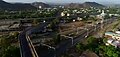
Riico Colony, an important residential area in Abu Road.
The city starts its geographical boundary from Talhati in North to Maval in south adjoining Gujarat-Rajasthan Border covering residential areas of Talhati, Akrabhatta, Manpur, Ganka, Tartoli, Railway Colony, Riico Housing Colony, Santpur and parts of Chandrawati.
Climate
Abu Road has a hot semi-arid climate (KöppenBSh), typical of northwestern India. In Summer, it's hot and humid with an average temperature of 40°C or 104°F and hot sandy winds. In winter, minimal can fall to 7 to 14°C (44.6 to 57.2°F), which is cool compared to other cities in Rajasthan and during the monsoon, the average rainfall is about 14 to 20 inches or 360 to 510 millimetres per season.
Climate data for Abu Road
Month
Jan
Feb
Mar
Apr
May
Jun
Jul
Aug
Sep
Oct
Nov
Dec
Year
Mean daily maximum °C (°F)
24.5 (76.1)
27.3 (81.1)
32 (90)
36.4 (97.5)
37.7 (99.9)
35.3 (95.5)
29.9 (85.8)
28.3 (82.9)
29.9 (85.8)
31.9 (89.4)
29 (84)
25.6 (78.1)
30.7 (87.2)
Mean daily minimum °C (°F)
10.2 (50.4)
12.9 (55.2)
17.8 (64.0)
22.2 (72.0)
24.3 (75.7)
25.4 (77.7)
24.1 (75.4)
23.1 (73.6)
22.4 (72.3)
20.6 (69.1)
16.3 (61.3)
11.7 (53.1)
19.3 (66.6)
Average rainfall mm (inches)
3 (0.1)
3 (0.1)
2 (0.1)
1 (0.0)
4 (0.2)
56 (2.2)
281 (11.1)
223 (8.8)
92 (3.6)
16 (0.6)
4 (0.2)
1 (0.0)
686 (27)
Source:
Economy
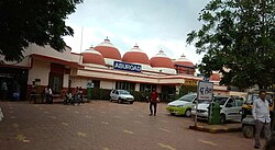
RIICO Industrial Area
Riico Industrial Area, Abu Road City
RIICO Industrial Area is spread over an expanse of 2,000 acres (8.1km2). Riico office at Abu Road is the administrative head quarter for Sirohi District covering Arbuda, Ambaji, Sheoganj, Sheoganj Ext., Sirohi Road, Sirohi, Sarneshwar, Swaroopganj, Mandar, Growth Center 1st and 2nd phase. The main industries are marble & granite, miniature cement plants, HDPE bags, synthetic yarns, mineral grinding, ABS resin, Steel, Electronics and Electrical, and insulators.
Industrial areas in Riico, Abu Road are:
Ambaji Industrial Area
Arbuda Industrial Area
Growth Center 1st Phase
Growth Center 2nd Phase
Diesel Shed
ABR WDM with Thar Express crossing India-Pakistan border.
The railway's diesel loco shed, Abu Road provides employment to a large number of people and holds an important place in town's economy. The Diesel Shed at Abu Road was commissioned by Indian Railways as a metre gauge shed on 26 October 1966. It was then the largest MG shed of Western Railway with holdings of 112 locomotives. With broad gauge conversion, the shed was converted to a BG shed with holdings of 60 locomotives. There are 68 supervisors and 570 workers in the shed.[citation needed]
A diesel training centre is located at the shed that conducts promotional, refresher and special courses for locomotive running staff as well as formal training of shed maintenance staff.
Modern Insulators Ltd.
Modern Insulators Ltd. manufacturing plant is situated in the town providing employment to many locals.[3]
Transport
The financial hub and the largest city in Sirohi district is well-connected by road and rail.
This page is based on this Wikipedia article Text is available under the CC BY-SA 4.0 license; additional terms may apply. Images, videos and audio are available under their respective licenses.