Sirohi district

Last updated

Sirohi district
Dilwara temple at mount abu.jpg
Achalgarh 2015.jpg
Top: Dilwara Temple at Mount Abu
Bottom: Lake near Achalgarh Fort
Sirohi in Rajasthan (India).svg
Location of Sirohi district in Rajasthan
CountryFlag of India.svg  India
State Rajasthan
Division Pali
Headquarters Sirohi
Area
  Total5,136 km2 (1,983 sq mi)
Population
 (2011)
  Total1,036,346
  Density200/km2 (520/sq mi)
Time zone UTC+05:30 (IST)

Sirohi District is a district of Rajasthan state in western India. The city of Sirohi is the district headquarters. [1]

Contents

As of 2011 it is the third least populous district of Rajasthan (out of 33), after Jaisalmer and Pratapgarh. [2]

History

In 1948, Sirohi was taken over by Bombay State from 15 January 1949 to 25 January 1950. [3] Shortly thereafter, on 25 January 1950, the former state was partitioned with Abu Road tehsil and part of Delwara tehsil being joined to Bombay and the remaining portion merging with Rajasthan. [4] At that time an area of 787 km2 consisting of Abu Road tehsil and a part of Delwara tehsil was merged with then Bombay state, [5] but it was returned to Sirohi district of Rajasthan State on 1 November 1956. [6]

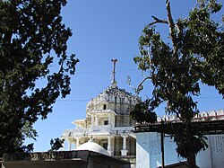
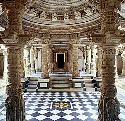
Sirohi is also called as "Dev Nagari" since ancient times because of many temples and shrines in the district. Sirohi is also famous for manufacturing of double edged swords, [7] [8] from the time of the Chauhan Deora rulers (15th century AD) until 1947. [9]

Geography

The district has an area of 5136 km². It is bordered on the west by Jalor District, on the north by Pali District, on the east by Udaipur District, and on the south by Banas Kantha District of Gujarat.

It has an area of 5139 km (2009 sq. miles). Sirohi district is situated at the south-west part of Rajasthan between parallel of 24° 20′ and 25° 17′ North Latitude and 72° 16′ and 73° 10′ East Longitude.

Sirohi District is broken up by hills and rocky ranges. The granite massif of Mount Abu divides the district into two portions, running from north-east to south-west. The south and south-east part of the district, which lies between Mount Abu and the main spine of the Aravallis, is mountainous and rugged, and is drained by the West Banas River. Abu Road, a station on the main Delhi-Ahmedabad rail line, lies in the valley of the West Banas. Dry deciduous forest is common in this part of the district, and the higher elevations of Mount Abu are covered in conifer forests. Abu Road is the biggest city and the main financial hub of Sirohi District. Sirohi district has the fewest villages in Rajasthan.

The portion of the district west and north of Mount Abu is drier, lying in the rain shadow of the mountain, which blocks the southwest monsoon. The southwest corner of the district is drained by the Sukri river, an intermittent stream that drains the western slope of Mount Abu. The northwestern portion of the district is drained by tributaries of the Luni River. The Northwestern thorn scrub forests cover the western and northern portion of the district. Warada is the last village of Sirohi located on SirohiSiyana Road.

Demographics

Historical population
YearPop.±% p.a.
1901162,965    
1911189,684+1.53%
1921188,781−0.05%
1931216,602+1.38%
1941235,760+0.85%
1951289,791+2.08%
1961352,303+1.97%
1971423,815+1.87%
1981542,049+2.49%
1991654,029+1.90%
2001851,107+2.67%
20111,036,346+1.99%
source: [10]
Religions in Sirohi district (2011) [11]
ReligionPercent
Hinduism
96.16%
Islam
2.94%
Jainism
0.66%
Other or not stated
0.24%

According to the 2011 census Sirohi district has a population of 1,036,346, [2] roughly equal to the nation of Cyprus [12] or the US state of Rhode Island. [13] This gives it a ranking of 437rd in India (out of a total of 640). [2] The district has a population density of 202 inhabitants per square kilometre (520/sq mi) . [2] Its population growth rate over the decade 2001-2011 was 21.86%. [2] Sirohi has a sex ratio of 938 females for every 1000 males, [2] and a literacy rate of 56.02%. 20.13% of the population live in urban areas. Scheduled Castes and Scheduled Tribes make up 19.48% and 28.22% of the population respectively. [2]

Languages

Languages of Sirohi district (2011) [14]

   Marwari (76.47%)
   Hindi (7.54%)
   Rajasthani (7.04%)
   Garasia (6.44%)
  Others (2.51%)

At the time of the 2011 census, 76.47% of the population spoke Marwari, 7.54% Hindi, 7.04% Rajasthani and 6.44% Garasia as their first language. [14]

Economy

In 2006 the Ministry of Panchayati Raj named Sirohi one of the country's 250 most backward districts (out of a total of 640). [15] It is one of the twelve districts in Rajasthan currently receiving funds from the Backward Regions Grant Fund Programme (BRGF). [15]

Administrative setup

There are six Sub Divisions in the Sirohi district: Abu Road, Sirohi, Mount Abu, Sheoganj, Pindwara and Reodar, while six tehsils are Abu Road, Deldar, Sirohi, Sheoganj, Pindwara, and Reodar. Five of the above tehsils (excluding Deldar) have Panchayat Samitis. [16] A total of 162 Gram Panchayts are there for 518 villages in the district and five Nagar Palikas (Municipalitys) are there for Sirohi, Sheoganj, Pindwara, Abu Road and Mount Abu. There are three sub-tehsils: Bhavri in Pindwara, Kalandri in Sirohi, and Mandar in Reodar tehsils respectively.

Places of interest

Adishwara temple, Dilwara Temples Delwada.jpg
Adishwara temple, Dilwara Temples

Related Research Articles

Gorwar or Godwar, is a region of Rajasthan state in India, which lies in the southwest Rajasthan and borders with the state of Gujarat.

<span class="mw-page-title-main">Abu Road</span> Place in Rajasthan, India

Abu Road is a city and sub-district in Sirohi district of Rajasthan state in western India, lies on the bank of West Banas River. It is the tehsil and sub-district headquarters and the largest city in Sirohi District in terms of area and population. Its railway station is an important stop on the main Indian Railways line between New Delhi and Ahmedabad and registers an impressive growth in passenger traffic and revenue generation for North Western Railway zone. The popular hill station, Mount Abu is 27 km up the hill from Abu Road.

<span class="mw-page-title-main">West Banas River</span> River in Rajasthan and Gujarat, India

The West Banas is a river in western India. It originates from the southern Aravalli Range, in Sirohi District of the state of Rajasthan. It flows south, draining the valley between Mount Abu on the west and the easterly ridge of the Aravallis on the east through the West Banas Dam, Swarupganj and Abu Road city. It continues south through the plains of Gujarat state, flowing through Banaskantha and Patan districts to empty into Little Rann of Kutch seasonal wetland.

Pindwara is a municipality and tehsil located, nearby Sirohi city in Sirohi District in the Indian state of Rajasthan. Pindwara is one of main financial city of Sirohi district after Abu Road. As of 2011, the population of Pindwara is 24,487. It is located 435 km (270 mi) southwest of the state capital, Jaipur, between Aravalli Hills and plains of Marwar region. The city used to be a major area of marble and stone carving in India by long time. It is common belief that if there is any construction of temple work all over the world, it could not complete without involvement of Pindwara artisan. This is proved by this fact that marble carvings of major temples of India like Akshardham temple network, Shri Ram temple Ayodhya are being carried out in the city.

<span class="mw-page-title-main">Sawai Madhopur district</span> District of Rajasthan in India

Sawai Madhopur district is a district of Rajasthan state in north-west India. Sawai Madhopur is the chief town and district headquarters. Sawai Madhopur district comes under Bharatpur division.

<span class="mw-page-title-main">Jhalawar district</span> District of Rajasthan in India

Jhalawar district is one of the 33 districts of Rajasthan state in western India. The historical city of Jhalawar is the administrative headquarters of the Jhalawar district. The district is bounded on the northwest by Kota district, on the northeast by Baran district, on the east by Guna district of Madhya Pradesh state, on the south by Rajgarh district and Agar Malwa district of Madhya Pradesh state and on the west by Ratlam district and Mandsaur district of Madhya Pradesh state. The district occupies an area of 6219 km². The district is part of Kota division. To know more about Jhalawar City

<span class="mw-page-title-main">Chittorgarh district</span> District of Rajasthan in India

Chittorgarh district is one of the 33 districts of Rajasthan state in western India. The historic city of Chittaurgarh is the administrative headquarters of the district. The district was established on 1 August 1948 by integrating portions of various princely states: Mewar, Pratabgarh, Tonk, and Jhalawar. Chittaurgarh is famous for the Chittor fort, home to various famous Rajput dynasties.

<span class="mw-page-title-main">Shivpuri district</span> District of Madhya Pradesh in India

Shivpuri District is a district of Madhya Pradesh state of India. The town of Shivpuri is the district headquarters. National Highway 3 (NH-3) runs through the district.

<span class="mw-page-title-main">Udaipur district</span> District of Rajasthan in India

Udaipur district is one of the 50 districts of Rajasthan state in western India. The historic city of Udaipur is the administrative headquarters of the district. The district is part of the Mewar region of Rajasthan.

<span class="mw-page-title-main">Rajsamand district</span> District of Rajasthan in India

Rajsamand District is a district of the state of Rajasthan in western India. The city of Rajsamand is the district headquarters. The district was constituted on 10 April 1991 from Udaipur district by carving out 7 tehsils - Bhim, Deogarh, Amet, Kumbhalgarh, Rajsamand, Nathdwara, and Railmagra.

<span class="mw-page-title-main">Tonk district</span> District of Rajasthan in India

Tonk district is a district of the state of Rajasthan in western India. The city of Tonk is the administrative headquarters of the district. The district is bounded on the north by Jaipur district, on the east by Sawai Madhopur district, on the southeast by Kota district, on the south by Bundi district, on the southwest by Bhilwara district, and on the west by Ajmer district.

<span class="mw-page-title-main">Jalore district</span> District of Rajasthan in India

Jalore District is a district of Rajasthan state in western India. The city of Jalore is the administrative headquarters of the district. The district has an area of 10,640 km2 (4,108 sq mi), and a population of 1,828,730, with a population density of 136 persons per square kilometre.

Varman is a village in Sirohi District of Rajasthan state in India. It is 45 km from Abu Road. The population of Varman is 3387. Male population is 1770 and female population is 1617. Varman is known for the BrahamanSwami or Sun Temple which follows the same traditional artistic style of Konark and Dashpur Sun Temples.

Sheoganj is a town in Sirohi District of Rajasthan state in India located on the bank of Jawai River. Sheoganj is the tehsil headquarters of Sheoganj Tehsil by the same name.

Rani is a town and municipality and tehsil of Pali district in the Indian state of Rajasthan. It lies on the banks of Sukri River, a tributary of the Luni River. It is an important railway station on Ahmedabad-Delhi railway line. Some nearby villages are Beejowa,Itendra Medtian,etc.

Jhadoli is a small village/hamlet in Pindwara tehsil in Sirohi district of Rajasthan, India. It comes under Pindwara panchayat samiti.

<span class="mw-page-title-main">Sirohi State</span> Former Hindu kingdom in present Rajasthan (India)

Kingdom of Sirohi or later Sirohi State was an independent Hindu state in present-day Rajasthan state of India. The state was founded in 1311 CE and lasted for six centuries until its peaceful dissolution in 1949 CE, when it merged into the erstwhile Bombay State of India.

Dantrai, also known as Harni Dantrai, is a town in Reodar tehsil, Sirohi district, Rajasthan, India. The total geographical area of village is 2218 hectares.

Bhatana is a village in Reodar Tehsil, Sirohi district in the state Rajasthan. Population of the village is around 4976, Number of houses are around 960 as per the census 2011. It is around 35 kilometer away from Abu Road.

Dabani is a town of 1589 people about 40 km south of Sirohi, Rajasthan, India. Dabani is in Reodar Tehsil in Sirohi District of Rajasthan State, India. Dabani is located at 24.62°N 72.62°E.

References

  1. District Census Handbook - Sirohi, Village and Town Wise Primary Census Abstract (PDF). Directorate of Census Operations. 2011. Retrieved 23 June 2020.
  2. 1 2 3 4 5 6 7 "District Census Handbook 2011 - Sirohi" (PDF). Census of India . Registrar General and Census Commissioner of India.
  3. A V Pandya (1952). Abu in Bombay State: a scientific study of the problem. B.K. Patel. p. 88. Retrieved 5 May 2011.
  4. District Census Handbook: Sirohi (Series 9: Part XII-A) (PDF). Directorate of Census Operations. 2011. Retrieved 21 March 2019.
  5. India. Directorate of Census Operations; Rajasthan. Census of India, 2001: Sirohi. Controller of Publications. p. 7. Retrieved 5 May 2011.
  6. K. S. Singh (1 January 1998). People of India: Rajasthan. Popular Prakashan. pp. 12–. ISBN   978-81-7154-766-1 . Retrieved 5 May 2011.
  7. E. Jaiwant Paul (1 October 2005). Arms and Armour: Traditional Weapons of India. Roli Books Private Limited. pp. 54–. ISBN   978-81-7436-340-4 . Retrieved 5 May 2011.
  8. East India Company; Edward Parry Thornton (1870). A gazetteer of the territories under the government of the East-India company and of the native states on the continent of India, by E. Thornton. pp. 874–. Retrieved 5 May 2011.
  9. "Sword of Sirohi". 2019. Retrieved 6 May 2019.
  10. Decadal Variation In Population Since 1901
  11. "Table C-01 Population By Religion - Rajasthan". census.gov.in. Registrar General and Census Commissioner of India.
  12. US Directorate of Intelligence. "Country Comparison:Population". Archived from the original on 13 June 2007. Retrieved 1 October 2011. Cyprus 1,120,489 July 2011 est.
  13. "2010 Resident Population Data". U. S. Census Bureau. Retrieved 30 September 2011. Rhode Island 1,052,567
  14. 1 2 "Table C-16 Population by Mother Tongue: Rajasthan". censusindia.gov.in. Registrar General and Census Commissioner of India.
  15. 1 2 Ministry of Panchayati Raj (8 September 2009). "A Note on the Backward Regions Grant Fund Programme" (PDF). National Institute of Rural Development. Archived from the original (PDF) on 5 April 2012. Retrieved 27 September 2011.
  16. "DISTRICT CENSUS HANDBOOK SIROHI - Village and Town Directory" (PDF). Census of India . Retrieved 18 November 2018.

24°53′06″N72°51′45″E / 24.88500°N 72.86250°E / 24.88500; 72.86250