Rawatsar

Last updated

Rawatsar
Baba Khetarpal ji ki Nagri
City
Rawatsar Ranjeet Burj.jpg
Ranjeet Burj Rawatsar
India Rajasthan location map.svg
Red pog.svg
Rawatsar
Location in Rajasthan, India
India location map.svg
Red pog.svg
Rawatsar
Rawatsar (India)
Coordinates: 29°17′N74°23′E / 29.28°N 74.38°E / 29.28; 74.38
CountryFlag of India.svg  India
State Rajasthan
District Hanumangarh
Elevation
176 m (577 ft)
Population
 (2011)
  Total35,102
Languages
  Official Hindi
Time zone UTC+5:30 (IST)
PIN
335524
Telephone code+91-1537
Sex ratio 950 /

Rawatsar is a city, a municipality, and one of the seven tehsils in Hanumangarh district in the Indian state of Rajasthan. It is divided into 35 wards for which elections are held every five years.

Contents

History

Establishment by Raghodas

Rawat Raghodas with his followers at Sihagoti establishing Rawatsar. Rawatsar establishment by Rawat Raghodas.jpg
Rawat Raghodas with his followers at Sihagoti establishing Rawatsar.
Battle of Hanumangarh, fought by Rawat Vijay Singh in 1804 Battle of Hanumangarh 1804.jpg
Battle of Hanumangarh, fought by Rawat Vijay Singh in 1804
Painting of IPS Balbhadra Singh IPS Balbhadra Singh.jpg
Painting of IPS Balbhadra Singh

Rawatsar was established in 1584 by Raghodas through conquest. Were also ruled by Guhilot. They had a common oppressor, the Nawab of Rania, who raided and pillaged the area. Raghodas defeated him, and he established the thikana of Rawatsar. He earned the title of Rawat, which carries prestige along with the headseat of the Kandhalot clan (descendants of Rawat Kandhal) for contributions in battles in the Deccan, South India, Gujarat and Sultanpur. The headseat of the clan shifted to Rawatsar from Jaitpur. Raghodas also constructed the Khetarpal ji Temple.

Rawatsar later on became a sirayat from a thikana, which made it one of the four major thikanas of Bikaner. [1]

Bahadur Singh of Rawatsar

The Bhatner fort is 24 miles from Rawatsar, and the Rawats were involved in its annexation. In 1799, the Maharaja Surat Singh of Bikaner sent a force of 2,000 under the leadership of Bahadur Singh (the fourth son of Rawat Anand Singh) to reclaim Bhatner, which had been occupied by Bhatti Muslims, Thakur Madan Singh of Bhukarka, and Rawat Padam Singh of Jaitpur. The Bhattis led by Ahmad Khan were defeated at Dabli and the Bikaner Forces erected a fortification known as Fatehgarh. The Bikaner forces lost against George Thomas of Hissar, who took Fatehgarh in 1799 with the Bhatti. Bahadur Singh temporarily recaptured it in a blitz attack, but Fatehgarh was seized again and Bahadur Singh was killed. [2]

Geography

Rawatsar is located at 29°17′N74°23′E / 29.28°N 74.38°E / 29.28; 74.38 . [3] It has an elevation of 176 meters (577 feet).

Demographics

As of the 2001 Census of India, [4] Rawatsar had a population of 35,102. Males constituted 18,308 (52%) of the population and females 16,794 (48%). Rawatsar had an average literacy rate of 69.16%, higher than the state average of 66.11%: male literacy is around 78.91%, and female literacy is 58.66%.

Language

Bagri, [5] a dialect of the Rajasthani language, is spoken by a majority of the population.

Khetapal Ji temple and fair

When Raghodas went to Burhapur, the army's supplies of food and water had depleted due to a drought. Due to the pressure he faced, he thought it was better to kill himself rather than to fail his followers. While he was trying to kill himself, it is said that Bhairava appeared in front of him and guided him to go to a certain place where he would find rations for the entire army and an idol. He did so and this idol was placed in the Khetarpal ji Temple. Every year, a large fair is held here. It is known as Ramdevji and KhetarPalji Mela. In the temple, devotees make a darshan of Baba Ramdev Ji and Baba Khetarpal Ji. In Rawtsar tehsil, Kinkriya is another fair that is held every year several times for Kesranath ji, who is considered a deity for treatment of snake bites. [6]

Rawatsar Ramdev Ji Khetarpal Ji Mela Rawatsar Ramdevji Mela.jpg
Rawatsar Ramdev Ji Khetarpal Ji Mela
Painting of the Rawatsar Fort with Ranjeet Burj on the right. Rawatsar Fort.jpg
Painting of the Rawatsar Fort with Ranjeet Burj on the right.
Indira Gandhi Canal near Rawatsar Indira Gandhi canal near Rawatsar.jpg
Indira Gandhi Canal near Rawatsar

Related Research Articles

Rao Bika Rathore, was the founder of the Kingdom of Bikaner in present-day Rajasthan. He was a scion of the Rathore clan of Rajputs. He was a son of Rao Jodha, founder of the kingdom of Marwar. Rao Bika got Godara Jats to accept their subordination in Bikaner region.

<span class="mw-page-title-main">Hanumangarh</span> City in Rajasthan, India

Hanumangarh is a city and municipal council in the Indian state of Rajasthan, situated on the banks of the river Ghaggar also identified as Ancient Sarasvati river, located about 400 km from Delhi. It is the administrative headquarter of Hanumangarh District. The city was once called Bhatner because it was founded by king Bhupat in 255 AD. It remained in the control of the Rajputs of Bhati clan and faced a historic siege by Timur in 1391, during which the Bhati Raput king Dulachand lost the fort for a short time. The fort was later occupied by Rao Jetsa of Bikaner.

<span class="mw-page-title-main">Sri Ganganagar</span> City in Rajasthan, India

Sri Ganganagar is the northernmost city of the Indian state of Rajasthan, near the international border of India and Pakistan. It is the administrative headquarters of Sri Ganganagar district. It is named after Maharaja Shri Ganga Singh Bahadur, Maharaja of Bikaner. The city is also known as the "Food Basket of Rajasthan".

<span class="mw-page-title-main">Churu district</span> District of Rajasthan in India

Churu district is a district of the Indian state of Rajasthan in northern India. It was founded by Banirot Rajputs. Some believe it was a village of jats known as kalera ka bas. Thakur Kushal Singh constructed the Churu fort in 1649 and during the battle of 1871 the area came under dominance of Bikaner State. The town of Churu is the administrative headquarters of the district.

<span class="mw-page-title-main">Hanumangarh district</span> District of Rajasthan in India

Hanumangarh district is a district in the state of Rajasthan in India. The city of Hanumangarh is the district headquarters and its largest city.

<span class="mw-page-title-main">History of Bikaner</span>

The region of Bikaner, stretching across northern Rajasthan State in India, was earlier known as Jangladesh. It included the present-day districts of Bikaner, Churu, Ganganagar, and Hanumangarh. It is bounded on the south by Marwar and Jaisalmer regions, on the east by Ajmer-Merwara region.

<span class="mw-page-title-main">Bassi Pathana</span> Historic city in Punjab, India

Bassi Pathana is a historical city and a municipal council in Fatehgarh Sahib district in the state of Punjab, India. Bassi Pathana is the founder of the First Sewing Machine and its key parts in Asia, and this city created a historical invention in 1920 year.

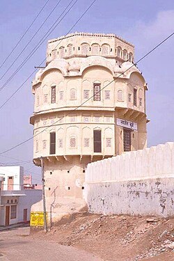
Deogarh, also known as Devgarh, is a town and a municipality, nearby Rajsamand city in Rajsamand District in the Indian state of Rajasthan. Formerly the town was an estate of the Chundawat Rajputs.

<span class="mw-page-title-main">Ladnu</span> City in Rajasthan, India

Ladnu, also Ladnun, is a city and a municipality, nearby Nagaur city in Didwana Kuchaman District in the Indian state of Rajasthan. It is a Tehsil headquarters of Didwana Kuchaman District. This city is famous as the birthplace of sacred Jain Aacharya Tulsi. It is the city of Jain temples and one of the most visited pilgrim places of Jain community after Shri Mahaveer ji. Ladnun is also home to the Jain Vishva Bharati University, several Jain temples with extensive marble work, Ramanand gaushala and other old temples of religious and architectural importance. Places within 15–20 km of Ladnun include Tal chhapar, Dungar Balaji, Salasar Balaji Dham, Tirupati Balaji at Sujangarh,Bhairav Baba Mandir at Bader village. Ladnun is also famous for cotton sarees.

Samana is a town and a municipal council in Patiala district in the Indian state of Punjab.

<span class="mw-page-title-main">Sardarshahar</span> City in Rajasthan, India

Sardarshahar is city located, in the Churu district of Rajasthan, India. It is also the seat of the Rajasthan legislative assembly Sardarshahar Assembly constituency. Sardarshahar is the tehsil headquarter. and part of the Churu Lok Sabha constituency. Sardarshahar was established in 1838 at the place of "Alwana" village in Bikaner state. The city is named after Sardar Singh, The son of Bikaner Maharaja(Raja Ratan Singh). It is known for its grand Havelis (mansions) with frescoes, The only Clock Tower (GhantaGhar) in Asia which streets running under it in all four directions, Shri Ichha Puran Balaji Mandir, Acharya Shri Mahapragya Samadhi Sthal(ShantiPeeth), Gandhi Vidya Mandir and many more. It is famous for its Food, handicraft work, silver work, and woodwork. It is the birthplace of the Eleventh Acharya -Acharyashri Mahashramanji of the Shri Jain Terapanthi Sect.

<span class="mw-page-title-main">Sirhind-Fategarh</span> Town in Punjab, India

Sirhind-Fategarh is a town and a municipal council in the Fatehgarh Sahib district in the Indian state of Punjab.

Vijaynagar or Vijaynagar is a town and a municipality in Anupgarh district in the Indian state of Rajasthan.

Degana is a town municipality and headquarter to Sub-Division and Tehsil located in Nagaur district of Rajasthan, India.

Rania is a city and a municipal committee Sirsa district in the Indian state of Haryana. Rania Town is the biggest grain market in Sirsa district.

<span class="mw-page-title-main">Jangladesh</span> Region in Northern Rajasthan

Jangladesh, also known as Janglu, was a historical region in north, north-western and north-eastern Rajasthan state in northern India. It included the present-day districts of Bikaner, Churu, Ganganagar, and Hanumangarh. It was bounded on the south by Marwar and Jaisalmer regions, on the east by Ajmer-Merwara region.

<span class="mw-page-title-main">Anupgarh district</span> District of Rajasthan state in India

Anupgarh district is a new north-west district of Rajasthan state in India. It was established on 7 August 2023 after curving it out of Sri Ganganagar District.

Maroth is a village located in Nawa, Nagaur district, in the state of Rajasthan, India. The area surrounding the village is named Gaurati, which means "The Land of Gaurs". This area was a principality granted by Maharaja Vigharaj Chauhan to Maharaja Bawan Gaur in 1260 AD. In 1659 AD, it was granted by Aurangzeb to Maharaja Raghunath Singh for his service in battle. During this time period the Gaur Rajputs of this area paid more than 6.65% of the Jama (tax) of the principality according to Ain-A-Akbari.

<span class="mw-page-title-main">Rao Kandhal</span> Founder of Khandhalot Rathores, uncle of Rao Bika

Rawat Kandhal, the third son of Rao Ranmal was the founder of the Kandhalot clan of the Rathore dynasty in Northern India, and the co-founder of the kingdoms of Bikaner and Marwar.

<span class="mw-page-title-main">Sujrai State</span> Former british colonial india state

Sujrai State was a princely state in British India. In legend it formed part of the mythological land of Braj ruled by Krishna.

References

  1. Rathore, Ajai. Kandhal rathodo ka vrihat itihaas. pp. 180–183.
  2. Rathore, Balbhadra. Thikana Rawatsar. pp. 17–18.
  3. Falling Rain Genomics, Inc - Rawatsar
  4. "Census of India 2001: Data from the 2001 Census, including cities, villages and towns (Provisional)". Census Commission of India. Archived from the original on 16 June 2004. Retrieved 1 November 2008.
  5. Gusain, Lakhan (2000). Bagri Grammar. (Languages of the World/Materials 384). Munich: Lincom Europa. ISBN   3-89586-398-X
  6. Rathore, Balbhadra. Thikana Rawatsar. p. 13.