This article has multiple issues. Please help improve it or discuss these issues on the talk page . (Learn how and when to remove these messages)
|
Baran district | |
|---|---|
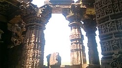 Bhand Devra Temple | |
 | |
| Coordinates: 25°06′N76°31′E / 25.1°N 76.52°E | |
| Country | |
| State | Rajasthan |
| Division | Kota |
| Formed | 10 April 1991 |
| Headquarters | Baran |
| Area | |
• Total | 6,992 km2 (2,700 sq mi) |
| Elevation | 262 m (860 ft) |
| Population (2011) [2] | |
• Total | 1,222,755 |
| • Density | 174.9/km2 (452.9/sq mi) |
| Languages | |
| • Official | Hindi |
| Time zone | UTC+5:30 (IST) |
| PIN | 325205 |
| Telephone code | 07453 |
| Vehicle registration | RJ-28 |
| Website | baran |
Baran district is a district in the Indian state of Rajasthan. The headquarters of the district are located at the city of Baran. [1]