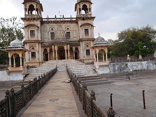
Rajakhera

Last updated

Rajakhera
राजाखेड़ा
Rajakhera
India Rajasthan location map.svg
Red pog.svg
Rajakhera
Location in Rajasthan, India
India location map.svg
Red pog.svg
Rajakhera
Rajakhera (India)
Coordinates: 26°32′N78°06′E / 26.54°N 78.10°E / 26.54; 78.10
CountryIndia
State Rajasthan
District Dholpur
Government
  Type Government of Rajasthan
  MLA Rohit Bohra
Population
 (2011) [1]
  Total163,904
Time zone UTC+5:30 (IST)
328025
328025
ISO 3166 code RJ-IN
Vehicle registration RJ-11

Rajakhera is a city and a municipality situated near the banks of the Chambal River in Dholpur district in the Eastern part of the Indian state of Rajasthan. Its part of Braj region and the local language has Braj Bhasha dialect. The culture is fused with Rajasthan and its border states.

Contents

The Rajakhera is divided into 25 wards for which elections are held every 5 years. As per report released by Census India 2011, Rajakhera has a total population of 1,63,904, out of which 89,022 are males while 74,882 are females. [2] Rajakhera Tehsil has a total of 116 villages.

The nearest metropolis cities are Agra and Morena. The nearest major railway stations are Dholpur Junction railway station and Agra Cantonment railway station. The nearest Airports are Agra Airport and Gwalior Airport. In the region, Chambal River is the only river known for fresh water, dolphin and crocodile sanctuary.

Geography

Rajakhera is located at 26°32′N78°06′E / 26.54°N 78.10°E / 26.54; 78.10 . It has an average elevation of 153 metres (505 feet). It is on the border of Rajasthan and also shares a border with Agra, Uttar Pradesh and Morena, Madhya Pradesh.

It is about 38 km from Agra, Uttar Pradesh and about the same distance from Dholpur district. Shamsabad, Agra (17 km) is the nearest town close to Uttar Pradesh border between Agra and Rajakhera. Utangan River flows between Shamshabad and Rajakhera and forms the border of Rajasthan and Uttar Pradesh. The bridge on this river was constructed in 1964 which allowed easy commute to Agra and other major cities.

Demographics

As of 2011 India census, [2] Rajakhera Tehsil of Dhaulpur district has a total population of 1,63,904 out of which 89,022 are males while 74,882 are females. In 2011 there were a total 27,149 families residing in Rajakhera Tehsil. The Average Sex Ratio of Rajakhera Tehsil is 841.

As per Census 2011 out of total population, 20.5% people live in Urban areas while 79.5% live in the Rural areas. The average literacy rate in urban areas is 67.5% while that in rural areas is 66.3%. Also the Sex Ratio of Urban areas in Rajakhera Tehsil is 860 while that of Rural areas is 836. The population of Children of age 0–6 years in Rajakhera Tehsil is 30,305 which is 18% of the total population. There are 16,206 male children and 14,099 female children between the age 0–6 years. Thus as per the Census 2011 the Child Sex Ratio of Rajakhera Tehsil is 870 which is greater than Average Sex Ratio (841) of Rajakhera Tehsil. The total literacy rate of Rajakhera Tehsil is 66.55%. The male literacy rate is 64.44% and the female literacy rate is 42.12% in Rajakhera Tehsil.

Transportation & Connectivity

The only mode of transport to Rajakhera is by road. The closest major Bus stands are in Agra and Dholpur. Both are approx. 38 km from Rajakhera. Rajasthan State Road Transport Corporation buses run between Agra and Rajakhera. Bus service from Rajakhera to Agra, and Rajakhera to Dholpur is available in every half-hour. Rajakhera is not connected with any railway line. The inter state transport is also from Rajakhera to Pinahat (formerly known as Shrinagar), a town in the Agra district, Uttar Pradesh India.

The nearest metropolis cities are Agra and Morena. The nearest major railway stations are Dholpur Junction railway station and Agra Cantonment railway station. The nearest National Airports are Agra Airport and Gwalior Airport. The nearest International Airports are Noida International Airport, Indira Gandhi International Airport New Delhi, and Jaipur International Airport.

Political and current affairs

Shri Padhyumn Singh is a well-known politician and former Finance Minister in Government of Rajasthan, who served 7 terms as Member of the Legislative Assembly (India) from Rajakhera Assembly constituency till 2018. He is currently serving as President of 16th State Finance Commission of Rajasthan.

Rohit Bohra, son of Padhyumn Singh of the Indian National Congress won the 2018 Rajasthan Legislative Assembly election and became Member of the Legislative Assembly (MLA) from Rajakhera constituency. He was re-elected in 2023 Rajasthan Legislative Assembly election from Rajakhera constituency.

Notable Person of Rajakhera

Related Research Articles

<span class="mw-page-title-main">Morena</span> Metropolis in Madhya Pradesh, India

Morena is the headquarter of Morena district in the Indian state of Madhya Pradesh. It is governed by a municipality corporation. It is also the administrative headquarters of the Chambal division. It is 39 kilometres (24 mi) from Gwalior, Madhya Pradesh.

<span class="mw-page-title-main">Dholpur</span> City in Rajasthan, India

Dholpur is a city in the Dholpur district in Rajasthan state of India. It is situated on the left bank of the famous Chambal river. The city is the administrative headquarters of Dholpur District and was formerly seat of the Dholpur princely State of Jats.

<span class="mw-page-title-main">Braj Bhasha</span> Western Hindi language of India

The Braj language, Braj Bhasha, also known as Vraj Bhasha or Brij Bhasha or Braj Boli, is a Western Hindi language. Along with Awadhi, it was one of the two predominant literary languages of North-Central India before the switch to Hindustani in the 19th century.

<span class="mw-page-title-main">Agra district</span> District in Uttar Pradesh, India

Agra is one of the 75 districts in the northern Indian state of Uttar Pradesh. The district headquarters is the historical city of Agra. Agra district is a part of Agra division.

<span class="mw-page-title-main">Etah district</span> District of Uttar Pradesh in India

Etah district is one of the districts of Uttar Pradesh, India, since 1854. Etah City is the district headquarters. Etah district is a part of Aligarh Division.

<span class="mw-page-title-main">Firozabad district</span> District of Uttar Pradesh in India

Firozabad district forms one of the western districts of the Indian state of Uttar Pradesh, which has Firozabad city as its district headquarters. The district is a part of the Agra division.
<span class="mw-page-title-main">Sheopur district</span> District of Madhya Pradesh in India

Sheopur District is a district of Madhya Pradesh state in central India. The district is located in the north of the state and forms part of Chambal division. It is situated on the periphery of Rajasthan, which shows in the influence of Rajasthani culture in this district.

<span class="mw-page-title-main">National Chambal Sanctuary</span> Wildlife sanctuary in India

National Chambal Sanctuary, also called the National Chambal Gharial Wildlife Sanctuary, is a 5,400 km2 (2,100 sq mi) tri-state protected area in northern India for the protection of the Critically Endangered gharial, the red-crowned roof turtle and the Endangered Ganges river dolphin. Located on the Chambal River near the tripoint of Rajasthan, Madhya Pradesh and Uttar Pradesh, it was first declared in Madhya Pradesh in 1978, and now constitutes a long narrow eco-reserve co-administered by the three states. Within the sanctuary, the pristine Chambal River cuts through mazes of ravines and hills with many sandy beaches.

<span class="mw-page-title-main">Morena district</span> District of Madhya Pradesh in India

Morena district is one of the 52 districts of the central Indian state of Madhya Pradesh, located in the Chambal division.

<span class="mw-page-title-main">Bharatpur district</span> District of Rajasthan in India

Bharatpur District is a district in Rajasthan state in western India. The city of Bharatpur is the District Headquarters, Division Headquarters and Headquarters of Bharatpur Police Range of Rajasthan Police. Bharatpur District is a part of National Capital Region of India Delhi.
<span class="mw-page-title-main">Dholpur district</span> District of Rajasthan in India

Dholpur District is a district of Rajasthan state in Northern India. The town of Dholpur is the district headquarters. Dholpur District is a part of Bharatpur Divisional Commissionerate. It was carved out from the erstwhile Bharatpur District on 15 April 1982.
Sarsawa is a town at the border of Haryana and a municipal board in Saharanpur district in the Indian state of Uttar Pradesh.

Todabhim is a city and a "municipality" in Gangapur City district in the Indian state of Rajasthan. It is headquarters of todabhim sub division, tehsil and C&RD block of Gangapur City district.

<span class="mw-page-title-main">Tundla</span> Town in Uttar Pradesh, India

Tundla is a town and a municipal board in Firozabad district in the Indian state of Uttar Pradesh. It is an important railway junction between the Delhi-Kanpur main line and the Agra branch line. Tundla is a railway town that sprang up when the railway was built in the late 1800s. It is served by Tundla Junction railway station. As of 2011, Tundla has a population of 50,423 people, in 8,744 households.

Ashwari is a village in Pindra Tehsil of Varanasi district in the Indian state of Uttar Pradesh. Ashwari has its own gram panchayat by the same name as the village. The village is about 42.0 kilometers North-West of Varanasi city, 273 kilometers South-East of state capital Lucknow and 791 kilometers South-East of the national capital Delhi.

<span class="mw-page-title-main">Varanasi cantonment</span> Town in Uttar Pradesh, India

Varanasi cantonment is a census town in Varanasi tehsil of Varanasi district in the Indian state of Uttar Pradesh. The census town does not have a gram panchayat. Varanasi Cantonment Census town is about 2 kilometers West of Varanasi railway station, 324 kilometers South-East of Lucknow and 12 kilometers North of Banaras Hindu University.

<span class="mw-page-title-main">Saifai</span> Village in Uttar Pradesh, India

Saifai is a large village and university town in the Etawah district of the Indian state of Uttar Pradesh. It is also a sub-division (Tehsil) and Block of the Etawah district. It is the birthplace of Mulayam Singh Yadav, the founding president of the Samajwadi Party, former Minister of Defence, in India and former Chief Minister of Uttar Pradesh.

Sahara is a village in Bichpuri Block in Agra District of Uttar Pradesh State, India. It belongs to Agra Division. It is located 13 km towards west from District headquarters Agra. 3 km from Bichpuri. 356 km from State capital Lucknow

<span class="mw-page-title-main">Sarmathura</span> Town in Rajasthan, India

Sarmathura is a subdivision located in Dholpur district, in the Indian state of Rajasthan.

Bhadauria also referred as Bhadoria, Bhadouria, Bhadauriya, Bhadoriya or Bhaduria are a Kshatriya Rajput clan belonging to the Chauhans of Shakambhari and Ajmer. They were historically mainly concentrated in the ethno-linguistic and geographical regions of the modern day Braj and the Chambal river valley, in what are now the districts of Agra, Etawah, Bhind and Dholpur, in the states of Uttar Pradesh, Madhya Pradesh, and Rajasthan.

References

  1. "Census of India Search details". censusindia.gov.in. Retrieved 10 May 2015.
  2. 1 2 "Rajakhera Population 2023, Tehsil Village List in Dholpur, Rajasthan". www.indiagrowing.com. Retrieved 18 December 2023.