Dholpur district

Last updated

Dholpur district
Queen's haveli - Much kund - 20210827 174408 HDR.jpg
Kaila Mata temple.jpg
Gateway-of-shergarh-fort.jpg
Talab e shahi bari, dholpur ,rajasthan. india.jpg
Chambal river near Dhaulpur, India.jpg
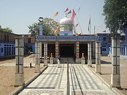
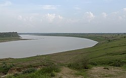
Rani ki Haveli in Machkund, Kalia Mata Temple in Bari, Talab-e-Shahi, Chambal River near Dholpur, Shergarh Fort
Dholpur in Rajasthan (India).svg
Location of Dholpur district in Rajasthan
CountryFlag of India.svg  India
State Rajasthan
Division Bharatpur
Area
  Total3,084 km2 (1,191 sq mi)
Population
 (2011) [1]
  Total1,206,516
  Density390/km2 (1,000/sq mi)
Time zone UTC+05:30 (IST)

Dholpur District is a district of Rajasthan state in Northern India. The town of Dholpur is the district headquarters. Dholpur District is a part of Bharatpur Divisional Commissionerate. It was carved out from the erstwhile Bharatpur District on 15 April 1982. [2]

Contents

Dholpur District has an area of 3084 km². The Chambal River forms the southern boundary of the district, across which lies the state of Madhya Pradesh. The district is bounded by the state of Uttar Pradesh on the east and northeast, by Bharatpur District of Rajasthan on the northwest, and Karauli District of Rajasthan on the west. All along the bank of the Chambal River the district is deeply intersected by ravines; low ranges of hills in the western portion of the district supply quarries of fine-grained and easily worked red sandstone.

Administratively the district is divided into four subdivisions, Dholpur, Bari, Rajakhera, and Baseri, and six tehsils, Dholpur, Bari, Rajakhera, Basedi, Sarmathura and Saipau.

Demographics

Historical population
YearPop.±% p.a.
1901298,547    
1911273,322−0.88%
1921241,508−1.23%
1931246,660+0.21%
1941286,788+1.52%
1951302,123+0.52%
1961363,727+1.87%
1971459,655+2.37%
1981585,059+2.44%
1991749,479+2.51%
2001983,258+2.75%
20111,206,516+2.07%
source: [3]
Religions in Dhaulpur district (2011) [4]
ReligionPercent
Hinduism
93.45%
Islam
5.99%
Other or not stated
0.56%

According to the 2011 census Dholpur district has a population of 1,206,516, [1] roughly equal to the nation of Bahrain [5] or the US state of New Hampshire. [6] This gives it a ranking of 394th in India (out of a total of 640). [1] The district has a population density of 398 inhabitants per square kilometre (1,030/sq mi) . [1] Its population growth rate over the decade 2001-2011 was 22.78%. [1] Dhaulpur has a sex ratio of 845 females for every 1000 males, [1] and a literacy rate of 70.14%. 20.51% of the population lives in urban areas. Scheduled Castes and Scheduled Tribes make up 20.36% and 4.86% of the population respectively. [1]

Languages of Dholpur district (2011) [7]

   Hindi (97.91%)
   Braj Bhasha (1.58%)
  Others (0.51%)

At the time of the 2011 Census of India, 97.91% of the population in the district spoke Hindi and 1.58% Braj Bhasha as their first language. [7]

Related Research Articles

<span class="mw-page-title-main">Dholpur</span> City in Rajasthan, India

Dholpur is a city in the Dholpur district in Rajasthan state of India. It is situated on the left bank of the famous Chambal river. The city is the administrative headquarters of Dholpur District and was formerly seat of the Dholpur princely State of Jats.

<span class="mw-page-title-main">Agra district</span> District in Uttar Pradesh, India

Agra is one of the 75 districts in the northern Indian state of Uttar Pradesh. The district headquarters is the historical city of Agra. Agra district is a part of Agra division.

<span class="mw-page-title-main">Sawai Madhopur district</span> District of Rajasthan in India

Sawai Madhopur district is a district of Rajasthan state in north-west India. Sawai Madhopur is the chief town and district headquarters. Sawai Madhopur district comes under Bharatpur division.

<span class="mw-page-title-main">Sheopur district</span> District of Madhya Pradesh in India

Sheopur District is a district of Madhya Pradesh state in central India. The district is located in the north of the state and forms part of Chambal division. It is situated on the periphery of Rajasthan, which shows in the influence of Rajasthani culture in this district.

<span class="mw-page-title-main">Bhind district</span> District of Madhya Pradesh in India

Bhind district is a district in the Chambal division of the Indian state of Madhya Pradesh. The town of Bhind is the district headquarters.Bhind District is situated in Chambal region in the northwest of the state. It is surrounded by Agra, Etawah, Jalaun and Jhansi districts of Uttar Pradesh state to the north and the east, and the Madhya Pradesh districts of Datia to the south, Gwalior to the southwest, and Morena to the west. The geography of the district is characterised by uneven ravines, plain fertile fields and scanty forests. The total area of the district is 4,459 km2 (1,722 sq mi).

<span class="mw-page-title-main">Guna district</span> District in Madhya Pradesh, India

Guna district is one of the 52 districts of Madhya Pradesh in central India. Its administrative headquarters is Guna. The district has a population of 1,241,519. It has an area of 6390 km², and is bounded on the northeast by Shivpuri District, on the east by Ashoknagar District, on the southeast by Vidisha District, on the southwest by Rajgarh District, on the west and northwest by Jhalawar and Baran districts of Rajasthan state. The Sindh River flows northward along the eastern edge of the district, forming part of the boundary with Ashoknagar District, and the Parvati River flows northwestward through the southern portion of the district, forming part of the boundary with Baran District before flowing into Rajasthan.

<span class="mw-page-title-main">Ratlam district</span> District of Madhya Pradesh in India

Ratlam District is a district of Madhya Pradesh state in central India. The town of Ratlam is administrative headquarters of the district.

<span class="mw-page-title-main">Jhalawar district</span> District of Rajasthan in India

Jhalawar district is one of the 33 districts of Rajasthan state in western India. The historical city of Jhalawar is the administrative headquarters of the Jhalawar district. The district is bounded on the northwest by Kota district, on the northeast by Baran district, on the east by Guna district of Madhya Pradesh state, on the south by Rajgarh district and Agar Malwa district of Madhya Pradesh state and on the west by Ratlam district and Mandsaur district of Madhya Pradesh state. The district occupies an area of 6219 km². The district is part of Kota division. To know more about Jhalawar City

<span class="mw-page-title-main">Vidisha district</span> District of Madhya Pradesh in India

Vidisha District (विदिशा) is in Madhya Pradesh state, in central India. The city of Vidisha is the administrative headquarters of the district.

<span class="mw-page-title-main">Sehore district</span> District of Madhya Pradesh in India

Sehore District is a district of Madhya Pradesh state in central India. The town of Sehore is the district headquarters. The district is part of Bhopal Division.

<span class="mw-page-title-main">Morena district</span> District of Madhya Pradesh in India

Morena district is one of the 52 districts of the central Indian state of Madhya Pradesh, located in the Chambal division.

<span class="mw-page-title-main">Yamunanagar district</span> District of Haryana in India

Yamunanagar district is one of the 22 districts of the Indian state of Haryana. The district came into existence on 1 November 1989 and occupies an area of 1,756 square kilometres (678 sq mi). Yamunanagar town is the district headquarters.

<span class="mw-page-title-main">Muzaffarnagar district</span> District of Uttar Pradesh in India

Muzaffarnagar district is a district of Uttar Pradesh state in northern India. It is part of Saharanpur division. The city of Muzaffarnagar is the district headquarters. This district is the part of National Capital Region.

<span class="mw-page-title-main">Kota district</span> District of Rajasthan in India

Kota District is a district of the state of Rajasthan in western India. The city of Kota is the administrative headquarters of the district.

<span class="mw-page-title-main">Bharatpur district</span> District of Rajasthan in India

Bharatpur District is a district in Rajasthan state in western India. The city of Bharatpur is the District Headquarters, Division Headquarters and Headquarters of Bharatpur Police Range of Rajasthan Police. Bharatpur District is a part of National Capital Region of India Delhi.

<span class="mw-page-title-main">Bhilwara district</span> District of Rajasthan in India

Bhilwara District is a district of the state of Rajasthan in western India. The city of Bhilwara is the district headquarters.

<span class="mw-page-title-main">Karauli district</span> District of Rajasthan, India

Karauli District is a district of the state of Rajasthan in western India. It is located in the Braj Bhoomi region. The town of Karauli serves as the administrative headquarters of the district. Karauli district also comes under the Bharatpur Divisional Commissionerate.

Rajakhera is a city and a municipality situated near the banks of the Chambal River in Dholpur district in the Eastern part of the Indian state of Rajasthan. Its part of Braj region and the local language has Braj Bhasha dialect. The culture is fused with Rajasthan and its border states.

<span class="mw-page-title-main">Sarmathura</span> Town in Rajasthan, India

Sarmathura is a subdivision located in Dholpur district, in the Indian state of Rajasthan.

<span class="mw-page-title-main">Deeg district</span> District of Rajasthan in India

Deeg district is a district in Rajasthan state in northwestern India. It is bordered by Haryana to the north, Uttar Pradesh to the east, Bharatpur district to the south, and Alwar district to the west.

References

  1. 1 2 3 4 5 6 7 "District Census Handbook 2011 - Dholpur" (PDF). Census of India . Registrar General and Census Commissioner of India.
  2. "History | DISTRICT COURT DHOLPUR | India" . Retrieved 25 February 2024.
  3. Decadal Variation In Population Since 1901
  4. "Table C-01 Population By Religion - Rajasthan". census.gov.in. Registrar General and Census Commissioner of India.
  5. US Directorate of Intelligence. "Country Comparison:Population". Archived from the original on 13 June 2007. Retrieved 1 October 2011. Bahrain 1,214,705 July 2011 est.
  6. "2010 Resident Population Data". U. S. Census Bureau. Archived from the original on 19 October 2013. Retrieved 30 September 2011. New Hampshire 1,316,470
  7. 1 2 "Table C-16 Population by Mother Tongue: Rajasthan". censusindia.gov.in. Registrar General and Census Commissioner of India.

26°42′N77°54′E / 26.700°N 77.900°E / 26.700; 77.900