
Udaipur district is one of the 50 districts of Rajasthan state in western India. The historic city of Udaipur is the administrative headquarters of the district. The district is part of the Mewar region of Rajasthan.
Bhilwara District is a district of the state of Rajasthan in western India. The city of Bhilwara is the district headquarters.
Sirohi District is a district of Rajasthan state in western India. The town of Sirohi is the district headquarters. Abu Road is the largest city in Sirohi District in terms of area and population.
Dhariawad is a census town in Pratapgarh district in the state of Rajasthan, India. It is the administrative headquarters for Dhariawad Tehsil.

Bali is a town and a municipality in Pali district in the state of Rajasthan, India. The town is situated on the left bank of the Mithari River. This walled town was the headquarters of a district having the same name in the Jodhpur State. Bali is a tehsil and panchayat samiti with the same name. Bali is also a sub-divisions among the 10 sub-divisions of the Pali district. It is known for its fort. Nearest towns are Falna & Sadri and nearest villages are Kot Baliyan, Shri Sela and Boya.

Pratapgarh district is the 33rd district of Rajasthan, created on 26 January 2008. It is a part of Udaipur Division and has been carved out from the erstwhile tehsils of Chittorgarh, Udaipur and Banswara districts. Pratapgarh town is the administrative headquarters of the district.
Phalasia is a village in Rajasthan, India, approximately 80 kilometers from Udaipur. The main places to visit in Phalasia are Lapni saat, Nagmala Talab.
Peepal Khoont mainly known as Pipalkhunt is a village, Tehsil headquarter and Panchayat Samiti of the Pratapgarh district of Rajasthan state. It is a sub-division among the 5 sub-divisions of the Pratapgarh district. The main market is called Sadar Bajar. It is situated on National Highway 113. Pipalkhunt is a town located on the Banswara - Jaipur Expressway surrounded by the hills, plants and trees. The town is situated on the bank of the Mahi River.
Girwa is a tehsil of Udaipur district, Rajasthan, India. The administrative headquarter of the tehsil is located in the City of Udaipur.

Kotra is a tehsil of Udaipur district in Rajasthan, India, consisting of 262 revenue villages and 31 panchayats. The tehsil is bordered to the north by Pali and Sirohi districts, to the east by Gogunda and Jhadol tehsils, and to the south by Gujarat state. The tehsil headquarter is located in the village of Kotra, southwest of the Udaipur at a distance of 57 km and 120 km by road.
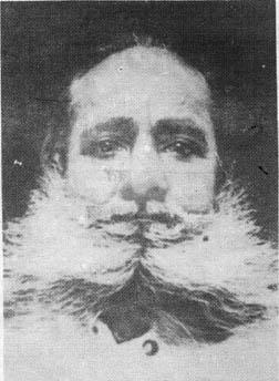
Motilal Tejawat , (1885–1963) was the leader of the Eki Movement that was agitated in the 1920s in the adivasi-dominated border areas of present-day Rajasthan and Gujarat.

Jhadol tehsil is an administrative sub-division of Udaipur district in Rajasthan, India. Jhadol tehsil was formerly called Phalasia tehsil. The tehsil consists of 283 revenue villages and 45 panchayats. The tehsil headquarter is located in the village of Jhadol, southwest of the district headquarters, Udaipur.

Gogunda is a tehsil of Udaipur district in Rajasthan, India. The tehsil consists of 232 revenue villages, 45 panchayats, and 1 census town. The tehsil headquarter is located in the town of Gogunda.

Kherwara is a tehsil of Udaipur district in Rajasthan, India. The tehsil consists of 195 revenue villages and 1 census town. The tehsil headquarter is located in the town of Kherwara Chhaoni. The tehsil is part of the Kherwara panchayat samiti (block).

Lasadiya is a tehsil of Salumbar district in Rajasthan, India.The tehsil consists of 114 revenue villages which are organized in 19 gram panchayats The tehsil headquarter is located in the village of Lasadiya. The boundaries of Lasadiya tehsil are conterminous with those of Lasadiya panchayat samiti.

Mavli is a tehsil of Udaipur district in Rajasthan, India.The tehsil consists of 179 revenue villages which are organized in 42 gram panchayats and one town (Mavli). The tehsil headquarter is located in the town of Mavli. The boundaries of Mavli tehsil are conterminous with those of Mavli panchayat samiti.

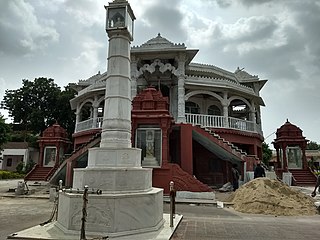
Rishabhdeo is a tehsil of Udaipur district in Rajasthan, India.The tehsil consists of 125 revenue villages and one town. The tehsil headquarter is located in the town of Rishabhdeo.
Banswari is a village in Jhadol Tehsil in Udaipur district in the Indian state of Rajasthan. It is administrated by Sarpanch who is elected representative of village.
Pai is a village in Jhadol Tehsil in Udaipur district in the Indian state of Rajasthan. It is administrated by Sarpanch who is elected representative of village. It is located on hilly area above 540 meters above the sea level.
Ogna, also Oghna, is a village in Jhadol tehsil, Udaipur district, Rajasthan, India. It is mostly dependent on agriculture.

