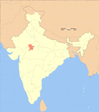
Rajasthan is a state in northwestern India. It covers 342,239 square kilometres (132,139 sq mi) or 10.4 per cent of India's total geographical area. It is the largest Indian state by area and the seventh largest by population. It is on India's northwestern side, where it comprises most of the wide and inhospitable Thar Desert and shares a border with the Pakistani provinces of Punjab to the northwest and Sindh to the west, along the Sutlej-Indus River valley. It is bordered by five other Indian states: Punjab to the north; Haryana and Uttar Pradesh to the northeast; Madhya Pradesh to the southeast; and Gujarat to the southwest. Its geographical location is 23°.3' to 30°.12' North latitude and 69°.30' to 78°.17' East longitude, with the Tropic of Cancer passing through its southernmost tip.

Hadauti or Harauti (Hadoti) is an Indo-Aryan language of Rajasthani languages group spoken by approximately four million people in the Hadoti region of southeastern Rajasthan, India. Its speakers are concentrated in the districts of Kota, Baran, Bundi and Jhalawar in Rajasthan, as well as in neighbouring areas of Madhya Pradesh.

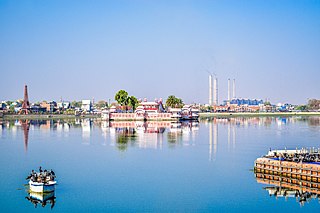
Kota, previously known as Kotah, is third-largest city in the southeast of the northern Indian state of Rajasthan. It is located about 240 kilometres (149 mi) south of the state capital, Jaipur, situated on the banks of Chambal River. With a population of over 1.2 million, it is the third most populous city of Rajasthan after Jaipur and Jodhpur, 46th most populous city of India and 53rd most populous urban agglomeration of India. It serves as the administrative headquarters for Kota district and Kota division. It is popular among the youth of India for its coaching institutes for engineering and medical entrance examinations. Many students come to Kota to prepare for the JEE, NEET and many other competitive exams, making it an Edtech city.

Bhilwara is a city and administrative headquarters in Bhilwara district of the Mewar region of Rajasthan, India. It has been termed as 'Textile city'.

Hadoti is a region of Rajasthan state in western India, which was once called the Bundi Kingdom. The biggest cities are Jhalawar and Kota. It includes the districts of Bundi, Baran, Jhalawar and Kota and is bounded on the west by the Mewar, on the northwest by Ajmer regions of Rajasthan, and on the south by the Malwa, on the east by the Gird regions of Madhya Pradesh state.
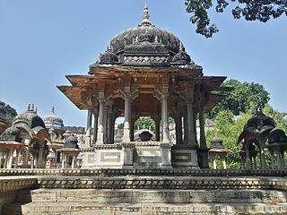
Bundi is a town in the Hadoti region of Rajasthan state in northwest India. It is of particular architectural note for its ornate forts, palaces, and stepwell reservoirs known as baoris. It is the administrative headquarters of Bundi District. Bundi has many temples, so it is called "Chhoti Kashi".

Sawai Madhopur district is a district of Rajasthan state in north-west India. Sawai Madhopur is the chief town and district headquarters. Sawai Madhopur district comes under Bharatpur division.

Jhalawar district is one of the 33 districts of Rajasthan state in western India. The historical city of Jhalawar is the administrative headquarters of the Jhalawar district. The district is bounded on the northwest by Kota district, on the northeast by Baran district, on the east by Guna district of Madhya Pradesh state, on the south by Rajgarh district and Agar Malwa district of Madhya Pradesh state and on the west by Ratlam district and Mandsaur district of Madhya Pradesh state. The district occupies an area of 6219 km². The district is part of Kota division. To know more about Jhalawar City

Kota District is a district of the state of Rajasthan in western India. The city of Kota is the administrative headquarters of the district.

Bhilwara District is a district of the state of Rajasthan in western India. The city of Bhilwara is the district headquarters.

Tonk district is a district of the state of Rajasthan in western India. The city of Tonk is the administrative headquarters of the district. The district is bounded on the north by Jaipur district, on the east by Sawai Madhopur district, on the southeast by Kota district, on the south by Bundi district, on the southwest by Bhilwara district, and on the west by Ajmer district.

Baran district is a district in the Indian state of Rajasthan. The headquarters of the district are located at the city of Baran.

Dhundhari (ढूंढाड़ी), also known as Jaipuri, is a Rajasthani language within the Indo-Aryan language family. It is spoken in the Dhundhar region of northeastern Rajasthan state, India. Dhundari-speaking people are found in four districts – Jaipur, Sawai Madhopur, Dausa, Tonk and some parts of Sikar, Karauli and Gangapur District.
Aklera is a town and an Indian municipality in Jhalawar district in the state of Rajasthan. It is in the south-eastern region of Rajasthan at the edge of the Malwa plateau and has a rocky, scrub-covered terrain.
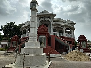
Jahazpur is a historical town and a municipality in Bhilwara district in the Indian state of Rajasthan. It is also the tehsil headquarters of the Jahazpur tehsil. It is known for the Jain temple swastidham, built around the Jahazpur fort.
Lakheri is a town and municipality in Bundi district in the Indian state of Rajasthan. It is located in the southeast of Rajasthan, around 180 kilometres (112 mi) south of the state capital, Jaipur. Lakheri has been a subdivision headquarters since 2002. Yugantar Sharma (RAS) is the Sub-division Officer and magistrate of Lakheri subdivision. It is the second largest city in the district, after Bundi and 104th largest city in rajasthan.

Newai or Niwai is a town, and a municipality and tehsil in Tonk district in the Indian state of Rajasthan. The Tonk district is bounded in the north by Jaipur district, in the east by Sawai Madhopur district, in the southeast by Kota district, in the south by Bundi district, in the southwest by Bhilwara district, and in the west by Ajmer district. Jaipur, capital of Rajasthan is the closest major city to Newai. In 1783 Nepalia-Mathur Kayastha of Jaipur estate occupied it after defeating Nawab of Tonk in a bloody battle fought at the fort of Rakhtanchal. Since then it was a vassal state to the Jaipur estate until Jaipur became part of Independent India. Darbar of Daroga ji ruled Niwai under Maharaja of Jaipur.
Uniara is a town and a municipality in Tonk district in the Indian state of Rajasthan. It is a tehsil of the Tonk district.

Baran is a city in Baran district of the Indian state of Rajasthan. It is a municipality and the district headquarters of Baran district, famous for its 11th century Bhand Devra Temple on banks of Ramgarh crater. It is 339 km from the state capital Jaipur near Kota city. Three large rivers, Parban, Parbati, and Kalisindh, flow through the district.


